D'Aguilar Range facts for kids
Quick facts for kids D'Aguilar |
|
|---|---|

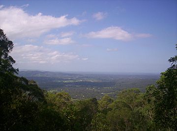
Looking towards the Glass House Mountains from Camp Mountain
|
|
| Highest point | |
| Peak | Tenison Woods Mountain |
| Elevation | 770 m (2,530 ft) |
| Geography | |
| Country | Australia |
| State | Queensland |
| Region | South East Queensland |
| Range coordinates | 27°07′57″S 152°47′20″E / 27.1325°S 152.7889°E |
The D'Aguilar Range is a mountain range located near Brisbane, Queensland, Australia. It's a beautiful area with lots of nature to explore.
Some towns are built on the lower parts of the range. These include Dayboro and Mooloolah. Many homes are also found on the eastern side of the range. Towns like Samford and Ferny Hills are good examples. The western side of the range is mostly thick forests. These forests are protected as state forests or national parks.
Contents
Exploring the Mountains
The D'Aguilar Range is quite long. It stretches from Caboolture, which is about 45 kilometers north of Brisbane. It goes all the way into Brisbane itself. A part of the range in Brisbane is protected. It's called the Brisbane Forest Park.
Many different mountains make up the D'Aguilar Range. Some of these include Camp Mountain and Mount Nebo. You can also find Mount Pleasant and Mount Glorious. Other peaks are Mount Samson and Mount Mee.
Just south of the D'Aguilar Range is the Taylor Range. Some people think it's like an arm reaching out from the D'Aguilar Range. If you look north from the D'Aguilar Ranges, you can clearly see the amazing Glass House Mountains.
Tallest Peaks and Great Views

Mount D'Aguilar is a significant peak. It stands 750 meters above sea level. It's the second highest mountain in the range. The very highest point is Tenison Woods Mountain. It reaches 770 meters high. This peak isn't always marked on old maps.
In 1974, a special plaque was placed on Tenison Woods Mountain. It was put there by a group called the Sisters of Perpetual Adoration. They named the mountain to honor J.E. Tenison Woods. This year also marked 100 years since their group was started.
In the southern part of the range, Mermaid Mountain is the highest point. It is 396 meters tall. There are also popular spots called McAfee's Lookout and Jolly's Lookout. From these lookouts, you can see amazing views. You can look east all the way to Moreton Bay.
Rivers and Water Catchments
The D'Aguilar Range is important for water. Many rivers start here and flow towards the east. These include the North Pine River, the South Pine River, and the Caboolture River. The North Pine River even forms Lake Kurwongbah.
To the north and west, other rivers begin. The Stanley River is one example. These rivers flow into large dams. They feed the Somerset Dam and Wivenhoe Dam. These dams hold water for many people.
In the southern parts of the range, Enoggera Creek starts. It flows east and is held back by the Enoggera Dam. Gold Creek is also in this area. It flows south into Moggill Creek after being dammed by the Gold Creek Reservoir. Further west, you'll find Cabbage Tree Creek. This creek feeds into a reservoir known as Lake Manchester.
Timber Industry in the Past
Logging timber from the D'Aguilar Range was very important. It helped the town of Dayboro grow a lot. In the 1870s, logging work became much bigger. Loggers cut down many types of trees. These included hoop pine and cedar. They also harvested silky oak and black bean trees.
 | Isaac Myers |
 | D. Hamilton Jackson |
 | A. Philip Randolph |


