Ferny Hills, Queensland facts for kids
Quick facts for kids Ferny HillsMoreton Bay, Queensland |
|||||||||||||||
|---|---|---|---|---|---|---|---|---|---|---|---|---|---|---|---|

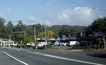
Ferny Way, Ferny Hills
|
|||||||||||||||
| Population | 8,726 (2021 census) | ||||||||||||||
| • Density | 855/km2 (2,210/sq mi) | ||||||||||||||
| Postcode(s) | 4055 | ||||||||||||||
| Area | 10.2 km2 (3.9 sq mi) | ||||||||||||||
| Time zone | AEST (UTC+10:00) | ||||||||||||||
| Location |
|
||||||||||||||
| LGA(s) | City of Moreton Bay | ||||||||||||||
| State electorate(s) | Ferny Grove | ||||||||||||||
| Federal Division(s) | Dickson | ||||||||||||||
|
|||||||||||||||
Ferny Hills is a suburb in Queensland, Australia. It is part of the City of Moreton Bay. In 2021, about 8,726 people lived there.
Contents
Exploring Ferny Hills' Location
Ferny Hills is located north-west of Brisbane. Brisbane is the capital city of Queensland. You can find Ferny Hills along Samford Road. Many people call this area the "Hills District."
The western side of Ferny Hills has a big park. It is called Samford Conservation Park. The eastern side is where people live in homes.
A Look at Ferny Hills' Past
Ferny Hills is on the traditional land of the Yugarabul people. They are Indigenous Australians.
Two schools opened in Ferny Hills many years ago. Ferny Way State School opened on January 27, 1970. It was renamed Ferny Hills State School in 1973. Patricks Road State School opened on January 24, 1977.
Until 2006, Ferny Hills had a special place. It was called the Australian Woolshed. This was a popular attraction. It showed Australian farming and wildlife. Visitors could see shows and animal exhibits. The Woolshed was even featured on a TV show. It appeared in an episode of The Amazing Race. The Woolshed was later taken down. Now, homes are built there. The new area is called 'Woolshed Grove'. This name remembers the old Woolshed.
Who Lives in Ferny Hills?
In 2011, about 8,721 people lived in Ferny Hills. Slightly more than half were female. The average age was 36 years old. Most people, about 82.6%, were born in Australia. Other people came from England and New Zealand.
Most people in Ferny Hills speak English at home. Some other languages spoken include Italian and German. In 2016, the population was 8,739 people. By 2021, it was 8,726 people.
Learning in Ferny Hills
Ferny Hills has two primary schools. They teach students from Prep to Year 6.
Ferny Hills State School
This school is for both boys and girls. It is located on Illuta Avenue. In 2018, about 343 students went to this school. It also has a special education program.
Patricks Road State School
This school is also for boys and girls. You can find it on Patricks Road. In 2018, about 789 students were enrolled here. This school also offers a special education program.
There is no high school in Ferny Hills itself. The closest high school is Ferny Grove State High School. It is in the nearby suburb of Ferny Grove.
Places to Visit in Ferny Hills
You can find small shopping areas in Ferny Hills. These "convenience centres" are on Ferny Way. They are located at the southern end of the suburb.
 | James Van Der Zee |
 | Alma Thomas |
 | Ellis Wilson |
 | Margaret Taylor-Burroughs |


