North Pine River facts for kids
Quick facts for kids North Pine |
|
|---|---|

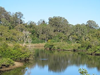
The river at Petrie, 2016
|
|
|
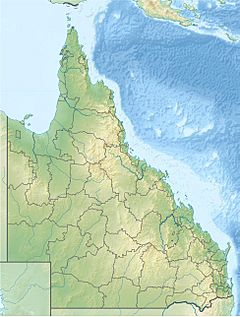
Location of the North Pine River mouth in Queensland
|
|
| Country | Australia |
| State | Queensland |
| Region | South East Queensland |
| Physical characteristics | |
| Main source | D'Aguilar Range below Bootawa 480 m (1,570 ft) 27°06′47″S 152°44′07″E / 27.11306°S 152.73528°E |
| River mouth | confluence with the South Pine River to form the Pine River Lawnton 10 m (33 ft) 27°17′16″S 153°00′57″E / 27.28778°S 153.01583°E |
| Length | 54 km (34 mi) |
| Basin features | |
| River system | Pine River catchment |
| Tributaries |
|
| Reservoir | Lake Samsonvale |
The North Pine River is an important river located in South East Queensland, Australia. It plays a big role in providing drinking water and is home to special wildlife.
Where the North Pine River Flows
The North Pine River starts high up in the D'Aguilar Range, which is a mountain range. This is about 50 km (31 mi) northwest of Brisbane. From there, it flows mostly towards the southeast.
Meeting the South Pine River
The North Pine River eventually meets up with the South Pine River at a place called Lawnton. When two rivers meet, it's called a confluence. After they join, they form a bigger river known as the Pine River. The North Pine River flows mainly through the Moreton Bay Region.
The North Pine Dam and Lake Samsonvale
A large dam called the North Pine Dam was built on the North Pine River near Whiteside. This dam created a big artificial lake called Lake Samsonvale. Another creek, Kobble Creek, also flows into this lake.
Supplying Drinking Water
Lake Samsonvale is very important because it holds drinking water for many nearby towns. This includes Redcliffe, Pine Rivers, Caboolture, and the northern parts of Brisbane. The area where all the water drains into the river and dam is called its catchment.
Journey to Bramble Bay
After flowing out of the North Pine Dam, the North Pine River continues its journey through suburbs like Petrie and Lawnton. Once it joins the South Pine River to form the Pine River, this combined river then flows into Bramble Bay. The river drops about 470 metres (1,540 ft) from its source to its mouth, over a distance of 54-kilometre (34 mi).
The former area known as the Pine Rivers Shire was named after the North Pine, South Pine, and Pine Rivers, showing how important these rivers are to the region.
History of the River
The North Pine River has played a part in the history of the area.
Building the Hornibrook Bridge
In the early 1930s, timber was needed to build the Hornibrook Bridge. This timber was floated down the North Pine River on large flat boats called barges, all the way to Bramble Bay.
Lake Kurwongbah
Another lake, Lake Kurwongbah, was built in 1964. It was created on Sideling Creek, which is a smaller stream that flows into the North Pine River.
The 2011 Flood
In January 2011, there was a very big flood. This happened because of a lot of heavy rain and water being released from the North Pine Dam. Some areas in Petrie, Strathpine, and Lawnton had to be quickly evacuated because the river rose very fast and caused flooding in low-lying areas.
Wildlife and Plants
The North Pine River is home to some unique and interesting animals and plants.
Special Fish and Mammals
The North Pine River is one of the few rivers where you can find natural groups of the rare Queensland lungfish. This is a very special type of fish. You might also spot Platypus in both the North and South Pine rivers. They are seen more often here than in many other rivers in the region.
Dealing with Invasive Plants
An invasive weed vine called Cat's claw creeper (Dolichandra unguis-cati) has caused a lot of damage to trees along the North Pine River. In Queensland, Cat's Claw is a Category 3 declared weed. This means it's not allowed to be released into the environment without a special permit, as it can harm native plants.
 | Mary Eliza Mahoney |
 | Susie King Taylor |
 | Ida Gray |
 | Eliza Ann Grier |


