Pine River (Queensland) facts for kids
Quick facts for kids Pine |
|
|---|---|

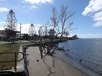
Dohls Rocks Road at Griffin, 2016
|
|
|
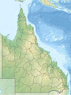
Location of the Pine River mouth in Queensland
|
|
| Country | Australia |
| State | Queensland |
| Region | South East Queensland |
| Physical characteristics | |
| Main source | D'Aguilar Range |
| River mouth | Bramble Bay, Moreton Bay north of Brighton 0 m (0 ft) 27°16′39″S 153°04′35″E / 27.27750°S 153.07639°E |
| Length | 7 km (4.3 mi) |
| Basin features | |
| Tributaries |
|
The Pine River is a small river in South East Queensland, Australia. It starts where the North Pine and the South Pine rivers meet at Lawnton. From there, it flows into Bramble Bay, which is part of Moreton Bay.
Contents
Where is the Pine River?
The Pine River acts like a natural border. It separates the Moreton Bay Region from the City of Brisbane. On its northern side, you'll find suburbs like Murrumba Downs and Griffin. On the southern side are Brisbane suburbs such as Bald Hills and Brighton.
The river is about 7 kilometers (4.3 miles) long. It drops about 11 meters (36 feet) from where it starts to where it meets the bay. A smaller stream called Bald Hills Creek flows into the Pine River. This area forms the Bald Hills Creek and Tinchi Tamba Wetlands Reserve. This is a large park covering more than 380 hectares (940 acres). The Pine River and Hays Inlet wetland are very important for wildlife. Many birds, especially those that migrate, use this area.
The Pine Rivers Shire, a local government area, was named after the Pine, North Pine, and South Pine rivers.
Plants and Trees Along the River
The Pine River area is home to many different plants. These plants help keep the river healthy and provide homes for animals.
Mangrove Species
Mangroves are special trees and shrubs that grow in salty water along coastlines. They are very important for the river's ecosystem.
- River mangrove (Aegiceras corniculatum)
- Large-fruited orange mangrove (Bruguiera gymnorhiza)
- Yellow mangrove (Ceriops tagal)
- Spotted mangrove (Rhizophora stylosa)
- Milky mangrove (Exoecaria agallocha)
- Black mangrove (Lumnitzera racemosa)
Eucalypt and Woodland Species
Away from the salty water, you can find different types of trees that grow in woodlands.
- Moreton Bay ash (Corymbia tessellaris)
- Grey ironbark (Eucalyptus paniculata)
- Swamp she-oak (Casuarina glauca)
- White bottlebrush (Callistemon salignus)
- Swamp paperbark (M. quinquenervia)
- Broad-leaved leopard tree (Flindersia collina)
- Cotton tree (Hibiscus tiliaceus)
Most of the land around the river is natural bush, used for grazing animals, or has homes spread out in rural areas and towns.
How People Use the Pine River
The Pine River and its connected rivers are used by people in several ways.
Water Supply
The North Pine Dam (also known as Lake Samsonvale) is built on the North Pine River. This dam holds a huge amount of water, about 215,000 megaliters. This water is used to supply homes and businesses in the area.
Recreational Fishing
The Pine River is a very popular place for people to go fishing for fun. In 1997, it was estimated that people caught over 1.5 million fish in the Pine River. This was from about 141,000 fishing trips!
The most common types of fish caught by recreational fishers in 1999 included:
- Whiting
- Bream
- Winter Whiting
- Diver Whiting
- Snapper (Squire)
The river is also used for other water activities like water skiing and riding personal watercraft.
 | Sharif Bey |
 | Hale Woodruff |
 | Richmond Barthé |
 | Purvis Young |


