Lake Marian facts for kids
Quick facts for kids Lake Marian |
|
|---|---|

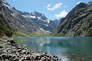
Lake Marian from the end of the walking track, with Mount Crosscut behind
|
|
| Location | Fiordland, South Island |
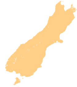
| Coordinates | 44°47′06″S 168°04′30″E / 44.785°S 168.075°E |
| Primary inflows | Marian Creek |
| Primary outflows | Marian Creek |
| Basin countries | New Zealand |
| Max. length | 2 kilometres (1.2 mi) |
| Max. width | 0.5 kilometres (0.3 mi) |
| Surface elevation | 695 metres (2,280 ft) |
Lake Marian is a beautiful alpine lake found in Fiordland National Park in the South Island of New Zealand. It sits high up in the Darran Mountains, just above where trees can grow. The lake is nestled in a special valley, surrounded by tall, snowy peaks that reach over 2,000 meters (about 6,500 feet) high!
Contents
Where is Lake Marian?
Lake Marian is located in a "hanging valley." This means it's a valley that ends high above a main valley. It leads northwest from the Hollyford Valley, close to a place called The Divide pass. The tall mountains around the lake keep it very sheltered.
How Water Flows In and Out
The lake gets its water from Marian Creek. This same creek also drains water out of the lake. Marian Creek then flows into the Hollyford River.
Before reaching Lake Marian, Marian Creek collects water from several permanent snowfields. These snowfields are high up in a bowl-shaped area called a cirque. The creek also drains two smaller alpine lakes, Lake Mariana and Lake Marianette. You can also see Lyttle Falls, a 122-meter (400-foot) tall waterfall, along the creek before it reaches Lake Marian.
Visiting Lake Marian
You can hike to Lake Marian on a walking track. The track starts from a car park on Hollyford Road. This spot is only about 1 kilometer (0.6 miles) from Milford Road (SH94).
The Lake Marian Track
The hike to Lake Marian usually takes about three hours to go there and back. The track begins by crossing the Hollyford River on a fun swing bridge.
As you walk, you'll follow Marian Creek upstream. The creek tumbles over many small waterfalls, making a lovely sound. After this part, the track becomes a bit rougher and can be muddy. The climb up to Lake Marian is quite a workout, as you go up almost 400 meters (1,300 feet) in height!
Views from Key Summit
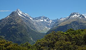
If you're looking for another amazing view, you can see Lake Marian from Key Summit. This spot is on the opposite side of the Hollyford Valley. You can reach Key Summit from a short side track off the famous Routeburn Track. From there, you can see Lake Marian nestled between the peaks of Mt Christina, Mount Crosscut, and Mt Gunn.
 | John T. Biggers |
 | Thomas Blackshear |
 | Mark Bradford |
 | Beverly Buchanan |


