Lake Rerewhakaaitu facts for kids
Quick facts for kids Lake Rerewhakaaitu |
|
|---|---|

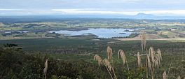
View of the lake from Mount Tarawera
|
|
| Location | North Island |
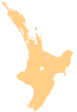
| Coordinates | 38°18′S 176°30′E / 38.300°S 176.500°E |
| Primary inflows | Awaroa and Mangakino Streams, subsurface |
| Primary outflows | subsurface, surface water channel engineered to Rangitaiki River |
| Catchment area | 3,700 ha (9,100 acres) |
| Basin countries | New Zealand |
| Max. length | 3.8 km (2.4 mi) |
| Max. width | 3.7 km (2.3 mi) |
| Surface area | 5.1 km2 (2.0 sq mi) |
| Average depth | 6 m (20 ft) |
| Max. depth | 18 m (59 ft) |
| Surface elevation | 434.9 metres (1,427 ft) |
Lake Rerewhakaaitu is a small, shallow lake found in the northern part of New Zealand. It is located about 30 kilometres (18.6 miles) east of the city of Rotorua. The lake sits right south of the active volcano Mount Tarawera. The land around the lake changed a lot after the big 1886 eruption of Mount Tarawera.
Contents
Lake Rerewhakaaitu: A Look at Its Location
Lake Rerewhakaaitu is the highest and southernmost of the Rotorua Te Arawa lakes. It sits about 435 metres (1,427 feet) above sea level. The lake is in a shallow bowl-shaped area. Most of the land around it is used for farming. However, in recent years, new forests, both native and non-native, have started to grow there.
How Water Flows In and Out
The lake gets its water from two streams called Awaroa and Mangakino. Lake Rerewhakaaitu does not have a natural, steady way for water to flow out. This is because it is higher than most of the water underground in the area.
To control the lake's highest water level, an artificial channel was built. This channel lets water flow out to the southeast when the lake gets too full. Sometimes, when the lake is very high, water can also flow into the Mangaharakeke Stream. The Awaroa Stream does not always have water flowing in it.
Scientists believe that some of the water from Lake Rerewhakaaitu flows underground. This underground water then feeds springs that form the Te Kauae Stream. This stream eventually flows into Lake Rotomahana, which is to the northwest. Water also flows underground from the lake towards the Rangitaiki River.
The Lake's Ancient History and Rocks
Lake Rerewhakaaitu is thought to be around 11,000 years old. It formed after a volcanic eruption called the Waiohau eruption, which happened about 14,000 years ago. The area around the lake has many volcanic rocks from past eruptions of Mount Tarawera. These rocks are called rhyolite and pyroclastics.
Older volcanic rocks, called ignimbrite, are also found along parts of the lake's southern and northern shores. These rocks came from a huge eruption of the Whakamaru Caldera about 335,000 years ago.
The 1886 eruption of Mount Tarawera covered the lake area with volcanic ash, called tephra. The ash was between 5 and 15 centimetres (2 to 6 inches) deep. Some of this ash, especially the thicker layers north of the lake, washed into the lake within a year or two after the eruption.
Wildlife and Water Quality
Lake Rerewhakaaitu is home to many different kinds of birds, with 46 species living there. Nine of these bird species are considered to be in danger. The lake has the largest group of banded dotterel birds that breed in the Rotorua Ecological District.
The lake is also stocked with Rainbow trout, which are a type of fish that were brought to New Zealand.
The lake's water quality is considered moderate. It has a good amount of plant and animal life. In 2014, its water quality was measured at 3.4 on a scale called the trophic level index.
Community and Education
The shores of Lake Rerewhakaaitu are often used for fun events, like dog shows. Dog agility competitions are held during Easter, and obedience shows happen in January.
Lake Rerewhakaaitu School
Lake Rerewhakaaitu School is a public primary school for students from Year 1 to Year 8. It teaches both boys and girls.
 | Leon Lynch |
 | Milton P. Webster |
 | Ferdinand Smith |


