Lake Rotomahana facts for kids
Quick facts for kids Lake Rotomahana |
|
|---|---|

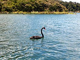
Black swans on Lake Rotomahana
|
|
| Location | North Island |
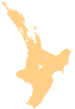
| Coordinates | 38°16′S 176°27′E / 38.267°S 176.450°E |
| Lake type | crater lake |
| Primary outflows | none |
| Basin countries | New Zealand |
| Max. length | 6.2 km (3.9 mi) |
| Max. width | 2.8 km (1.7 mi) |
| Surface area | 8.0 km2 (3.1 sq mi) |
| Average depth | 51 m (167 ft) |
| Max. depth | 112.4 m (369 ft) |
| Surface elevation | 337 m (1,106 ft) |
| Lake Rotomahana | |
|---|---|

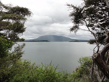
Lake Rotomahana in 2011
|
|
| Highest point | |
| Elevation | 337 m (1,106 ft) |
| Naming | |
| Etymology | Hot Lake |
| Geography | |
| Location | Bay of Plenty Region, New Zealand |
| Geology | |
| Mountain type | volcanic crater lake |
| Type of rock | basalt |
| Volcanic arc | Taupo Volcanic Zone |
| Last eruption | 1987 |
Lake Rotomahana is a lake in northern New Zealand. It covers about 8 square kilometers (800 hectares). You can find it about 20 kilometers southeast of Rotorua.
This lake sits right next to Mount Tarawera, a volcano that is currently sleeping. The land around the lake changed a lot after a huge eruption of Mount Tarawera in 1886. Lake Rotomahana and the mountain are both inside a larger area called the Okataina caldera.
The name Rotomahana means "warm lake" in the Māori language. This translation comes from an early explorer named Hochstetter.
Before the 1886 eruption, there were only two small lakes in this area. After the eruption, many craters filled with water over 15 years. This is how today's Lake Rotomahana was formed. It is the newest large natural lake in New Zealand. It is also the deepest lake in the Rotorua area.
The northern edge of Lake Rotomahana is close to Lake Tarawera. Less than 700 meters of land separates them. This land is mostly made of material from the 1886 eruption. Lake Rotomahana does not have a natural river flowing out of it. Its water level changes by about one meter depending on how much rain falls and how much water evaporates.
The lake is a special place for wildlife. It has been a protected area for birds for a very long time. Hunting birds here is not allowed. Many black swans live on the lake. There are also efforts to keep Patiti Island, the lake's largest island, free of pests. Scientists have found that Patiti Island is the closest part of the old lake that survived the 1886 eruption. It used to be called Rangipakaru Hill.
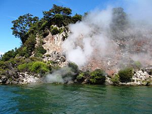
You cannot usually visit the lake directly. The only public way to get there is by using the Tourist Track. This track goes overland from Lake Tarawera. You can also take a boat cruise on the lake. This cruise lets you see hot springs and other natural features along the shore. It is offered by the Waimangu Volcanic Valley tourism group.
Contents
The Famous Pink and White Terraces
Before the 1886 eruption, the Pink and White Terraces were a famous natural wonder. They were located on the shores of Lake Rotomahana. Many people called them the eighth wonder of the natural world. They were New Zealand's most popular tourist spot from about 1870 to 1886. Sadly, the eruption either buried or destroyed them.
In 2011, scientists thought they had found the lower parts of the terraces. They believed these parts were on the lake bed, about 60 meters deep. However, newer research from 2016-2020 suggests something different. It seems the upper parts of both terraces might be on land. This means parts of them could have survived the eruption in their original spots.
The research in 2017 used the old notes of a geologist named Ferdinand von Hochstetter. He was from Germany and Austria and visited the lake in 1859. His notes are the only known detailed survey of the terraces before the eruption. Using his diaries and compass readings, a team of New Zealand researchers found a spot. They believe the Pink and White Terraces are preserved there. They think they are about 10 to 15 meters deep.
The researchers wanted to find money to explore the area fully. But any work would need approval from the local Māori tribe. The terraces are on their sacred ancestral land. In 2017, they tried using ground-penetrating radar. But the equipment could not look deep enough to confirm if the terraces were in those spots. Later research, using Hochstetter's survey, helped to find the exact locations of the Pink, Black, and White Terraces.
Exploring Green Lake
A smaller lake called Green Lake is near the eastern shore of Lake Rotomahana. It is important not to confuse it with the much larger Lake Rotokakahi, which is also known as Green Lake. That one is located to the west of Rotomahana.
This Green Lake is shaped like a circle and is about 100 meters wide. It gets its name from its unique color. It is much greener and darker than Lake Rotomahana. This lake also formed after the 1886 eruption of Mount Tarawera.
Before the eruption, there was another small lakelet. It was also called Green Lake (or Lake Rotopounamu). This older lake was to the north of Lake Rotomahana. But it was destroyed during the Tarawera eruption. After the eruption, water flowed into the new Green Lake crater. It was given the same name as the older lake. Other small lakes that existed before the eruption around Lake Rotomahana included Lakes Rotomakariri, Rangipakaru, Ruahoata, and Wairake.
The Myth of the Sunken Totara Forest
One interesting story about Lake Rotomahana is the "sunken totara forest." This is a semi-mythical feature. In 2016, a team of scuba divers explored the lake for the first time. They did not find any evidence of a sunken forest or trees.
Before the eruption, there were forests on Mount Tarawera. However, Totara trees were not very common. They were only found scattered on the western and southern sides of the mountain. It is unlikely that Totara tree groves would appear in the eruption craters. So, it seems any sunken forest would be in the northeast corner of the new lake.
The idea of a sunken forest would likely have happened after the eruption. This is similar to what the US Forest Service described after the Mount St. Helens eruption. Trees were uprooted by the eruption. They were then pushed into the crater during or after the event. As the new lake slowly formed over many years, these tree trunks floated for a while. Then, they tipped vertically and sank. They became stuck in the lake floor, looking like a sunken forest. This helps to explain another myth about the Tarawera eruption and Lake Rotomahana.
See also
 In Spanish: Lago Rotomahana para niños
 | Georgia Louise Harris Brown |
 | Julian Abele |
 | Norma Merrick Sklarek |
 | William Sidney Pittman |


