
Taupo Volcanic Zone facts for kids
The Taupo Volcanic Zone (often called TVZ) is a very active area in the North Island of New Zealand. It has been active for the last two million years and still has many active volcanoes. This zone stretches from Mount Ruapehu in the southwest, goes through the Taupo and Rotorua areas, and even extends out into the Bay of Plenty sea.


The Taupo Volcanic Zone is slowly getting wider, moving about 8 millimeters (about the width of a pencil) each year. It gets its name from Lake Taupo, which is a huge lake filling the crater of the biggest volcano in the zone, the Taupo Volcano.
Contents
Volcanic Activity in the TVZ
The Taupo Volcanic Zone has many volcanoes and areas with hot springs and geysers (called geothermal fields). Some of the most active volcanoes are Mount Ruapehu, Mount Ngauruhoe, and White Island. They erupt quite often.
The biggest eruption since people from Europe arrived in New Zealand was from Mount Tarawera in 1886. This powerful eruption caused many deaths and changed the landscape. Even earlier, around 1300 AD, a much larger eruption from Tarawera, called the Kaharoa eruption, would have affected the early Māori.
Past Major Eruptions
The last huge eruption from the Taupo Volcano (which now holds Lake Taupo) was the Hatepe eruption in 232 AD. It was so powerful that it's thought to have emptied the lake first! Then, a super-hot cloud of gas and ash, called a pyroclastic flow, covered a massive area of about 20,000 square kilometers (that's a huge amount of land) with volcanic ash. Scientists believe about 120 cubic kilometers of material was blasted out, and over 30 cubic kilometers of that came out in just a few minutes!
Even bigger was the Oruanui eruption from Taupo about 26,500 years ago. This eruption blasted out an estimated 1170 cubic kilometers of material. It was the most recent eruption on Earth to reach VEI-8, which is the highest level on the Volcanic Explosivity Index. This means it was incredibly powerful.
The Rotorua Caldera has been quiet for a longer time. Its main eruption happened about 240,000 years ago, though some lava has slowly oozed out in the last 25,000 years.
How Big is the Taupo Volcanic Zone?
The Taupo Volcanic Zone is about 350 kilometers (217 miles) long and 50 kilometers (31 miles) wide. It starts at Mount Ruapehu in the south and goes all the way to the underwater Whakatane volcano, which is about 85 kilometers (53 miles) past White Island in the northeast.
This zone is part of a larger area where the Earth's plates are moving. It sits behind the Kermadec-Tonga Subduction Zone, where one of Earth's huge plates is sliding under another. This movement causes the volcanic activity you see in the TVZ.
Studying the TVZ
Scientists have been studying the Taupo Volcanic Zone closely. They've found that the Earth's crust (its outer layer) under the TVZ might be as thin as 16 kilometers (10 miles). They also believe there's a huge layer of hot, melted rock (called magma) about 50 kilometers (30 miles) wide and 160 kilometers (100 miles) long, sitting just 10 kilometers (6 miles) below the surface.
The history of the volcanoes here shows that while they don't erupt often, when they do, their eruptions are very large, violent, and destructive.
Volcanoes, Lakes, and Hot Spots
The Taupo Volcanic Zone is home to several important volcanic areas, each with its own volcanoes, lakes, and geothermal fields.
Whakatane Area – Bay of Plenty
This area includes volcanoes that are partly or fully underwater, like the Submarine Whakatane volcano.
- Mayor Island/Tuhua
- Whale Island
- Whakaari/White Island: A very active island volcano.
- Mount Edgecumbe
- A geothermal field here is the Kawerau Power Station area, where heat from the Earth is used to make electricity.
Rotorua Volcanic Center
This area is famous for its geothermal activity and beautiful lakes.
- Rotorua Caldera: A large volcanic crater, about 22 km wide, now mostly filled by Lake Rotorua.
- Ngongotaha (volcano)
- Lakes:
* Lake Rotorua: A large lake with Mokoia Island in its center.
- Geothermal fields:
* Tikitere/Hell's Gate * Whakarewarewa: Home to the famous Pohutu Geyser.

Okataina Volcanic Center
This center is known for its complex volcanic structures and many lakes.
- Okataina Caldera: A large caldera, roughly 27 x 20 km.
- Mount Tarawera: Famous for its 1886 eruption.
- Lakes:
* Lake Okataina * Lake Tarawera * Lake Rotokakahi (Green Lake) * Lake Tikitapu (Blue Lake) * Lake Okareka * Lake Rotomahana * Lake Rotoiti * Lake Rotoma * Lake Rotoehu
- Geothermal fields:
* Waimangu Volcanic Rift Valley: Home to Frying Pan Lake, one of the largest hot springs in the world.


Maroa Volcanic Center
This area includes several large calderas and active geothermal sites.
- Maroa Caldera: About 16 x 25 km.
- Reporoa Caldera: About 10 x 15 km.
- Whakamaru Caldera: A very large caldera, 30 x 40 km.
- Geothermal fields:
* Waiotapu: Famous for its colorful hot springs and geysers like Lady Knox Geyser. * Wairakei: A major geothermal power station area, including Craters of the Moon. * Orakei Korako: Another beautiful geothermal park. * Ngatamariki * Ohaaki Power Station
Taupo Volcanic Center
This is the heart of the TVZ, home to New Zealand's largest lake.
- Taupo Caldera: A huge caldera, roughly 35 km wide, now filled by Lake Taupo.
- Mount Tauhara
- Lakes:
* Lake Taupo: The largest lake in New Zealand.


Tongariro Volcanic Center
This area includes some of New Zealand's most iconic volcanoes, often seen in movies!
- Kakaramea
- Pihanga
- Mount Tongariro: A large volcanic complex.
* Mount Ngauruhoe: A cone-shaped volcano that is a main vent of Tongariro. * Tama crater lakes: Volcanic lakes within craters.
- Mount Ruapehu: The highest mountain in the North Island and an active volcano.
- Lakes:
* Lake Rotoaira * Lake Rotopounamu
- Geothermal fields:
* Ketetahi Springs
Mangakino Volcanic Center
This is the westernmost and oldest volcanic caldera in the Taupo Volcanic Zone. The Waikato River flows through this area.
- Artificial Lake Maraetai
Other important features in the TVZ include areas where the ground has dropped down, forming valleys called grabens, such as Whakatane, Ngakuru, and Ruapehu grabens.
Images for kids
-
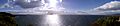
Panorama across Lake Taupo
See also
 In Spanish: Zona volcánica de Taupo para niños
