Lake Rivadavia facts for kids
Quick facts for kids Lake Rivadavia |
|
|---|---|
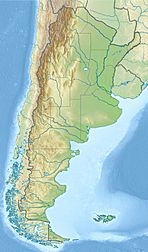
| Location | Chubut Province, Argentina, |
| Coordinates | 42°36′S 71°39′W / 42.600°S 71.650°W |
| Lake type | glacial lake |
| Primary inflows | Carrileufú River |
| Primary outflows | Rivadavia River |
| Catchment area | 1,647 square kilometres (636 sq mi) |
| Basin countries | Argentina |
| Max. length | 13 kilometres (8.1 mi) |
| Max. width | 2.5 kilometres (1.6 mi) |
| Surface area | 21.7 km2 (5,400 acres) |
| Average depth | 103.7 metres (340 ft) |
| Max. depth | 147.2 metres (483 ft) |
| Water volume | 2.25 cubic kilometres (1,820,000 acre⋅ft) |
| Residence time | 3.6 years |
| Surface elevation | 527 metres (1,729 ft) |
Lake Rivadavia (also called Lago Rivadavia) is a beautiful lake found in Chubut Province, Argentina. It's the second lake in a series of lakes that are all connected. These lakes are part of the Futaleufú River system. This river eventually flows into the Pacific Ocean in Chile.
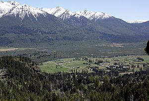
Lake Rivadavia is located in the Andes mountains. It was formed by glaciers, which are like giant, slow-moving rivers of ice. The lake sits in a long, narrow valley between tall, icy peaks. Most of the lake is inside the Los Alerces National Park, which is a protected area.
You can find Argentina Provincial Highway 71 (RP 71) along the eastern side of the lake. This road was unpaved in 2016. There are only a few campgrounds near the highway for visitors. The small town of Villa Lago Rivadavia is about 3 km (1.9 mi) north of the lake.
Exploring Lake Rivadavia's Features
Lake Rivadavia is located at an elevation of 527 metres (1,729 ft) above sea level. It sits in a deep, narrow valley, much like a fjord. This valley is surrounded by mountains that were shaped by glaciers. On the east, you'll find Sierra Rivadavia, which is 1,924 metres (6,312 ft) tall. To the west is Cerro Coronado, standing at 2,097 metres (6,880 ft).
Rivers and Connected Lakes
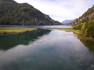
The Jara River flows into Lake Rivadavia on its western side, near the southern end. The water from Lake Rivadavia then flows out through the Rivadavia River. This river travels about 6.7 kilometres (4.2 mi) to a smaller lake called Green Lake (Lago Verde). Green Lake is about 151 hectares (370 acres) in size.
The Rivadavia River and Green Lake are very popular for trout fishing. People describe them as having "turquoise water, Jurassic Park like jungle, and snow-capped peaks." You can find several types of trout here, including Rainbow, brown, and brook trout. There are also landlocked Atlantic Salmon. It's important to know that these fish were introduced to the lake and are not native to the area.
The water then flows from Green Lake into a river called the Arrayanes River. There's a pedestrian bridge that crosses this river near where the water flows out of Green Lake. The Arrayanes River is also joined by water flowing from Lake Menéndez. After that, it flows for about 5 kilometres (3.1 mi) until it reaches Futalaufquen Lake.
Argentina Provincial Highway 71 continues along the shore of Green Lake and the Arrayanes River, leading to Futalaufquen Lake. Along this route, you'll find campgrounds and lodges where visitors can stay.
See also
 In Spanish: Lago Rivadavia para niños


