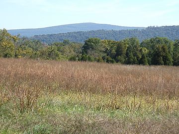
Lambs Knoll facts for kids
Quick facts for kids Lambs Knoll |
|
|---|---|

Lambs Knoll
|
|
| Highest point | |
| Elevation | 1,758 ft (536 m) |
| Geography | |
| Location | Washington County / Frederick County, Maryland |
| Parent range | South Mountain Blue Ridge Mountains |
| Climbing | |
| First ascent | unknown |
| Easiest route | drive up |
Lambs Knoll is a mountain peak located in Maryland, United States. It sits right on the border between Washington County and Frederick County. This peak is part of South Mountain, a long ridge that stretches through Maryland and Pennsylvania.
Lambs Knoll is about 1,758 feet (536 meters) tall. It's the second highest point on South Mountain in Maryland, just a bit shorter than Quirauk Mountain.
Exploring Lambs Knoll
Lambs Knoll is found south of two famous spots called Fox and Turner's Gaps. These gaps are like low points in the mountain ridge.
The Appalachian Trail
A very famous hiking path, the Appalachian Trail, goes right by Lambs Knoll. It passes just to the southeast of the mountain's top. If you're hiking, a smaller trail branches off the Appalachian Trail and leads up to the very top of Lambs Knoll.
At the summit, you can see an old fire tower. There's also a concrete tower that used to be a military communication center. Now, the FAA uses it.
Just a little south of the peak, the Appalachian Trail passes by a spot called White Rocks. This place offers some of the best views from the mountain! On the eastern side of Lambs Knoll, you can find the Bear Springs Cabin. This cabin is maintained by the Potomac Appalachian Trail Club and is a nice spot for hikers.
History of Lambs Knoll
The mountain we call Lambs Knoll today had a different name long ago. In the 1800s, people called it Lamb's Old Field. It's believed that a family named Milton and Mary Lamb farmed on the mountain's top in the 1830s, which is likely how it got its name.
This old name was still used during the American Civil War and maybe even into the early 1900s. The first time the name "Lambs Knoll" was officially written down was in 1934. That's when the Civilian Conservation Corps (a group that helped build things during the Great Depression) put up a fire tower on the summit.
The fire tower had people working in it until the late 1940s. Hikers used to climb it to get amazing views of the Middletown and Hagerstown valleys. However, in the 1980s, the state of Maryland put a fence around the tower, so people couldn't climb it anymore.
 | William Lucy |
 | Charles Hayes |
 | Cleveland Robinson |

