Lanagan, Missouri facts for kids
Quick facts for kids
Lanagan, Missouri
|
|
|---|---|

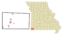
Location in McDonald County and the state of Missouri
|
|
| Country | United States |
| State | Missouri |
| County | McDonald |
| Area | |
| • Total | 0.94 sq mi (2.44 km2) |
| • Land | 0.94 sq mi (2.44 km2) |
| • Water | 0.00 sq mi (0.00 km2) |
| Elevation | 886 ft (270 m) |
| Population
(2020)
|
|
| • Total | 373 |
| • Density | 396.81/sq mi (153.18/km2) |
| Time zone | UTC-6 (Central (CST)) |
| • Summer (DST) | UTC-5 (CDT) |
| ZIP code |
64847
|
| Area code(s) | 417 |
| FIPS code | 29-40592 |
| GNIS feature ID | 2396706 |
Lanagan is a small city located in McDonald County, Missouri, in the United States. It's known for being close to a natural spot called Truitt's Cave. In 2020, about 373 people lived in Lanagan. This was a bit less than the 419 people who lived there in 2010.
Contents
History of Lanagan
Lanagan has had a post office since 1891. This means people could send and receive mail there for a very long time. People say the city was named after someone who worked for the railroad.
Geography of Lanagan
Lanagan is found in the western part of McDonald County. A main road, Missouri Route 59, goes right through the city. It's called Main Street there. This road can take you north to Anderson (about 3 miles away) or south to Noel (about 6 miles away). Pineville, which is the main town of the county, is about 5 miles to the east. You can get there using local county roads.
The city of Lanagan covers about 0.94 square miles (2.44 square kilometers) of land. There is no water area within the city limits. Indian Creek flows through Lanagan. Most of the city is on the west side of this creek. Indian Creek flows south and eventually joins the Elk River. The Elk River is part of the larger Neosho River system.
Population of Lanagan
The number of people living in Lanagan has changed over the years. Here's a quick look at the population counts from different years:
| Historical population | |||
|---|---|---|---|
| Census | Pop. | %± | |
| 1930 | 347 | — | |
| 1940 | 340 | −2.0% | |
| 1950 | 368 | 8.2% | |
| 1960 | 357 | −3.0% | |
| 1970 | 374 | 4.8% | |
| 1980 | 440 | 17.6% | |
| 1990 | 501 | 13.9% | |
| 2000 | 411 | −18.0% | |
| 2010 | 419 | 1.9% | |
| 2020 | 373 | −11.0% | |
| U.S. Decennial Census | |||
What the 2010 Census Showed
In 2010, the census counted 419 people living in Lanagan. There were 171 households, which are groups of people living together in one home. Out of these, 105 were families. This means about 446 people lived in each square mile of the city.
About 34% of the households had children under 18 living there. About 40% were married couples. Some households had a single parent, either a mother or a father. The average household had about 2.45 people. The average family had about 3.14 people.
The average age of people in Lanagan in 2010 was 36.3 years old. About 29% of the residents were under 18. About 14% were 65 years old or older.
Economy and Jobs in Lanagan
For a long time, Lanagan's economy depended on agriculture, which means farming. There were also small factories and local shops. In recent years, more people have started visiting Lanagan. This is because of nearby natural places like Truitt's Cave. Tourism is becoming more important for the city.
However, like many small towns, Lanagan faces some money challenges. The average income for a household in Lanagan was $40,625. Also, about 19.9% of the people in Lanagan live below the poverty line. This means they have a very low income compared to what is needed to live comfortably.
See also
 In Spanish: Lanagan (Misuri) para niños
 | Misty Copeland |
 | Raven Wilkinson |
 | Debra Austin |
 | Aesha Ash |

