Lanare, California facts for kids
Quick facts for kids
Lanare
|
||
|---|---|---|
|
||

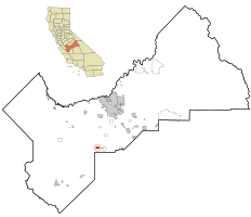
Location in Fresno County and the state of California
|
||
| Country | ||
| State | ||
| County | Fresno | |
| Area | ||
| • Total | 2.018 sq mi (5.228 km2) | |
| • Land | 2.018 sq mi (5.228 km2) | |
| • Water | 0 sq mi (0 km2) 0% | |
| Elevation | 207 ft (63 m) | |
| Population
(2020)
|
||
| • Total | 540 | |
| • Density | 267.6/sq mi (103.3/km2) | |
| Time zone | UTC-8 (PST) | |
| • Summer (DST) | UTC-7 (PDT) | |
| ZIP code |
93656
|
|
| Area code(s) | 559 | |
| FIPS code | 06-40116 | |
| GNIS feature IDs | 1660887, 2408570 | |
Lanare is a small community in Fresno County, California, United States. It is known as a census-designated place (CDP). This means it's a special area defined by the government for counting people.
In 2010, about 589 people lived in Lanare. This was a bit more than the 540 people counted in 2000. Lanare is located about 24 miles (39 km) south of Fresno. It sits at an elevation of 207 feet (63 meters) above sea level.
The name "Lanare" comes from Llewellyn A. Nares. He was the person who helped develop this community. Today, people in Lanare get their mail from the Riverdale Post Office. Students living in Lanare go to public schools in Riverdale.
Contents
Exploring Lanare's Location
Lanare is located in Fresno County. It covers a total area of about 2.0 square miles (5.2 square kilometers). All of this area is land, with no water.
A Look Back at Lanare's History
Lanare was named after Llewellyn A. Nares. He was a very important person in the area. He owned a large piece of land called the Rancho Laguna de Tache. This was a big ranch from the time when California was part of Mexico.
A post office opened in Lanare in 1912. It served the community until 1925. A railway line, the Laton and Western Railway, was built to Lanare in 1911. This helped connect the community to other places.
Understanding Lanare's Population
| Historical population | |||
|---|---|---|---|
| Census | Pop. | %± | |
| U.S. Decennial Census | |||
Population in 2010
The 2010 United States Census counted 589 people living in Lanare. This means there were about 292 people for every square mile (113 people per square kilometer).
Most of the people in Lanare were from diverse backgrounds. About 88% of the people identified as Hispanic or Latino.
All 589 people lived in homes, not in special group housing. There were 140 households in total. Many of these households (about 64%) had children under 18 living there. The average household had about 4 people.
The population included people of all ages. About 34% were under 18 years old. About 8% were 65 years or older. The average age in Lanare was 28.5 years.
Most homes were owned by the people living in them (about 62%). The rest were rented.
Population in 2000
In the census of 2000, there were 540 people in Lanare. There were 126 households. The population density was about 272 people per square mile (105 people per square kilometer).
About 76% of the people in 2000 were Hispanic or Latino.
Many households had children under 18 (about 46%). The average household size was about 4 people. The average family size was about 4.5 people.
The population was also spread across different age groups. About 34% were under 18. About 10% were 65 or older. The average age was 28 years.
The average income for a household in 2000 was $26,375. For families, it was $28,056. About 29% of the people in Lanare lived below the poverty line. This included many children and older adults.
See also
 In Spanish: Lanare para niños
 | Precious Adams |
 | Lauren Anderson |
 | Janet Collins |


