Lanfair Valley facts for kids
Quick facts for kids Lanfair Valley |
|
|---|---|

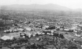
Hart Ghost Town
(northeast Lanfair Valley) |
|
| Length | 30 mi (48 km) |
| Geography | |
| Location | United States |
| Country | California |
| States/Provinces | Mojave National Preserve and Mojave Desert |
| Communities | Cima, Kelso and Lanfair |
| Borders on |
List
|
Lanfair Valley is a special place in the Mojave Desert, located in southeastern California. It's very close to the Nevada state line. This valley is surrounded by tall mountains. To the north, you'll find the New York Mountains and Castle Mountains. The Piute Range is to the east, and the Woods Mountains and Vontrigger Hills are to the south. You'll see lots of Joshua Trees growing all over the valley. The valley sits about 4,045 feet above sea level.
Water from the valley flows southeast, then south, through a dry riverbed called the Sacramento Wash. This wash then turns east and joins with the Piute Wash, which comes from Nevada. Together, they flow into the Colorado River. This unique U-shaped drainage is the first major dry riverbed from the west that empties into the Colorado River, just south of Lake Mead.
Contents
Exploring the Mojave Road
The Old Mojave Road is a historic trail that crosses right through the middle of Lanfair Valley, going from west to east. As it heads east, it passes just south of the center of the Piute Range. From there, it continues through the southern part of the Piute Valley until it reaches its end point. This end is located on the west bank of the Colorado River, across from Fort Mohave, Arizona.
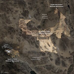
Discovering Castle Mountains National Monument

The Castle Mountains National Monument forms part of the northern and northeastern edge of Lanfair Valley. This area is important because it's where the water from the valley begins to flow. The Castle Mountains (California) themselves are on a water divide. This means they separate the water that flows south into Lanfair Valley from the water that flows northwest into the Piute Wash. The Piute Wash is part of the Piute Valley, which is another valley similar to Lanfair Valley, located just to its east.
In the central part of Lanfair Valley, you can find some interesting hills. These are called the Grotto Hills, and sometimes they are also known as the Giotto Hills. Nearby, you'll also see the Lanfair Buttes, which are isolated hills with steep sides.
The Ghost Town of Lanfair
Lanfair Valley is home to the Lanfair ghost town. You can find it where Cedar Canyon Road and Lanfair Road meet. This town was once a busy place, but now all that's left are some old ruins. Both Lanfair Valley and the ghost town are named after Ernest L. Lanfair, who owned land in the area.
Even though much of the valley is inside the Mojave National Preserve, tens of thousands of acres are still privately owned. Not many people live in the valley today. However, a long time ago, it was a lively community with schools, farms, post offices, and even a railroad.
Valley Geography
The Hart ghost town site is in the northeast part of Lanfair Valley. Its location is 35°17′20″N 115°6′12″W / 35.28889°N 115.10333°W. The Lanfair ghost town site is located at 35°07′36″N 115°11′00″W / 35.12667°N 115.18333°W.
 | Anna J. Cooper |
 | Mary McLeod Bethune |
 | Lillie Mae Bradford |

