Piute Range facts for kids
Quick facts for kids Piute Range |
|
|---|---|

western flank
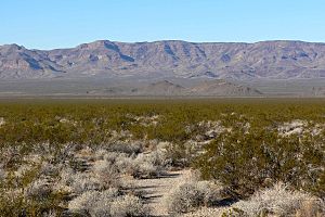
View due west from Piute Valley |
|
| Highest point | |
| Elevation | 4,908 ft (1,496 m) |
| Dimensions | |
| Length | 20 mi (32 km) N-S |
| Geography | |
| Country | United States |
| Topo map | USGS East of Grotto Hills |
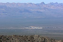
The Piute Range is a mountain range found in the Mojave Desert in the United States. Most of these mountains are in San Bernardino County, California, but a northern part stretches into Nevada. This range forms the eastern edge of the Mojave National Preserve, which is a large natural area managed by the National Park Service.
Where are the Piute Mountains?
The Piute Range is located east of a place called Lanfair Valley. To its southeast are the New York Mountains and Castle Mountains. The Piute Range runs from north to south. It forms the western edge of the Piute Valley, which also stretches north past towns like Cal-Nev-Ari and Searchlight.
A Look Back in Time: Fort Piute
An important historical site called Fort Piute is located at the southeastern end of the Piute Range, near Piute Spring. This fort was one of many military stations built long ago. Their job was to protect travelers using the Mojave Road. This road was a key route across the Mojave Desert, connecting San Bernardino to Fort Mojave on the Colorado River.
How Water Flows in the Desert

The southern part of the large McCullough Range meets four valleys and three mountain ranges at a special spot. This spot is called a water divide. It's where water flows in different directions.
West of the McCullough Range are the Roach and Ivanpah Dry Lakes. These are "endorheic" lakes, meaning their water doesn't flow out to the ocean. Instead, it stays in the valley and usually evaporates. The Ivanpah Valley extends north towards Las Vegas.
Northeast of the water divide is the southwest Eldorado Valley, which also has an endorheic lake called Eldorado Dry Lake. To the southwest, the Piute Valley drains south. Then, the Piute Wash turns east and flows steeply past the Dead Mountains. Finally, its water reaches the Colorado River near Needles.
Most of the Mojave National Preserve is also endorheic. This means that much of the water that falls there stays within the preserve. For example, the western border of the preserve is near Baker, California, and has two dry lakes: Silver Dry Lake and Soda Dry Lake.
The Piute Valley Watershed is the first major area southeast of Las Vegas where water flows into the western side of the Colorado River.
 | Leon Lynch |
 | Milton P. Webster |
 | Ferdinand Smith |


