
Langres facts for kids
Quick facts for kids
Langres
|
||
|---|---|---|

View of Langres
|
||
|
||

Langres
Location in France

Langres
Location in Grand Est
|
||
| Country | France | |
| Region | Grand Est | |
| Department | Haute-Marne | |
| Arrondissement | Langres | |
| Canton | Langres | |
| Intercommunality | Le Grand Langres | |
| Area
1
|
22.33 km2 (8.62 sq mi) | |
| Population
(2014)
|
7,850 | |
| • Density | 351.55/km2 (910.5/sq mi) | |
| Time zone | UTC+01:00 (CET) | |
| • Summer (DST) | UTC+02:00 (CEST) | |
| INSEE/Postal code |
52269 /52200
|
|
| Elevation | 327–475 m (1,073–1,558 ft) (avg. 401 m or 1,316 ft) |
|
| Website | www.langres.fr | |
| 1 French Land Register data, which excludes lakes, ponds, glaciers > 1 km2 (0.386 sq mi or 247 acres) and river estuaries. | ||

Langres is a cool town in northeastern France. It's in a region called Grand Est, and it's an important local center for the Haute-Marne department. Langres is known for its history and its beautiful location.
Contents
Exploring Langres: Where is it?
Langres is located in the southern part of the Haute-Marne department in France. It sits on a high piece of land, like a natural fortress, called a promontory. This promontory is part of a larger area known as the Plateau de Langres.
The town covers about 22.3 square kilometers (about 8.6 square miles). It's pretty high up, with an average height of 401 meters (about 1,316 feet) above sea level. The city hall is even higher, at 450 meters (about 1,476 feet).
Langres is well-connected to other major cities in France. For example:
- Paris, the capital of France, is about 294 kilometers (183 miles) away.
- Lyon is about 269 kilometers (167 miles) away.
- Strasbourg is about 279 kilometers (173 miles) away.

The town of Langres is surrounded by several other small towns. These include Balesmes-sur-Marne, Champigny-lès-Langres, Chatenay-Mâcheron, Humes-Jorquenay, Peigney, Perrancey-les-Vieux-Moulins, Saint-Ciergues, Saint-Vallier-sur-Marne, and Saints-Geosmes.
 |
Perrancey-les-Vieux-Moulins | Peigney | Peigney | |
| Saints-Geosmes | Peigney | |||
| Saints-Geosmes | Saints-Geosmes | Saint-Vallier-sur-Marne |
The Marne river flows through the area where Langres is located.
Langres Weather: What's the Climate Like?
Langres has a "Marine West Coast Climate." This means it has mild temperatures and rain throughout the year. It's similar to the climate you might find in parts of the United Kingdom or the Pacific Northwest of the USA.
On average, Langres gets about 746.8 millimeters (29.4 inches) of rain each year. The rainiest month is usually December, while August tends to be the driest.
The average temperature in Langres for the whole year is about 9.7°C (49.5°F). July is usually the warmest month, with an average temperature of 18.7°C (65.7°F). January is the coolest, averaging around 1.1°C (34.0°F).
| Climate data for Langres, France | |||||||||||||
|---|---|---|---|---|---|---|---|---|---|---|---|---|---|
| Month | Jan | Feb | Mar | Apr | May | Jun | Jul | Aug | Sep | Oct | Nov | Dec | Year |
| Mean daily maximum °C (°F) | 3.4 (38.1) |
5.1 (41.2) |
9.4 (48.9) |
13.1 (55.6) |
17.4 (63.3) |
20.8 (69.4) |
23.5 (74.3) |
22.2 (72.0) |
18.9 (66.0) |
13.8 (56.8) |
7.6 (45.7) |
4.1 (39.4) |
13.3 (55.9) |
| Daily mean °C (°F) | 1.1 (34.0) |
2.2 (36.0) |
5.8 (42.4) |
8.9 (48.0) |
13.1 (55.6) |
16.3 (61.3) |
18.7 (65.7) |
18.6 (65.5) |
14.8 (58.6) |
10.5 (50.9) |
5 (41) |
1.9 (35.4) |
9.7 (49.5) |
| Mean daily minimum °C (°F) | −1.3 (29.7) |
−0.7 (30.7) |
2.1 (35.8) |
4.6 (40.3) |
8.7 (47.7) |
11.7 (53.1) |
13.9 (57.0) |
13.9 (57.0) |
10.6 (51.1) |
7.2 (45.0) |
2.4 (36.3) |
−0.3 (31.5) |
6.1 (42.9) |
| Average rainfall mm (inches) | 77.1 (3.04) |
55 (2.2) |
57.5 (2.26) |
52 (2.0) |
67.5 (2.66) |
51.1 (2.01) |
55.4 (2.18) |
41.7 (1.64) |
61.8 (2.43) |
75.9 (2.99) |
68.2 (2.69) |
83.5 (3.29) |
746.7 (29.39) |
| Source: Weatherbase.com [1] | |||||||||||||
Langres Population: How Many People Live There?
People who live in Langres are called Langonais (for boys and men) or Langonaises (for girls and women) in French. They can also be called Langrois or Langroises.
In 2014, the city of Langres had a population of 7,850 people. This means there were about 351 people living in each square kilometer of the town.
How Langres's Population Has Changed Over Time

Langres Government: How the Town is Run
Langres is a "subprefecture" of the Haute-Marne department. This means it's an important administrative center for that part of France. It's the main town for the arrondissement of Langres.
It's also the main town (called chef-lieu in French) for the Langres canton. A canton is a group of smaller towns and villages. The Langres canton includes 18 different towns, and in 2014, about 12,160 people lived there.
Langres is part of a larger group of towns called Le Grand Langres. This group works together on things like public services and local development.
Langres's Sister Cities: Friends Around the World
Langres has special friendships with other towns in different countries. These are called "twinned" or "partner" towns. They often exchange visits and learn about each other's cultures.
Langres is twinned with:
 Beaconsfield, United Kingdom (since 1995)
 Ellwangen, Germany (since 1964)
 Abbiategrasso, Italy
Gallery
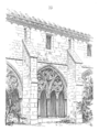
-
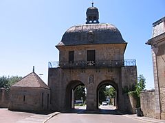
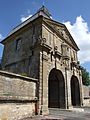
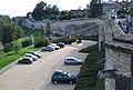
Porte des Moulins in the old city wall.
-
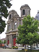
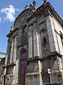
Saint-Mammès cathedral, Langres.
-
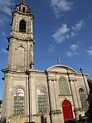
Saint-Martin church, Langres.
-
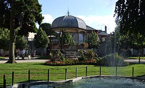
Claude-Henriot square.
-
Renaissance house.


Related pages
Images for kids
-
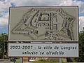
Road sign announcing improvements to the Citadel of Langres
-
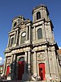
Saint-Mammès Cathedral
-
Saint-Mammès Cathedral
-
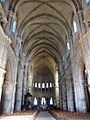
Saint-Mammès Cathedral
-
Saint-Mammès Cathedral
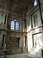
-
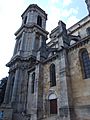
Saint-Mammès Cathedral Cloister
-
Saint-Mammès Cathedral Cloister
-
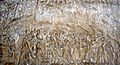
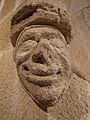
Bas relief at Saint-Mammès Cathedral
-
Moulins Gate
-
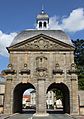
Moulins Gate
-
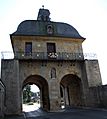
Moulins Gate
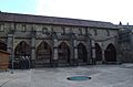
-
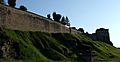
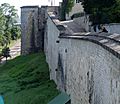
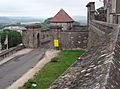
Ramparts of the Citadel
-
Ramparts and Funicular
-
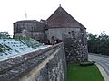
Saint-Ferjeux Tower
-
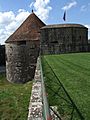
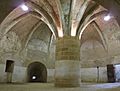
Navarre and d'Orval Tower
-
Navarre and d'Orval Tower
-
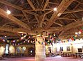
Navarre and d'Orval Tower ceiling framework
-
Navarre and d'Orval Tower torch holder
-
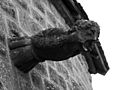
Navarre and d'Orval Tower gargoyle
-
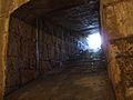
Navarre and d'Orval Tower
-
Navarre and d'Orval Tower
-
Navarre and d'Orval Tower
-
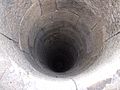
Navarre and d'Orval Tower well
-
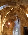
Navarre and d'Orval Tower vaulted arch
-
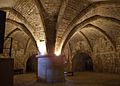
Former Jesuit College
-
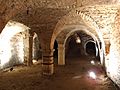
Renaissance cellar
-
Entrance to City Hall
-
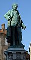
Statue of Denis Diderot
-
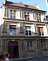
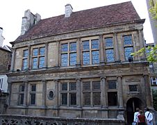
Renaissance period mansion


See also
 In Spanish: Langres (Alto Marne) para niños
