Lawes, Queensland facts for kids
Quick facts for kids LawesQueensland |
|||||||||||||||
|---|---|---|---|---|---|---|---|---|---|---|---|---|---|---|---|
| Population | 105 (2021 census) | ||||||||||||||
| • Density | 6.91/km2 (17.9/sq mi) | ||||||||||||||
| Postcode(s) | 4343 | ||||||||||||||
| Area | 15.2 km2 (5.9 sq mi) | ||||||||||||||
| Time zone | AEST (UTC+10:00) | ||||||||||||||
| Location | |||||||||||||||
| LGA(s) | Lockyer Valley Region | ||||||||||||||
| State electorate(s) | Lockyer | ||||||||||||||
| Federal Division(s) | Wright | ||||||||||||||
|
|||||||||||||||
Lawes is a small rural area, also called a locality, in Queensland, Australia. It is part of the Lockyer Valley Region. In 2021, about 105 people lived in Lawes.
Where is Lawes Located?
Lawes is found on the eastern edge of the town of Gatton. A major road, the Warrego Highway, runs through the northern part of Lawes. This highway goes from east to west.
The Main Line railway also crosses through Lawes. There used to be a train station called Lawes railway station, but it is no longer used today.
The Story Behind the Name
The name Lawes comes from the old Lawes railway station. Before 1936, the station was known as "College Siding." This was because it was next to the Queensland Agricultural College.
In 1936, the college principal, John K. Murray, suggested the name "Lawes." He wanted to honor Sir John Bennett Lawes. Sir John was an important scientist from England. He started the Rothamsted Experimental Station and helped people understand how to use artificial fertilizers, especially superphosphate, to grow better crops.
What Can You Find in Lawes?
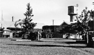
Lawes is home to the heritage-listed University of Queensland Gatton Campus. This campus is a part of the University of Queensland. It is an important place for learning and research.
 | Jessica Watkins |
 | Robert Henry Lawrence Jr. |
 | Mae Jemison |
 | Sian Proctor |
 | Guion Bluford |


