Laytonsville, Maryland facts for kids
Quick facts for kids
Laytonsville, Maryland
|
|||
|---|---|---|---|
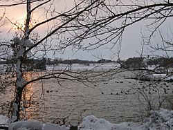
The Rachel Carson Greenway in February 2006
|
|||
|
|||
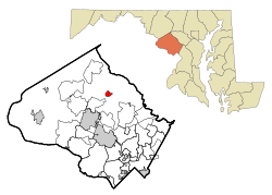
Location of Laytonsville in Montgomery County and Maryland
|
|||
| Country | |||
| State | |||
| County | Montgomery | ||
| Incorporated | 1892 | ||
| Area | |||
| • Total | 1.05 sq mi (2.72 km2) | ||
| • Land | 1.05 sq mi (2.71 km2) | ||
| • Water | 0.00 sq mi (0.01 km2) | ||
| Elevation | 614 ft (187 m) | ||
| Population
(2020)
|
|||
| • Total | 572 | ||
| • Density | 546.32/sq mi (211.02/km2) | ||
| Time zone | UTC-5 (Eastern (EST)) | ||
| • Summer (DST) | UTC-4 (EDT) | ||
| ZIP code |
20882
|
||
| Area code(s) | 301, 240 | ||
| FIPS code | 24-46250 | ||
| GNIS feature ID | 0585383 | ||
Laytonsville is a small town in Montgomery County, Maryland, United States. It's a quiet place with a rich history. In 2020, about 572 people lived there. This was an increase from 353 people in 2010. Laytonsville officially became a town in 1892.
Contents
History of Laytonsville
Laytonsville was once known by a different name: "Cracklintown." This interesting name came from a popular food called cracklin bread. This bread was a type of bacon cornbread often baked in the area. The entire region was even called the Cracklin District.
The original town was larger than it is today. It stretched along Sundown Road towards the Hawlings River. The first church, school, and store were located in this older part of town.
Early Roads and Trade
The first major road through Cracklintown was built in the early 1800s. It was known as the Brink-Sundown Road. This road connected the Monocacy River to Ellicotts Mills.
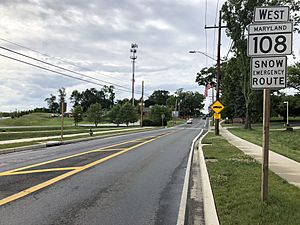
Another important road, which later became Route 108, was added around the same time. These crossroads were very important for trade. They created a main path for farmers to move their cattle and pigs. These animals were headed to busy markets in Baltimore. Laytonsville became a good stopping point for the drovers (people who moved livestock).
By the early 1800s, solid brick buildings started to appear. These included the Layton House and a tavern. By 1850, the southeast corner of the crossroads was developed. Most of the rest of the town along Route 108 grew later, in the 1870s.
Farming Success
Laytonsville grew not only because of its roads but also due to successful farming. The local farmers were lucky to have excellent soil. This soil, called Manor loam or Chester loam, was very fertile. It drained well but also held moisture. A layer of red clay beneath the loam helped keep the roots watered. This was helpful even during hot, dry summers.
Laytonsville officially became an incorporated town in 1892. This meant it had its own local government.
Geography of Laytonsville
Laytonsville is located in the northern part of Montgomery County. It is about 10 miles (16 km) north of Rockville. Rockville is the county seat. The town is also about 24 miles (39 km) north of Washington, D.C.. It is the same distance southeast of Frederick.
The town covers about 1.05 square miles (2.72 square kilometers) of land. Only a tiny part, about 0.004 square miles (0.01 square kilometers), is water. Laytonsville sits on a low ridge. Water from the west side of the ridge flows into the Goshen Branch. This branch leads to Seneca Creek. Seneca Creek is part of the Potomac River watershed. Water from the east side flows into the Hawlings River. This river is a tributary of the Patuxent River.
Laytonsville feels more like a small, rural town. It is different from nearby Olney. You can find many farmlands on the edges of town. There are also many homes on large pieces of land.
Population and People
| Historical population | |||
|---|---|---|---|
| Census | Pop. | %± | |
| 1900 | 148 | — | |
| 1910 | 133 | −10.1% | |
| 1920 | 133 | 0.0% | |
| 1930 | 146 | 9.8% | |
| 1940 | 127 | −13.0% | |
| 1950 | 132 | 3.9% | |
| 1960 | 196 | 48.5% | |
| 1970 | 293 | 49.5% | |
| 1980 | 195 | −33.4% | |
| 1990 | 248 | 27.2% | |
| 2000 | 277 | 11.7% | |
| 2010 | 353 | 27.4% | |
| 2020 | 572 | 62.0% | |
| U.S. Decennial Census | |||
In 2010, there were 353 people living in Laytonsville. These people made up 127 households. About 98 of these were families. The town's population density was about 339 people per square mile.
Many households, about 39%, had children under 18 living there. Most households, about 68%, were married couples. The average household had about 2.78 people. The average family had about 3.19 people.
The average age in Laytonsville was 42.9 years old. About 23.8% of residents were under 18. About 38.5% were between 45 and 64 years old. The population was almost evenly split between males (51%) and females (49%).
Education in Laytonsville
Students in Laytonsville attend schools run by the Montgomery County Public Schools.
The schools that serve the Laytonsville area include:
- Laytonsville Elementary School
- Gaithersburg Middle School
- Gaithersburg High School
Transportation
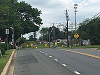
The main state highway that goes through Laytonsville is Maryland Route 108. This road generally runs from east to west. It connects Maryland Route 27 in Damascus to Maryland Route 175 in eastern Columbia.
Maryland Route 108 also connects to other important highways. These include U.S. Route 29, Maryland Route 97, and Maryland Route 650. All three of these highways lead towards Washington, D.C..
See also
 In Spanish: Laytonsville (Maryland) para niños
 | May Edward Chinn |
 | Rebecca Cole |
 | Alexa Canady |
 | Dorothy Lavinia Brown |


