Leading Creek (Little Kanawha River tributary) facts for kids
Quick facts for kids Leading Creek |
|
|---|---|

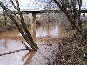
Leading Creek at its mouth in Gilmer County in 2006
|
|
|
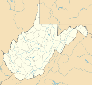
Location of the mouth of Leading Creek in Gilmer County, West Virginia
|
|
| Country | United States |
| State | West Virginia |
| Counties | Lewis, Gilmer |
| Physical characteristics | |
| Main source | near Camden, Lewis County 1,120 ft (340 m) 39°03′10″N 80°34′30″W / 39.0528699°N 80.5750948°W |
| River mouth | Little Kanawha River Gilmer County 696 ft (212 m) 38°56′48″N 80°52′37″W / 38.9467562°N 80.8770491°W |
| Length | 28.6 mi (46.0 km) |
| Basin features | |
| Basin size | 147 sq mi (380 km2) |
Leading Creek is a river in central West Virginia, United States. It is about 28.6 miles (46 km) long. It flows into the Little Kanawha River. A river that flows into a larger river is called a tributary.
From the Little Kanawha River, Leading Creek's water travels to the Ohio River. Then it flows into the mighty Mississippi River. This means Leading Creek is part of the huge watershed of the Mississippi. It drains an area of 147 square miles (381 km²). This area is a rural part of the Allegheny Plateau that was never covered by glaciers.
Contents
Where Leading Creek Begins and Ends
Leading Creek starts near Camden in Lewis County. It then flows west-southwest. The creek passes through small towns like Alum Bridge and Pickle Street. These towns are in Lewis County.
The creek continues into Gilmer County. There it flows through Linn and Troy. Finally, it joins the Little Kanawha River. This meeting point is about 2.4 miles (3.9 km) west-northwest of Glenville.
Roads Along the Creek
Between Camden and Troy, roads follow the creek's path. These roads include parts of U.S. Route 33 and U.S. Route 119. They also include West Virginia Route 47. These routes were once part of an old road called the Staunton and Parkersburg Turnpike.
Nature Around Leading Creek
Most of the land around Leading Creek is covered by forests. About 84% of the area is forested. These forests are mostly made up of deciduous trees. Deciduous trees are trees that lose their leaves in the fall.
About 15% of the land is used for farming. This includes areas for pasture (where animals graze) and other types of agriculture. This information comes from the West Virginia Department of Environmental Protection.
The Name of Leading Creek
The official name of the creek is Leading Creek. However, it has also been known as "Leeding Creek." This spelling was used in the past.
According to local stories, the creek got its name because explorers used it to find their way. It "led" them through the area.
How Fast the Water Flows
Scientists measure how much water flows in rivers. They use a special tool called a stream gauge. One stream gauge was placed on Leading Creek. It was located about 1.4 miles (2.3 km) upstream from where the creek meets the Little Kanawha River.
From 1937 to 1951, the average flow of the creek was 220 cubic feet per second (6 m³/s). This is like 220 boxes, each 1 foot by 1 foot by 1 foot, passing by every second.
The highest flow ever recorded there was on June 25, 1950. On that day, 12,100 cubic feet per second (343 m³/s) of water rushed by. The lowest flow was much smaller. It was only 0.1 cubic feet per second (0 m³/s). This happened on several days in September 1939.
 | Lonnie Johnson |
 | Granville Woods |
 | Lewis Howard Latimer |
 | James West |


