Lee County, Georgia facts for kids
Quick facts for kids
Lee County
|
|
|---|---|

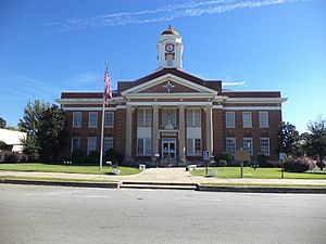
Lee County courthouse in Leesburg
|
|

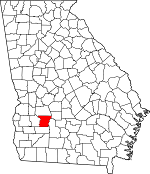
Location within the U.S. state of Georgia
|
|
 Georgia's location within the U.S. |
|
| Country | |
| State | |
| Founded | June 9, 1825 |
| Named for | Henry Lee III |
| Seat | Leesburg |
| Largest city | Leesburg |
| Area | |
| • Total | 362 sq mi (940 km2) |
| • Land | 356 sq mi (920 km2) |
| • Water | 5.9 sq mi (15 km2) 1.6%% |
| Population
(2020)
|
|
| • Total | 33,163 |
| • Density | 93/sq mi (36/km2) |
| Time zone | UTC−5 (Eastern) |
| • Summer (DST) | UTC−4 (EDT) |
| Congressional district | 2nd |
Lee County is a place in the state of Georgia. It's like a big neighborhood with its own government. In 2020, about 33,163 people lived here. The county was started in 1825. Its main town, or "county seat," is Leesburg. Lee County is part of the larger Albany area.
Contents
History of Lee County
Lee County has an interesting past. The land for Lee County and a few other counties was once owned by the Creek people. They gave up this land in 1825. This happened during a meeting called the Treaty of Indian Springs.
The borders for these new counties were set on June 9, 1825. However, they didn't get their names until December 14, 1826. Lee County was named to honor Henry Lee III. He was a famous American general.
Geography of Lee County
Lee County covers about 362 square miles. Most of this area, about 356 square miles, is land. The rest, about 5.9 square miles, is water. This means about 1.6% of the county is water.
Most of the county is in the Kinchafoonee-Muckalee area. This area is part of a larger river system. This system is called the Apalachicola-Chattahoochee-Flint River Basin. The eastern part of the county is near the Middle Flint River. A small southern part is near the Lower Flint River. There is also a tiny corner in the southwest. This corner is near the Ichawaynochaway Creek.
Major Roads in Lee County
Many important roads run through Lee County. These roads help people travel around the county. They also connect Lee County to other places.
Neighboring Counties
Lee County shares its borders with several other counties. These are:
- Sumter County (to the north)
- Crisp County (to the northeast)
- Worth County (to the east)
- Dougherty County (to the south)
- Terrell County (to the west)
Communities in Lee County
Lee County has two main communities. These are the towns where people live and work.
- Leesburg (the county seat)
- Smithville
Population and People
The number of people living in Lee County has changed over time. The U.S. Census counts the population every ten years.
| Historical population | |||
|---|---|---|---|
| Census | Pop. | %± | |
| 1830 | 1,680 | — | |
| 1840 | 4,520 | 169.0% | |
| 1850 | 6,660 | 47.3% | |
| 1860 | 7,196 | 8.0% | |
| 1870 | 9,567 | 32.9% | |
| 1880 | 10,577 | 10.6% | |
| 1890 | 9,074 | −14.2% | |
| 1900 | 10,344 | 14.0% | |
| 1910 | 11,679 | 12.9% | |
| 1920 | 10,904 | −6.6% | |
| 1930 | 8,328 | −23.6% | |
| 1940 | 7,837 | −5.9% | |
| 1950 | 6,674 | −14.8% | |
| 1960 | 6,204 | −7.0% | |
| 1970 | 7,044 | 13.5% | |
| 1980 | 11,684 | 65.9% | |
| 1990 | 16,250 | 39.1% | |
| 2000 | 24,757 | 52.4% | |
| 2010 | 28,298 | 14.3% | |
| 2020 | 33,163 | 17.2% | |
| 2023 (est.) | 33,872 | 19.7% | |
| U.S. Decennial Census 1790-1880 1890-1910 1920-1930 1930-1940 1940-1950 1960-1980 1980-2000 2010 |
|||
In 2020, the census showed 33,163 people lived in Lee County. There were 10,226 households. About 7,872 of these were families.
| Group | Number of People | Percentage |
|---|---|---|
| White (not Hispanic or Latino) | 22,758 | 68.62% |
| Black or African American (not Hispanic or Latino) | 7,331 | 22.11% |
| Native American | 57 | 0.17% |
| Asian | 850 | 2.56% |
| Pacific Islander | 9 | 0.03% |
| Other/Mixed (two or more races) | 1,205 | 3.63% |
| Hispanic or Latino | 953 | 2.87% |
Education in Lee County
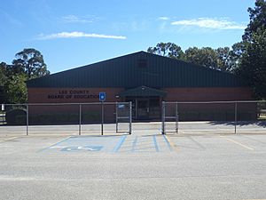
Public schools in Lee County are managed by the Lee County School District. This district helps make sure students get a good education. The only high school in the district is Lee County High School.
See also
 In Spanish: Condado de Lee (Georgia) para niños


