Leichhardt County facts for kids
Quick facts for kids LeichhardtNew South Wales |
|||||||||||||||
|---|---|---|---|---|---|---|---|---|---|---|---|---|---|---|---|

Location in New South Wales
|
|||||||||||||||
|
|||||||||||||||
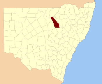
Leichhardt County is a special type of land division in New South Wales, Australia. It's one of 141 such areas called cadastral divisions. Think of it like a big, old-fashioned way to divide up land for mapping and ownership. This county is located south of the Namoi River and includes parts of the Castlereagh River, even covering the town of Coonamble.
Leichhardt County was named to honor a famous explorer and scientist named Friedrich Wilhelm Ludwig Leichhardt. He was from Prussia (which is now part of Germany) and explored many parts of Australia in the 1800s. He disappeared during one of his expeditions in 1848, but his discoveries were very important.
What are Parishes?
Inside Leichhardt County, just like in other counties, there are smaller land areas called parishes. These parishes are even tinier divisions of land. They were created a long time ago to help organize land for things like property records and local government.
Each parish has its own name and specific boundaries. They help people keep track of land ownership and manage local areas. Even though we use modern maps and GPS today, these old divisions are still used for official land records in Australia. Leichhardt County contains many of these parishes, each playing a small part in how the land is organized.

