Gregory County, New South Wales facts for kids
Quick facts for kids GregoryNew South Wales |
|||||||||||||||
|---|---|---|---|---|---|---|---|---|---|---|---|---|---|---|---|

Location in New South Wales
|
|||||||||||||||
|
|||||||||||||||
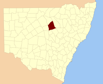
Gregory County is one of the 141 special land areas in New South Wales, Australia. These areas are called cadastral divisions. Think of them like old-fashioned map sections used for keeping track of land.
This county is located in the central-western part of New South Wales. It's bordered by the Bogan River on its western side. You can find Gregory County to the northeast of the town of Nyngan. It's also home to the amazing Macquarie Marshes Nature Reserve, a very important wetland area. The small town of Quambone is also located within Gregory County.
Who Was Gregory County Named After?
Gregory County got its name from a very important person: Sir Augustus Charles Gregory. He was a famous explorer and surveyor-general. A surveyor-general is like the head map-maker for a whole region.
Augustus Gregory lived from 1819 to 1905. He explored many parts of Australia. Naming a county after him was a way to honor his contributions to mapping the land.
Understanding Parishes in Gregory County
Within Gregory County, there are smaller land areas called parishes. In Australia, parishes are traditional land units. They were used for mapping and land ownership records. They are not the same as church parishes.
Each parish has its own name and location. They help to divide the larger county into smaller, easier-to-manage sections. Today, these parishes are part of different local government areas (LGAs). LGAs are like local councils that manage towns and regions.
Some of the LGAs that cover parts of Gregory County include:
- Bogan Shire
- Warren Shire
- Coonamble Shire
These shires help manage the land and services in the different parishes.
 | Lonnie Johnson |
 | Granville Woods |
 | Lewis Howard Latimer |
 | James West |

