Bogan River facts for kids
Quick facts for kids Bogan River |
|
|---|---|

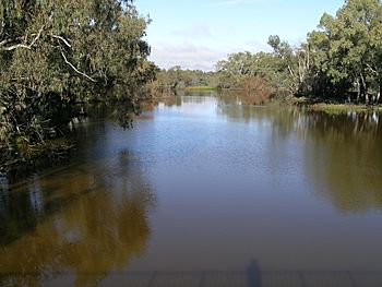
The Bogan River at Nyngan
|
|
|
Location of the Bogan River mouth in New South Wales
|
|
| Country | Australia |
| State | New South Wales |
| Region | Central West, Orana |
| Physical characteristics | |
| Main source | Little River (Parkes) Cooks Myalls, near Parkes 305 m (1,001 ft) 33°00′30″S 148°02′00″E / 33.00833°S 148.03333°E |
| River mouth | Darling River Dry Bogan Weir, near Bourke 111 m (364 ft) 29°58′30″S 146°20′56″E / 29.97500°S 146.34889°E |
| Length | 617 km (383 mi) |
| Basin features | |
| River system | Macquarie–Barwon sub-catchment, Darling River catchment, Murray-Darling basin |
| Basin size | 18,000 km2 (6,900 sq mi) |
| Tributaries |
|
| Basin area is upstream of Nyngan only | |
The Bogan River is a river in New South Wales, Australia. It's a perennial river, which means it flows all year round. The river is an important part of the larger Murray-Darling basin, one of the biggest river systems in the world.
The Bogan River starts near Parkes and flows for about 617 kilometres (383 mi) (383 miles). It eventually joins the Little Bogan River to form part of the Darling River near Bourke.
The name "Bogan" comes from the Aboriginal people. In the Wiradjuri or Ngiyambaa languages, it means 'the birthplace of a notable leader of the local tribe'.
Contents
Where is the Bogan River Located?
The Bogan River begins in the foothills of the Herveys Range, near a place called Cooks Myalls. This is about 19 kilometres (12 mi) (12 miles) north-west of Parkes. The river generally flows towards the north-west.
It passes by several towns, including Tottenham, Peak Hill, and Nyngan. East of Bourke, the Bogan River meets the Little Bogan River, and together they become part of the Darling River.
The Bogan River has more than twenty smaller streams, called tributaries, that flow into it. Some of the main ones are Bullock, Bulbodney, Pangee, and Whitbarrow Creeks.
Why is the Bogan River Unique?
Unlike many other major rivers in inland New South Wales, the Bogan River doesn't start in areas with lots of rainfall. This means its water flow can be low and change a lot. Because of this, it's not used much for irrigation, which is when water is supplied to help grow crops.
There are several weirs (small dams) along the river. These include Muddal Weir, Nyngan Weir, and Gongolgon Weir. Weirs help manage the river's water flow.
The Kamilaroi Highway crosses the Bogan River about 43 kilometres (27 mi) (27 miles) east of Bourke.
A Look at Bogan River's History
Who Lived Along the River?
For thousands of years, different Aboriginal groups lived along the Bogan River. Near Peak Hill, the Wiradjuri people were the traditional owners of the land. Around Nyngan, the Ngiyambaa Aboriginal people were the main custodians.
When Did Europeans Explore the River?
The Bogan River was first crossed by a European explorer named John Oxley in 1817. Later, in 1829, Charles Sturt named it New Years Creek. However, it was already known as the Bogan River before Major Sir Thomas Mitchell explored the area in 1835.
During Mitchell's expedition in 1835, a botanist named Richard Cunningham became lost near the Bogan River and sadly disappeared.
How Has the River Been Used?
In 1941, the Albert Priest Channel was built. This channel helps bring water from the Macquarie River to Nyngan and Cobar. It's about 60 kilometres (37 mi) (37 miles) long and connects to the Bogan River upstream of Nyngan.
The Bogan River can sometimes flood. In April 1990, there was a very big flood in Nyngan. Even though local people worked hard to build walls with sandbags, about 2,500 people had to leave their homes. The floods caused about AUD$50 million in damage. Other big floods happened in 1928, 1950, and 1989.
 | John T. Biggers |
 | Thomas Blackshear |
 | Mark Bradford |
 | Beverly Buchanan |


