Ewenmar County facts for kids
Quick facts for kids EwenmarNew South Wales |
|||||||||||||||
|---|---|---|---|---|---|---|---|---|---|---|---|---|---|---|---|

Location in New South Wales
|
|||||||||||||||
|
|||||||||||||||
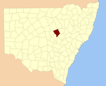
Ewenmar County is a special type of land division in New South Wales, Australia. It's one of 141 such areas, like a big section on a map. This county is located in the central-west part of New South Wales. You can find it between two important rivers: the Macquarie River to the west and the Castlereagh River to the east. It's also situated between the towns of Warren and Gilgandra. The name "Ewenmar" comes from a word used by the local Aboriginal people, showing the deep history of the land.
Contents
What Are Cadastral Divisions?
Have you ever wondered how land is officially divided and recorded? That's where cadastral divisions come in! These are special ways of splitting up land for legal and administrative reasons. Think of them like invisible lines on a map that help governments keep track of who owns what, where properties are, and how land is used.
Why Do We Use Cadastral Divisions?
- Keeping Records: They help keep clear records of land ownership and boundaries.
- Planning: They make it easier for governments to plan for new roads, towns, or protected areas.
- Taxes: They help work out land taxes fairly.
- History: Many of these divisions, like counties, have been around for a long time and tell us about how places were settled.
In New South Wales, counties are one of the oldest types of cadastral divisions. They were first set up in the 1800s to help manage the growing colony.
Geography and Rivers
Ewenmar County is a fascinating place because of its location between two major rivers: the Macquarie River and the Castlereagh River. Rivers are super important for the environment and for people!
The Macquarie River
The Macquarie River flows through a large part of New South Wales. It's known for its beautiful wetlands, especially the Macquarie Marshes, which are home to many different birds and other wildlife. The river provides water for farming and supports many towns along its path.
The Castlereagh River
The Castlereagh River is another significant waterway in the region. It's often called an "anabranch" river, which means it sometimes splits into different channels and then rejoins. Like the Macquarie, it's vital for the local environment and agriculture.
These rivers shape the landscape of Ewenmar County, influencing the types of plants and animals that live there, as well as the farming activities that take place.
Parishes Within Ewenmar County
Counties like Ewenmar are further divided into smaller areas called parishes. Think of parishes as even smaller puzzle pieces that make up the bigger county puzzle. Each parish is a specific land area, often named after local features or early settlers.
Why Parishes Are Important
- Local Details: Parishes help pinpoint very specific locations within a county.
- Historical Use: Historically, they were used for land grants and surveys.
- Local Government: Today, these parishes fall within different Local Government Areas (LGAs), which are like local councils that manage services for towns and communities. For example, some parishes in Ewenmar County are part of the Gilgandra Shire, while others belong to the Warren Shire or Coonamble Shire.
While there are many parishes within Ewenmar County, each with its own unique coordinates, they all contribute to the overall map and history of this part of New South Wales.

