Leilani Estates, Hawaii facts for kids
Quick facts for kids
Leilani Estates, Hawaii
|
|
|---|---|

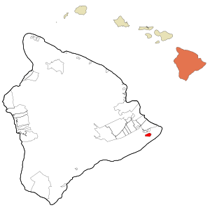
Location in Hawaiʻi County and the state of Hawaii
|
|
| Country | United States |
| State | Hawaii |
| County | Hawaiʻi |
| Area | |
| • Total | 4.04 sq mi (10.45 km2) |
| • Land | 4.04 sq mi (10.45 km2) |
| • Water | 0.00 sq mi (0.00 km2) |
| Elevation | 771 ft (235 m) |
| Population
(2020)
|
|
| • Total | 1,139 |
| • Density | 282.28/sq mi (109.00/km2) |
| Time zone | UTC-10 (Hawaii-Aleutian Standard Time Zone) |
| ZIP code |
96778
|
| Area code(s) | 808 |
| FIPS code | 15-44562 |
| GNIS feature ID | 1852580 |
Leilani Estates is a community in Hawaii, United States. It is located on the Big Island of Hawaii, in an area called the Puna District. This community was created in 1964.
In 2020, about 1,139 people lived here. This number was lower than in 2010, when 1,560 people lived in Leilani Estates.
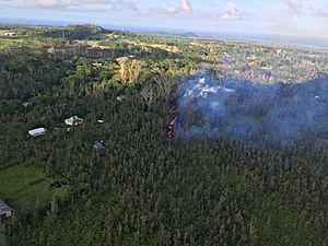
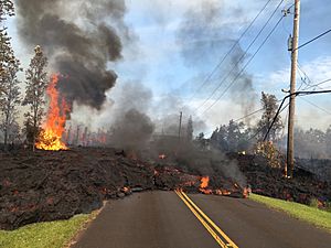
A big event happened here in 2018. The Kīlauea volcano erupted, and lava flowed into the community. Many homes were destroyed. Because of the danger, people are not allowed to visit the areas covered by the hardened lava. The community association also set rules to stop people from parking or trespassing on private roads and properties.
Contents
Where is Leilani Estates Located?
Leilani Estates is found near the eastern tip of the island of Hawaiʻi. It is about 3 miles (5 km) south of a town called Pāhoa. It is also about 23 miles (37 km) south of Hilo, a larger city.
The community covers an area of about 4.04 square miles (10.45 square kilometers). All of this area is land.
Living Near a Volcano: Lava Flow Hazard Zone 1
Leilani Estates is built right on a part of the lower East Rift Zone of the Kīlauea volcano. This means it is in what is called "lava flow hazard zone 1."
Zone 1 is the most dangerous area. New volcanic vents, where lava can come out, can open up anywhere in this zone. Since 1790, about 10% of the Puna area has been covered by lava flows. This shows how active the volcano can be.
The 2018 Kīlauea Eruption
During the 2018 eruption, 24 new openings, called volcanic fissure vents, formed. Of these, 14 erupted lava within Leilani Estates.
One of the most active vents was named ʻAhuʻailāʻau (also known as Fissure 8). It shot lava fountains as high as 330 feet (100 meters) into the air! The lava flowed very quickly, sometimes as fast as 76 meters per hour (250 feet per hour), as it moved towards the ocean.
By the time the eruption ended on August 9, 2018, around 200 homes in Leilani Estates had been destroyed by the lava.
Who Lives in Leilani Estates?
| Historical population | |||
|---|---|---|---|
| Census | Pop. | %± | |
| 2020 | 1,139 | — | |
| U.S. Decennial Census | |||
In 2010, there were 1,560 people living in 696 homes in Leilani Estates. The population density was about 371 people per square mile (143 people per square kilometer).
The people living in Leilani Estates come from many different backgrounds. In 2010, the population included people who identified as White, African American, Native American, Asian, Native Hawaiian or Pacific Islander, and people of two or more races. About 9.8% of the population identified as Hispanic or Latino.
The community has a mix of age groups. In 2010, about 17.4% of the people were under 18 years old. About 13.4% were 65 years old or older.
See also
 In Spanish: Leilani Estates para niños
 | Roy Wilkins |
 | John Lewis |
 | Linda Carol Brown |


