
Lenhartsville, Pennsylvania facts for kids
Quick facts for kids
Lenhartsville, Pennsylvania
|
|
|---|---|

A winter day in Lenhartsville
|
|

Location of Lenhartsville in Berks County in Pennsylvania
|
|

Lenhartsville, Pennsylvania
Location in Pennsylvania

Lenhartsville, Pennsylvania
Location in the United States
|
|
| Country | United States |
| State | Pennsylvania |
| County | Berks |
| Area | |
| • Total | 0.19 sq mi (0.49 km2) |
| • Land | 0.18 sq mi (0.48 km2) |
| • Water | 0.01 sq mi (0.01 km2) |
| Elevation | 381 ft (116 m) |
| Population
(2020)
|
|
| • Total | 180 |
| • Density | 972.97/sq mi (375.79/km2) |
| Time zone | UTC-5 (EST) |
| • Summer (DST) | UTC-4 (EDT) |
| ZIP Code |
19534
|
| Area code(s) | 610 |
| FIPS code | 42-42688 |
Lenhartsville is a small borough located in Berks County, Pennsylvania, in the United States. It's a quiet community with a population of 180 people, according to the 2020 census.
Contents
Where is Lenhartsville Located?
Lenhartsville is found in the northern part of Berks County. It sits in a valley near Maiden Creek. Even though it's surrounded by Greenwich Township, Lenhartsville is its own separate area.
The borough is quite small. It covers about 0.19 square miles (0.49 square kilometers). A tiny part of this area, about 0.01 square miles, is water.
The History of Lenhartsville
The town of Lenhartsville was founded by Heinrich (Henry) Lenhart. He lived from 1773 to 1837. The land where the town was built used to belong to his grandfather, Johan Peter Lenhart.
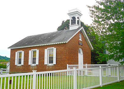
A special place called the Lenhart Farm is in Lenhartsville. It was added to the National Register of Historic Places in 1978. This means it's an important historical site that should be protected.
-
Borough Hall

Population Over the Years
The number of people living in Lenhartsville has changed over time. Here's a look at the population from 1880 to 2020:
|
||||||||||||||||||||||||||||||||||||||||||||||||||||||||||||||||||||||||
In 2000, there were 173 people living in Lenhartsville. Most of the people living there were White. Many people in the area have a background linked to the Pennsylvania Dutch culture.
Getting Around Lenhartsville
Lenhartsville has a few public roads. Some of these roads are taken care of by the state, and others by the borough itself.
_at_Old_Route_22_in_Lenhartsville,_Berks_County,_Pennsylvania.jpg)
Main Roads in Lenhartsville
Pennsylvania Route 143 is the main state highway that goes through Lenhartsville. It runs through the town on Chestnut Street and Willow Street. This road can take you south to U.S. Route 222 near Kutztown and Reading. It also goes northeast to New Tripoli.
Nearby Highways
A major highway, Interstate 78/U.S. Route 22, passes just north of Lenhartsville. You can get to Lenhartsville from this highway using Exit 35. This highway connects Lenhartsville to bigger cities like Allentown to the east and Harrisburg to the west.
See also
 In Spanish: Lenhartsville para niños
