Lerum Municipality facts for kids
Quick facts for kids
Lerum Municipality
Lerums kommun
|
||
|---|---|---|

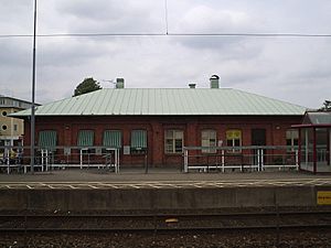
Lerum Railway Station
|
||
|
||
 |
||
| Country | Sweden | |
| County | Västra Götaland County | |
| Seat | Lerum | |
| Area | ||
| • Total | 310.2 km2 (119.8 sq mi) | |
| • Land | 260.29 km2 (100.50 sq mi) | |
| • Water | 49.91 km2 (19.27 sq mi) | |
| Area as of January 1, 2010. | ||
| Population
(June 30, 2012)
|
||
| • Total | 38,491 | |
| • Density | 124.084/km2 (321.38/sq mi) | |
| Time zone | UTC+1 (CET) | |
| • Summer (DST) | UTC+2 (CEST) | |
| ISO 3166 code | SE | |
| Province | Västergötland | |
| Municipal code | 1441 | |
| Website | www.lerum.se | |
| Density is calculated using land area only. | ||
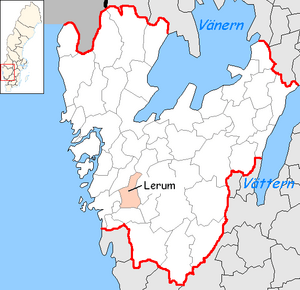
Lerum Municipality (Lerums kommun) is a special area in western Sweden. It is located just east of Gothenburg. This area is called a municipality. Its main town and administrative center is Lerum.
In 1969, Lerum Municipality became its current size. This happened when the older Lerum area joined with Skallsjö and Stora Lundby.
Symbols of Lerum
In 2007, Lerum Municipality got a new logotype. A logotype is like a special picture or symbol that represents a company or place. This new symbol was created to be used instead of its older official coat of arms.
Old Coat of Arms
The old coat of arms showed the head of an ox and three oak leaves. Officials thought this old symbol looked "outdated." Even though it is not used much anymore, the coat of arms is still officially recognized.
New Logotype Design
The new logotype has a colorful weaving pattern. This modern design helps represent the municipality in a fresh way.
Towns and Villages in Lerum
Lerum Municipality is made up of several towns and villages. These places are called "localities."
- Floda
- Gråbo
- Lerum (This is the main town and where the local government is located)
- Norsesund (partly)
- Stenkullen
- Tollered
See also
 In Spanish: Municipio de Lerum para niños
 | Leon Lynch |
 | Milton P. Webster |
 | Ferdinand Smith |


