
Liff, Angus facts for kids
Quick facts for kids Liff |
|
|---|---|
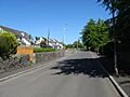
 Church Road, Liff, looking east |
|
| Lua error in Module:Location_map at line 420: attempt to index field 'wikibase' (a nil value).Lua error in Module:Location_map at line 420: attempt to index field 'wikibase' (a nil value). | |
| Population | 1,570 (2020) |
| OS grid reference | NO333328 |
| Council area | |
| Lieutenancy area | |
| Country | Scotland |
| Sovereign state | United Kingdom |
| Post town | DUNDEE |
| Postcode district | DD2 |
| Dialling code | 01382 |
| Ambulance | Scottish |
| EU Parliament | Scotland |
| UK Parliament |
|
| Scottish Parliament |
|
Liff is a small village in Angus, Scotland. It's located about 4.5 miles (7 km) west-northwest of Dundee. The village sits on a south-facing hill, about 2 miles (3 km) north of the River Tay. In 2011, Liff had a population of 568 people.
The area around Liff is mostly farmland. People have described it as a peaceful place with great views over the Firth of Tay. Just half a mile (800 meters) east of Liff is the site of the old Royal Dundee Liff Hospital, which is now private homes. Even further east, you'll find Camperdown House and Park. To the south is House of Gray, a large old mansion built in the 1700s. Liff village itself has twelve buildings that are officially protected due to their history.
For many centuries, the name Liff referred to a much larger area, not just the village. This included the parish of Liff and nearby areas like Benvie, Invergowrie, Logie, and Lochee. This meant it covered big parts of the city of Dundee. The small village around the church was often called Kirkton of Liff or simply the Kirkton.
An ancient spot in the village, called Hurly Hawkin, was once believed to be a palace belonging to King Alexander I. The village's name also appears in the title of a famous book, The Meaning of Liff, by Douglas Adams and John Lloyd.

Contents
History of Liff
How did Liff get its name?
The exact origin of the name Liff is not fully known. Some older writers thought it might come from a Gaelic word, lighe, meaning a flood. They also suggested it could be linked to the River Isla, which was sometimes spelled Yleff. However, there isn't a river or flood near Liff, so this idea is unlikely.
A more recent idea from experts is that 'Liff' comes from the Gaelic word cliathach. This means 'side' or 'slope of a hill'. This makes sense because Liff is located on a long slope rising from the River Tay. This theory is supported by old farm names like Ochterlyf ('Upper Liff') and Netherliff ('Lower Liff'). These names would mean 'upper slope' and 'lower slope', which fits the landscape. This explanation is popular but hasn't been fully proven.
What is Hurly Hawkin?
Just west of Liff Churchyard, on a 90-foot (27-meter) high point, are the remains of a place called Hurly Hawkin. For centuries, people believed this was a palace of King Alexander I. Stories from the 1400s say that King Alexander I started building a palace here. One time, rebels tried to attack him there, but he escaped and later gave the land to the Monastery of Scone.
However, archaeological digs starting in 1958 showed that the structures at Hurly Hawkin are much older than King Alexander's time. The earliest building was a very old fort. Later, a broch (a type of Iron Age tower) was built on top of it. This broch, with walls about 19 feet (5.8 meters) thick, dates back to the second century AD. Many ancient items were found during the digging.
Was there a 'Battle of Liff'?
Old historians tell a story about a battle between Alpin, King of the Scots, and Brudus, leader of the Picts. Brudus supposedly tricked his enemies by dressing women and camp followers as soldiers. This made his army look bigger and helped him win the battle. King Alpin was captured and killed. The place where he died was called Pitalpin.
In the 1800s, some writers started calling this the 'Battle of Liff'. They used Liff to refer to the whole large parish area. However, there is no real proof that this battle happened very close to the Liff village we know today.
Liff's later history
For a long time, the land around Liff belonged to the Abbey of Scone. After the Scottish Reformation, the land was divided up. This led to the growth of a 'kirktown' at Liff. A kirktown was a small village linked to a church, where people worked together on farms.
This way of farming lasted for about 200 years. Over the 1700s, these small farms were replaced by larger estates. Many small farmers had to leave their homes and move to towns.
By 1791, over 2,000 acres (800 hectares) were divided into 12 large farms. Farmers grew oats, wheat, turnips, potatoes, and barley. Besides farming, many people in Liff also wove coarse linen cloth. New roads were also being built, which created jobs for day-laborers.
In 1842, there were 26 families in the Kirktown of Liff. Many people still farmed in spring and harvest, but wove cloth in winter. Potatoes became a very important crop, and dairy farming also grew.
By the 1880s, the area called 'Liff' was very large, covering parts of what is now the city of Dundee. The local church group, the Kirk Session, was even responsible for helping the poor people in this big industrial area.
Liff in the 1900s
In the early 1900s, Liff was a busy village with many different jobs. There was a blacksmith, a carpenter, a shoemaker, a stonemason, and shopkeepers. There was also a doctor and staff at the nearby hospital.
Traveling traders also visited the village. A baker came twice a week, and a fish cart brought fresh fish. Grocery and butcher vans also made deliveries. A tailor from another town would take orders and deliver clothes on his next visit.
A bus service started in 1932, connecting Liff to Dundee. Before that, people had to walk 4 miles (6.4 km) to the nearest shops in Lochee.
The 1940s were tough years. Mains electricity arrived just after the Second World War. But people still had to get water from wells until 1961, when piped water and sewage systems were finally installed.
During the second half of the 1900s, many local trades disappeared. The pub closed, and the carpenter, shoemaker, and blacksmith shops shut down. Machines replaced people on farms. By 2001, Liff's population had dropped to 410 people. The school and church were the only public buildings left.
However, in the early 2000s, Liff's population started to grow again. New houses were built, and old farm buildings were turned into homes. By 2011, Liff had become a village where many people live but travel to other places for work.
Geography and Geology
Liff is located on a south-facing slope, about 250 to 410 feet (76 to 125 meters) above sea level. North of the village, the land rises towards the Sidlaw Hills. Liff Church is about 2.2 miles (3.5 km) north of the River Tay. The landscape is generally very pleasant, with houses, trees, and cultivated fields.
The main rocks in the Liff area are sandstones, siltstones, and shales. These rocks are from the Devonian period, about 417 to 354 million years ago. In the 1800s, local quarries produced a grey sandstone used for building. West of Liff, at Balruddery, fossils of fish and a huge 'lobster' (an ancient sea creature called a eurypterid) have been found. Some of these fossils are in the National Museum of Scotland. The ground is mostly covered by much younger glacial deposits, and the soils are rich.
Governance
Liff is part of the Monifieth and Sidlaw Ward within the Angus Council Area. Its local community council is called Muirhead, Birkhill, and Liff.
Historically, Liff was always in Angus. However, in 1973, it was made part of the City of Dundee. Then, in 1996, it was returned to Angus.
Transport
Bus services run daily by Moffat & Williamson connect Liff to Ninewells Hospital in Dundee. They also connect to nearby villages like Fowlis, Piperdam, Birkhill, and Muirhead. Buses run almost every hour.
The A90 main road is about 2 miles (3 km) south of Liff. Dundee Airport is 4 miles (6 km) southeast, with flights to London City, Belfast City, and Sumburgh. Dundee railway station is two miles further east from the airport, in the city center. Closer to Liff is a small, unmanned train station called Invergowrie.
Education
Liff Primary School teaches children aged 5 to 11 or 12. For secondary school, children go to Monifieth High School, which is about 11 miles (18 km) away. Some children also attend the private High School of Dundee.

History of Liff Schools
In 1613, the closest school was in Benvie. By 1705, there was a schoolhouse in Liff, but it needed repairs. This school was also used by children from Invergowrie and Benvie. It was considered far away, especially in winter, so it only had 35 students in the 1790s. Because of this, five small private schools opened, but they weren't always very good.
The school moved to Liff around 1828. The building from that time, designed by David Neave, is still there at the crossroads. It's now the school hall and early years classrooms. The main school building was built in 1899. In 1999, the school celebrated its 100th birthday. The number of students has changed over the years, from 93 in 1882 to 21 in 1986, and then up to 110 in 2014. A large extension was added around 2000 to prepare for more housing in the village.
Places of Worship
Liff Church and Parish are connected with the churches in nearby Fowlis, Muirhead, and Lundie. They all belong to the Church of Scotland.

The current Liff Church was built in 1839. It was designed by William Macdonald Mackenzie, an architect from Perth. The church is rectangular with a tall tower and spire at the east end, reaching 108 feet (33 meters) high.
Inside the church, you can see a plaster copy of the Bullion Stone. This is an ancient Pictish stone found in 1933. It shows a horseman drinking from a horn. It might have marked the grave of an important Norseman.
The church bell was cast in 1596 by Jan Burgerhuis in the Netherlands. His company made many bells for Scottish churches. The church also has an oak baptismal font with a plaque listing the names of ten people from Liff who died in the Second World War.
Outside the church, in the churchyard, is the Watt-Webster Memorial from 1809. It's a grand monument with classical columns. The churchyard has over 760 gravestones and a War Memorial listing 35 men who died in the First World War. A large oak tree in the churchyard is older than the current church.
History of Liff Churches
There were at least two churches in Liff before the current one. An older medieval church, dedicated to the Virgin Mary, often needed repairs. A new church was built in 1774 on the old foundations. It was described as not very attractive. By the 1830s, its walls were cracking, and the roof was sinking.
In the late 1830s, Lord Gray offered land and building stone for a new church. This allowed the construction of the current 1839 church, which cost £2200.
Landmarks
House of Gray
About half a mile (800 meters) south of Liff is House of Gray. This large mansion was built by the tenth Lord Gray between 1714 and 1716. It's a great example of Scottish architecture from that time.
When it was being built in 1722, a writer named John Macky said it would be "one of the prettiest Seats in Scotland." He also wondered if it might be "too big for the Estate."

The house is featured in Vitruvius Scoticus, a book of architectural drawings of Scottish houses. Because of this, many people wrongly thought William Adam designed it. Most historians now believe it was designed by Alexander McGill.
By 1897, the house was rented out to a nearby mental health facility for wealthy patients. In 1918, the Gray Estate was broken up, and the house was sold to James Ogilvie, a mill owner. During the Second World War, it was used to house children evacuated from the Dundee Orphanage. Later, a food company used it for storage. By the mid-1970s, it was falling apart. There were attempts to restore it between 1978 and 1995, but they weren't finished. As of 2015, the house is mostly protected from the weather, but it's still on a list of buildings at risk in Scotland. The famous Cedar of Lebanon trees in its grounds are still there today.
Royal Dundee Liff Hospital

The Westgreen Asylum was a large mental health hospital. It moved to new buildings in Liff in 1882. The hospital, later known as the Royal Dundee Liff Hospital, eventually closed in 2001.
Old Manse and Dower House
Liff's old Manse (the minister's house) was south of the church. It was in bad condition by the late 1750s. The ruins were fixed up in 2012.
The Dower House was built in the 1750s for the dowager Lady Gray, but she died before it was finished. It became the Manse for Liff Church until 1979 and is now a private home.
'Spinkie Den'

'Spinkie Den' is the informal name for the Den of Fowlis, east of Liff. The name comes from the many primroses that grew there in spring. It was a popular picnic spot. The poet William McGonagall even wrote about it in his poem 'The Den o' Fowlis' (1882).
Liff Railway Station
The Dundee and Newtyle Railway opened in 1831. In 1861, a new section of the line was built, which included a station called Liff. This station was named after the area, not the village, and was about 2 miles (3 km) by road from present-day Liff. Children would walk to the station to catch a train to schools in Dundee. The Stationmaster's house still exists today.
Passenger trains stopped running at Liff in 1955, and the railway line closed completely in June 1967.
Notable Residents
Many interesting people have lived in or had connections to Liff.
- John Playfair, born in 1748, was a minister at Liff. He later became a famous mathematician and professor. He was a friend of James Hutton, known as the 'Father of Modern Geology'. John Playfair helped share Hutton's ideas with many people. He was with Hutton when they discovered Siccar Point, a famous geological site that proved Hutton's theories about how the Earth formed.
- Another son, also named James (born 1755), became a very important architect in Scotland. His son, William Henry Playfair (born 1790), became even more famous. He designed parts of Edinburgh's New Town and many important public buildings in the city, like the Scottish National Gallery.
- A third son, William (born 1759), was a very creative person. He was an engineer, inventor, and economist. He is famous for creating the first pie charts, line graphs, and bar graphs, which we still use today to show data!
Culture
Fine Art
The artist James McIntosh Patrick painted many scenes in and around Liff. Some of his paintings include 'Frosty Day at Liff' and 'Winter Sunlight, Mains of Gray'.
Literature
'Meg O'Lyff Or The Hags O' Hurly Hawkin' is a long poem written by an unknown local poet around 1860. It's written in a style similar to Robert Burns's 'Tam O'Shanter'.
Liff also gave its name to the funny book The Meaning of Liff (1983) by Douglas Adams and John Lloyd.
Images for kids
-
Church Road, Liff, looking east
See also
 In Spanish: Liff para niños
