Light River (South Australia) facts for kids
Quick facts for kids Light |
|
|---|---|

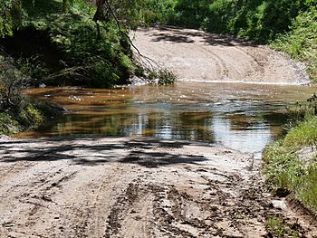
Wasley Road ford through Light River, Korunye
|
|
|
Location of the river mouth in South Australia
|
|
| Native name | Yarralinka |
| Country | Australia |
| State | South Australia |
| Region | Mid North |
| Physical characteristics | |
| Main source | Mount Lofty Range Waterloo 449 m (1,473 ft) 33°57′53″S 138°52′21″E / 33.9646°S 138.8724°E |
| River mouth | Gulf St Vincent 0 m (0 ft) 34°34′43″S 138°21′35″E / 34.5786°S 138.3596°E |
| Length | 164 km (102 mi) |
| Basin features | |
| Tributaries |
|
The Light River is an important river in South Australia. It's also known by its traditional Kaurna name, Yarralinka. The river was named after an early explorer, William Light.
This river flows through the Mid North region of South Australia. It's a seasonal river, meaning its water levels change with the seasons. The area around the river is also called Light, and several local councils have been named after it over the years. For example, the Light Regional Council is still named after the river today.
Contents
Where Does the Light River Flow?
The Light River starts in the northern part of the Mount Lofty Ranges. It begins near a place called Waterloo. From there, it flows south through towns like Steelton and Marrabel.
About halfway along its journey, the river turns west. It then passes by towns such as Kapunda, Hamley Bridge, and Mallala. Finally, the river reaches the coast at Lower Light. Here, it flows into the Gulf St Vincent through an area with mangrove trees.
River's Length and Features
The Light River travels about 164-kilometre (102 mi) (102 miles). During its journey, it drops about 447 metres (1,467 ft) (1,467 feet) in elevation.
The land around the river, called its catchment, is mostly made up of rolling hills. Much of this land has been cleared for farming. The river has several smaller streams that flow into it, called tributaries. One important tributary is the Gilbert River, which joins the Light River near Hamley Bridge.
A Look at the River's History
The original name for the river, given by the Kaurna people and Ngadjuri people, is Yarralinka. The upper part of the river was in the traditional lands of the Ngadjuri people. The lower part was in the territory of the Kaurna people.
The river was later named after William Light. He was an important surveyor in early South Australia. An exploration group, including John Hill, likely gave the river its new name in 1838.
Early Settlements and Copper
One of the first towns planned on the Light River was called Victoria. This town was meant to be a big settlement. However, its plans changed when copper was found nearby. This discovery led to the growth of Kapunda, which became a more important town. Today, Victoria is a quiet farming area.
The River's Reputation and Floods
In the past, the Light River was sometimes called The Dirty Light. This name came from bullock teamsters in the 1840s and 1850s. They had to cross the river with heavy loads of copper ore. The river's deep mud made crossing very difficult.
Today, the lower parts of the river are usually calm, especially in summer. You might see peaceful chains of ponds. However, the river can change quickly. A big thunderstorm in the area can cause a sudden and strong flash flood. In the early days, before bridges were common, these floods sometimes caused people to drown.
 | Leon Lynch |
 | Milton P. Webster |
 | Ferdinand Smith |


