Lower Light, South Australia facts for kids
Quick facts for kids Lower LightSouth Australia |
|||||||||||||||
|---|---|---|---|---|---|---|---|---|---|---|---|---|---|---|---|

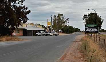
Lower Light Hotel
|
|||||||||||||||
| Postcode(s) | 5501 | ||||||||||||||
| Location | 46 km (29 mi) N of Adelaide | ||||||||||||||
| LGA(s) | Adelaide Plains Council | ||||||||||||||
| State electorate(s) | Narungga > | ||||||||||||||
| Federal Division(s) | Grey | ||||||||||||||
|
|||||||||||||||
| Footnotes | Adjoining localities | ||||||||||||||
Lower Light is a small township located right next to Port Wakefield Road in the southern part of South Australia's Mid North region. It's about 46 kilometers (28 miles) north of Adelaide, the state capital. The area also includes what was once the township of Port Prime, which was planned on the coast of Gulf St Vincent in 1880. Today, not much is left of Port Prime, and it's now considered part of Lower Light.
Discover Lower Light
Lower Light is a quiet place in South Australia. It's known for its connection to the nearby Light River and its history. Even though Port Prime was once a separate coastal town, it has now become part of the Lower Light area.
Where Does the Name Come From?
The name "Lower Light" comes from its location near the lower part of the Light River. This is where the river flows into the Gulf St Vincent. So, the town is named after this important natural feature.
Skydiving Adventures!
If you love adventure, Lower Light has something exciting! Since 1962, it has been a popular spot for parachuting and skydiving. People come here to jump out of planes and experience the thrill of freefall. These skydiving activities happen at the George Quigley Airfield, which is just a short distance north of the main township. It's a great place for people to learn to skydive or enjoy the sport.
 | May Edward Chinn |
 | Rebecca Cole |
 | Alexa Canady |
 | Dorothy Lavinia Brown |


