List of National Natural Landmarks in Puerto Rico facts for kids
Puerto Rico is home to some truly special natural places! These are called National Natural Landmarks. They are areas recognized by the United States government because they have unique natural features, like amazing rock formations, rare plants, or special wildlife habitats. Think of them as natural treasures that we need to protect.
There are five National Natural Landmarks in Puerto Rico. Each one offers a glimpse into the island's incredible natural beauty and history.
Contents
Discover Puerto Rico's Natural Treasures
Baño de Oro Natural Area
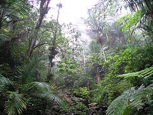
Located in Río Grande, the Baño de Oro Natural Area became a National Natural Landmark in 1980. This special place is part of the famous El Yunque National Forest, which is the only tropical rainforest in the U.S. National Forest System.
What makes Baño de Oro so unique? It's the only area in Puerto Rico where you can find several types of forests all next to each other. These include subtropical wet forest, true rainforest, and even a "dwarf forest" where trees are much smaller due to strong winds and poor soil. It also has special Pterocarpus trees, which are known for their unique roots.
Cabo Rojo
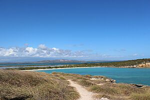
The Cabo Rojo landmark, designated in 1980, is found in the municipality of Cabo Rojo. This area is an amazing example of a landform called a tombolo. Imagine a small island that gets connected to the mainland by a narrow strip of sand or gravel. That's a tombolo!
Cabo Rojo has a tombolo with two "sand spits," which are like long, narrow beaches extending into the water. It's a beautiful coastal area, often visited for its stunning views and the famous Cabo Rojo Lighthouse.
Mona and Monito Islands
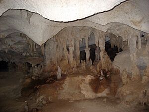
Off the coast of Mayagüez, the Mona and Monito Islands were recognized as a National Natural Landmark in 1975. These islands are often called the "Galapagos of the Caribbean" because they are home to many unique plants and animals.
One of the most incredible features of Mona and Monito Islands are their caves. These aren't just any caves; they are some of the largest and most extensive "flank margin caves" in the world. These caves form when groundwater dissolves limestone near the coastline, creating huge underground chambers.
Puerto Mosquito
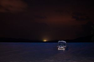
In Vieques, you'll find Puerto Mosquito, which became a landmark in 1980. This bay is truly magical! It's considered the best example of a bioluminescent bay in the United States.
What is bioluminescence? It's when living things create light! In Puerto Mosquito, tiny organisms called dinoflagellates light up the water when they are disturbed. So, if you paddle a kayak or splash your hand in the water at night, you'll see a beautiful, glowing blue light. It's like swimming in starlight!
Río Abajo State Forest
The Río Abajo State Forest, located in Utuado, was designated a landmark in 1980. This forest is a fantastic example of karst topography. Karst is a type of landscape formed when soluble rocks, like limestone, are dissolved by water.
This process creates unique features such as numerous sinkholes, which are depressions in the ground, and "tower karst," which are steep, cone-shaped hills. The Río Abajo State Forest is a great place to see these interesting geological formations and explore the natural beauty of Puerto Rico's interior.
See also
 | Frances Mary Albrier |
 | Whitney Young |
 | Muhammad Ali |


