
List of Pennsylvania state historical markers in Philadelphia County facts for kids

Welcome to Philadelphia County, a place full of amazing history! This page is a guide to the special historical markers placed by the Pennsylvania Historical and Museum Commission (PHMC). These markers help us remember important people, places, and events that happened right here in Philadelphia.
As of 2021, there were 321 markers in Philadelphia, which is the same area as Philadelphia County. These markers come in different types: some are large "Roadside" markers on posts, some are smaller "City" markers also on posts, and others are "Plaque" markers attached to buildings. Sadly, 12 of these markers are currently missing. Let's explore some of the fascinating stories these markers tell!
Contents
- Cool Historical Markers in Philadelphia
- Important People and Their Stories
- Benjamin Franklin (1706-1790)
- William Penn
- Marian Anderson
- Paul Robeson (1898-1976)
- Betsy Ross (1752-1836)
- W.E.B. Du Bois (1868-1963)
- Sadie T.M. Alexander (1898-1989)
- Gloria Casarez (1971-2014)
- Connie Mack (1862-1956)
- Wilt Chamberlain (1936-1999)
- Eddie Gottlieb (1898-1979)
- Roy Campanella (1921-1993)
- Sister Rosetta Tharpe (1915-1973)
- Billie Holiday (1915-1959)
- Frank Gasparro (1909-2001)
- Thomas Eakins (1844-1916)
- Henry O. Tanner (1859-1937)
- Laura Wheeler Waring (1887-1948)
- Meta V.W. Fuller (1877-1968)
- Violet Oakley (1874-1961)
- Louisa May Alcott
- Sarah Josepha Hale (1788-1879)
- Owen Wister (1860-1938)
- Ruth Plumly Thompson (1891-1976)
- Frank Furness (1839-1912)
- Paul Philippe Cret (1876-1945)
- Louis I. Kahn (1901-1974)
- Ralph Modjeski (1861-1940)
- Thomas Ustick Walter (1804-1877)
- John Bartram (1699-1777)
- Elisha Kent Kane (1820-1857)
- Meriwether Lewis (1774-1809)
- Dr. Constantine Hering (1800-1880)
- Dr. Oscar James Cooper
- Walter Golaski (1913-1996)
- Baruch S. Blumberg (1925-2001)
- Samuel Hopkins (1743-1818)
- Lorenzo L. Langstroth (1810-1895)
- Robert Cornelius
- Siegmund Lubin (1851-1923)
- Frank N. Piasecki (1919-2008)
- Nicholas Biddle (1786-1844)
- John Wanamaker (1838-1922)
- Milton Hershey
- Albert M. Greenfield (1887-1967)
- Stephen Girard (1750-1831)
- Mathew Carey (1760-1839)
- Robert Aitken (1734-1802)
- Rev. Isaac Leeser (1806-1868)
- Gertrude E.H. Bustill Mossell (1855-1948)
- Frances E.W. Harper (1825-1911)
- Jessie Redmon Fauset
- Louisa May Alcott
- Edward Drinker Cope
- Benjamin Smith Barton (1766-1815)
- Mother Jones (1830-1930)
- Anna Thomas Jeanes (1822-1907)
- Caroline Earle White (1833-1916)
- John E. Fryer, M.D. (1937-2003)
- Octavius V. Catto (1839-1871)
- Robert Purvis (1810-1898)
- William Still (1821-1902)
- Stephen Smith (1795-1873)
- William Whipper (1804?-1876)
- James Forten (1766-1842)
- Ebenezer Don Carlos Bassett (1833-1908)
- John C. Asbury (1862-1941)
- Crystal Bird Fauset
- C. DeLores Tucker (1927-2005)
- Rev. Dr. Leon Howard Sullivan (1922-2001)
- David Bustill Bowser (1820-1900)
- Henry L. Phillips (1847-1935)
- Rev. Jehu Jones, Jr. (1786-1852)
- Francis Johnson (1792-1844)
- Joe Venuti (1903-1978)
- John W. Coltrane (1926-1967)
- Marc Blitzstein (1905-1964)
- Mario Lanza (1921-1959)
- Leopold Stokowski (1882-1977)
- The Barrymores
- Pearl Bailey (1919-1990)
- W.C. Fields (1880-1948)
- Ed Bradley (1941-2006)
- Anthony Benezet (1713-1784)
- David Salisbury Franks (c.1740-1793)
- Haym Salomon (1740-1785)
- Tomas Garrigue Masaryk (1850-1937)
- Joseph Bonaparte (1768-1844)
- George Gordon Meade (1815-1872)
- Stephen Decatur
- Commodore John Barry (1745-1803)
- John Page Nicholson (1842-1922)
- Dr. Mary Davis Ridgway (1873-1927)
- Barbara Gittings (1932-2007)
- Henry George
- Joseph Huston (1866-1940)
- Julian Francis Abele (1881-1950)
- Robert Smith
- Edmund N. Bacon (1910-2005)
- John S. Trower (1849-1911)
- Joseph and Amy Cassey (1789-1848)/(1809-56)
- Robert Bogle (1774-1848)
- Robert Mara Adger (1837-1910)
- Jacob C. White Jr. (1837-1902)
- Ora Washington (1899-1971)
- John J. McDermott (1891-1971)
- Tommy Loughran (1902-1982)
- The Kelly Family
- The Giannini Family
- Nicola Monachesi (c. 1795-1851)
- Maxfield Parrish (1870-1966)
- Charles Willson Peale
- Anthony J. Drexel (1826-1893)
- William Allen (1704-1780)
- William Lewis (1751-1819)
- John Penn
- Anthony Palmer (1664-1749)
- Captain Thomas Holme (1624-1695)
- Thomas Holme (1624-1695)
- Philip Syng, Jr. (1703-1789)
- Robert Patterson (1743-1824)
- Thaddeus Kosciuszko
- John Nepomuk Maelzel (1772-1838)
- Christopher Saur (1693-1758)
- John Bill Ricketts
- The Dixie Hummingbirds
- American Bandstand
- NFL Films
- The Barrymores
- Pearl Bailey (1919-1990)
- W.C. Fields (1880-1948)
- Arthur Lee Hall (1934-2000)
- Vincent Persichetti (1915-1987)
- The SPHAs Basketball Team
- The Dixie Hummingbirds
- American Bandstand
- NFL Films
- The Barrymores
- Pearl Bailey (1919-1990)
- W.C. Fields (1880-1948)
- Arthur Lee Hall (1934-2000)
- Vincent Persichetti (1915-1987)
- The SPHAs Basketball Team
- Sigma Sound Studios
- Union Local 274, American Federation of Musicians
- The Dunbar Theatre
- Freedom Theatre
- Standard Theatre
- Walnut Street Theatre
- Philadelphia Sketch Club
- Samuel S. Fleisher Art Memorial
- Oldest Photograph
- Girl Scout Cookies
- America's First Lager
- Insurance Company of North America
- Baldwin Locomotive Works
- Commercial Digital Computer Birthplace
- ENIAC
- Fairmount Water Works
- Penn Relays
- Schuylkill Navy of Philadelphia
- Veterans Stadium
- Shibe Park/Connie Mack Stadium
- Baker Bowl National League Park
- Jefferson Street Ballparks
- African American Baseball in Philadelphia
- Palestra
- Smith Memorial Playground & Playhouse
- Philadelphia Zoo
- Fairmount Park - Commonwealth Treasure
- Laurel Hill Cemetery
- The Woodlands
- Greenbelt Knoll
- Ebenezer Maxwell Mansion
- Knowlton
- The Solitude
- William Penn - Slate Roof House
- Jefferson House
- Fraunces Tavern
- London Coffee House
- Wissahickon Inn
- PSFS Building
- Masonic Temple Philadelphia
- Central Library
- Wyoming Branch of the Free Library
- Pennsylvania Academy of the Fine Arts
- Institute for Colored Youth
- Berean Institute
- Girard College Civil Rights Landmark
- Opportunities Industrialization Centers
- Philadelphia College of Pharmacy and Science
- Philadelphia College of Textiles and Science
- Roman Catholic High School
- Thomas A. Edison High School and the Vietnam War
- William Penn Charter School
- Historical Society of Pennsylvania
- Medical Library Association
- Wistar Institute of Anatomy and Biology
- Children's Hospital of Philadelphia
- Pennsylvania Hospital
- Philadelphia General Hospital
- Frederick Douglass Memorial Hospital
- Mercy Hospital
- Christian Street Hospital
- Satterlee U.S.A. General Hospital
- Jewish Hospital
- Wills Eye Hospital
- Ronald McDonald House
- Female Medical College of Pennsylvania
- House of Industry
- Jack and Jill of America Foundation
- Wissahickon Boys Club
- Union Fire Company (1736-1843)
- Engine Company No. 11
- The MOVE Bombing
- Philadelphia Knights of Pythias
- Grand United Order of Odd Fellows
- Hotel Brotherhood USA
- New Century Guild
- Public Sector Collective Bargaining
- Mechanics' Union of Trade Associations
- The Pennsylvania Slave Trade
- First Protest Against Slavery
- Pennsylvania Abolition Society
- Philadelphia Female Anti-Slavery Society
- Underground Railroad Sites
- The Liberation of Jane Johnson
- Lombard Street Riot
- Dewey's Sit-In
- Gay Rights Demonstrations July 4, 1965 - 1969
- Philadelphia Gay News
- Freedom Now Rally
- First Republican National Convention
- Union League of Philadelphia
- US Sanitary Commission Great Central Fair
- National Funeral for President Washington
- Common Sense
- Battle of Germantown
- Fort Mifflin
- Tun Tavern
- First Troop Philadelphia City Cavalry
- U.S.S. United States
- Grand Battery
- Mower General Hospital
- Schuylkill Arsenal
- Glomar Explorer
- Thomas E. Cahill (1828-1878)
- Philadelphia Chinatown
- German Society of Pennsylvania
- Kahal Kodosh Mikveh Israel
- Mikveh Israel Cemetery
- Federal Street Burial Ground
- Washington Avenue Immigration Station
- St. Mary Magdalen De Pazzi Parish
- South 9th Street Curb Market
- Old St. Joseph's Roman Catholic Church
- Old St. Mary's Roman Catholic Church
- St. Augustine's Roman Catholic Church
- St. John Neumann
- St. John the Evangelist Roman Catholic Church
- St. Peter Claver Catholic Church
- Christ Church
- Arch Street Meeting House
- Germantown Meetinghouse
- Pennepack Baptist Church
- Presbyterian Church in the U.S.A.
- The Salvation Army
- African Zoar Methodist Episcopal Church
- First African Baptist Church (16th Street)
- First African Baptist Church (West Philadelphia)
- First African Baptist Church Cemetery
- First African Presbyterian Church
- Mother Bethel A.M.E. Church
- Wesley A.M.E. Zion Church
- Church of the Advocate
- St. Thomas' African Episcopal Church
- Tindley Temple
- Muhammad's Temple of Islam #12
- Universal Negro Improvement Association
- Prince Hall Grand Lodge
- Kelpius Community
- Gloria Dei Church (Old Swedes')
- Mason-Dixon Survey
- Pennypack Creek Bridge
- Shot Tower
- Reading Terminal & Market
- Terminal Commerce Building
- Broad Street Station
- Philadelphia & Columbia Railroad
- Wood Street Riverbank Steps
- Rittenhouse Town
- Whitaker Mill Cedar Grove
- Moyamensing Prison
- Walnut Street Prison
- Philadelphia Contributionship
- A.M.E. Book Concern
- Pennsylvania Bible Society
- Philadelphia
- Academy of Natural Sciences
- Civilian Public Service
- Philadelphia Flower Show
- Missing Markers
- Important People and Their Stories
- Images for kids
- See also
Cool Historical Markers in Philadelphia
Here are some of the most interesting historical markers you can find in Philadelphia:
Important People and Their Stories
Benjamin Franklin (1706-1790)

Benjamin Franklin was a true superstar! He was a writer, a scientist, an inventor, and a politician. He helped create the United States. You can find his marker on Chestnut Street, reminding everyone of his incredible contributions to our country and to science.
William Penn

William Penn was the founder of Pennsylvania. He wanted a place where everyone could live peacefully. His markers, like the one at Penn Treaty Park, celebrate his vision and the early days of Philadelphia.
Marian Anderson

Marian Anderson (1897-1993) was an incredible African American singer. She broke down barriers with her powerful voice and became a symbol of the Civil Rights movement. Her marker is at the Union Baptist Church on Fitzwater Street.
Paul Robeson (1898-1976)

Paul Robeson was a famous African American singer, actor, and civil rights activist. He used his talents to fight for justice and equality. His marker is on Walnut Street, celebrating his amazing life and work.
Betsy Ross (1752-1836)

Betsy Ross is famous for supposedly sewing the first American flag! Her marker on Arch Street tells the story of this important woman from the American Revolution.
W.E.B. Du Bois (1868-1963)

W.E.B. Du Bois was a very important African American leader, writer, and educator. He fought for equal rights for Black people. His marker on South 6th Street honors his lifelong work for justice.
Sadie T.M. Alexander (1898-1989)

Sadie T.M. Alexander was a true pioneer! She was the first African American woman to earn a Ph.D. in economics in the U.S. and the first to practice law in Pennsylvania. Her marker in Mount Airy celebrates her achievements in civil rights and government.
Gloria Casarez (1971-2014)

Gloria Casarez was a dedicated civil rights leader. She was the first Director of LGBT Affairs for the City of Philadelphia. Her marker near City Hall honors her work for equality and the LGBTQ+ community.
Connie Mack (1862-1956)

Connie Mack was a legendary figure in baseball. He managed the Philadelphia Athletics for 50 years! His marker in Mount Airy celebrates his long and successful career in sports.
Wilt Chamberlain (1936-1999)

Wilt Chamberlain was one of the greatest basketball players of all time. He played for the Philadelphia Warriors and set many records. His marker at Overbrook High School remembers his incredible sports achievements.
Eddie Gottlieb (1898-1979)

Eddie Gottlieb was a very important person in the early days of professional basketball. He helped found the NBA and coached the Philadelphia Warriors. His marker at South Philadelphia High School celebrates his impact on the sport.
Roy Campanella (1921-1993)

Roy Campanella was a fantastic African American baseball catcher who played for the Brooklyn Dodgers. He was a three-time MVP. His marker at Simon Gratz High School honors his legacy in baseball.
Sister Rosetta Tharpe (1915-1973)
Sister Rosetta Tharpe was an amazing African American singer and guitarist. She was a pioneer of rock and roll music! Her marker on Master Street celebrates her groundbreaking musical talent.
Billie Holiday (1915-1959)

Billie Holiday was a legendary jazz singer. Her unique voice and emotional performances made her a music icon. Her marker on Lombard Street remembers her incredible contributions to music.
Frank Gasparro (1909-2001)

Frank Gasparro was a talented artist who designed many U.S. coins, including the reverse of the Lincoln penny and the Susan B. Anthony dollar. His marker on Carpenter Street celebrates his artistic legacy.
Thomas Eakins (1844-1916)

Thomas Eakins was a very important American painter and educator. He was known for his realistic portraits and scenes of everyday life. His marker on Mt. Vernon Street honors his artistic contributions.
Henry O. Tanner (1859-1937)

Henry O. Tanner was a famous African American artist. He was known for his religious paintings and became the first African American painter to achieve international fame. His marker on W Diamond Street celebrates his artistic journey.
Laura Wheeler Waring (1887-1948)
Laura Wheeler Waring was an important African American artist and educator. She was known for her portraits of prominent African Americans. Her marker on N 43rd Street honors her artistic and educational work.
Meta V.W. Fuller (1877-1968)

Meta V.W. Fuller was a groundbreaking African American sculptor. She was known for her works that explored African American themes and history. Her marker on S 12th Street celebrates her artistic legacy.
Violet Oakley (1874-1961)

Violet Oakley was a celebrated American artist, known for her murals and stained glass. She created many important works for the Pennsylvania State Capitol. Her marker on St. George's Road honors her artistic achievements.
Louisa May Alcott

Louisa May Alcott (1832-1888) was a famous American writer, best known for her novel "Little Women." Her marker on Germantown Avenue reminds us of her connection to Philadelphia.
Sarah Josepha Hale (1788-1879)

Sarah Josepha Hale was an influential writer and editor. She campaigned for the creation of Thanksgiving as a national holiday and wrote "Mary Had a Little Lamb." Her marker on Spruce Street celebrates her impact on American culture.
Owen Wister (1860-1938)

Owen Wister was an American writer, often called the "father of Western fiction" for his novel "The Virginian." His marker on Germantown Avenue connects him to Philadelphia's literary history.
Ruth Plumly Thompson (1891-1976)
Ruth Plumly Thompson was a children's author who wrote many of the "Oz" books after L. Frank Baum. Her marker on S Farragut Street celebrates her contributions to children's literature.
Frank Furness (1839-1912)

Frank Furness was a very important architect in Philadelphia. He designed many unique and impressive buildings in the city. His marker on Pine Street celebrates his architectural genius.
Paul Philippe Cret (1876-1945)

Paul Philippe Cret was a French-born architect and educator who designed many famous buildings and bridges, including the Benjamin Franklin Bridge. His marker on Woodland Terrace honors his work.
Louis I. Kahn (1901-1974)
Louis I. Kahn was one of the most important architects of the 20th century. He designed buildings all over the world. His marker on Walnut Street celebrates his unique and powerful designs.
Ralph Modjeski (1861-1940)
Ralph Modjeski was a brilliant bridge engineer who designed many famous bridges across the United States. His marker on N 6th Street celebrates his engineering achievements.
Thomas Ustick Walter (1804-1877)
Thomas Ustick Walter was a prominent architect known for designing the dome of the U.S. Capitol Building. His marker on Arch Street honors his significant architectural contributions.
John Bartram (1699-1777)

John Bartram was America's first native-born botanist. He traveled widely to collect plants and seeds. His marker on Harley Avenue celebrates his love for nature and science.
Elisha Kent Kane (1820-1857)

Elisha Kent Kane was a famous Arctic explorer and naval officer. He led expeditions to find the lost Franklin expedition. His marker at Laurel Hill Cemetery remembers his brave journeys.
Meriwether Lewis (1774-1809)

Meriwether Lewis was a famous explorer who, with William Clark, led the first American expedition to cross the western part of the United States. His marker on Ben Franklin Parkway celebrates his adventurous spirit.
Dr. Constantine Hering (1800-1880)
Dr. Constantine Hering was a German-born physician who is considered the father of American homeopathy. His marker at 12th and Arch Streets recognizes his contributions to medicine.
Dr. Oscar James Cooper
Dr. Oscar James Cooper was one of the founders of Omega Psi Phi, a historically African American fraternity. He was also a physician. His marker on W Jefferson Street celebrates his legacy in both medicine and community leadership.
Walter Golaski (1913-1996)

Walter Golaski was an inventor who created important medical devices, including the first successful artificial artery. His marker on Drexel campus celebrates his innovations in science and medicine.
Baruch S. Blumberg (1925-2001)
.jpg)
Baruch S. Blumberg was a Nobel Prize-winning scientist who discovered the hepatitis B virus and developed its vaccine. His marker on S Lawrence Court celebrates his life-saving work.
Samuel Hopkins (1743-1818)

Samuel Hopkins received the first U.S. patent in 1790, signed by President George Washington, for a new method of making potash. His marker on Arch Street celebrates this important moment in American invention.
Lorenzo L. Langstroth (1810-1895)

Lorenzo L. Langstroth was an American beekeeper, clergyman, and writer. He invented the movable frame beehive, which revolutionized beekeeping. His marker on S Front Street celebrates his important invention.
Robert Cornelius

Robert Cornelius was an American photographer and inventor. He took one of the first self-portraits in history and was a pioneer in early photography. His marker on S 8th Street celebrates his contributions to this art and science.
Siegmund Lubin (1851-1923)

Siegmund Lubin was a German-American film pioneer who produced and distributed many early motion pictures. You can find markers for him on N 15th Street and S 8th Street, celebrating his role in the birth of cinema.
Frank N. Piasecki (1919-2008)

Frank N. Piasecki was an American aviation engineer who designed and built some of the first successful helicopters. His marker on Callowhill Street celebrates his innovative work in flight.
Nicholas Biddle (1786-1844)

Nicholas Biddle was a powerful American financier who served as the president of the Second Bank of the United States. His marker on Spruce Street remembers his influence on American finance.
John Wanamaker (1838-1922)

John Wanamaker was a famous merchant who created one of the first department stores in the United States. He changed how people shopped! His marker on S 13th Street celebrates his business innovations.
Milton Hershey

Milton Hershey was a famous candy maker and the founder of The Hershey Company. His first candy store was in Philadelphia! His marker on Spring Garden Street celebrates the sweet beginnings of his empire.
Albert M. Greenfield (1887-1967)
.jpg)
Albert M. Greenfield was a successful businessman and a leader in Philadelphia. He was involved in many important projects that helped the city grow. His marker on Walnut Street celebrates his contributions to business and community.
Stephen Girard (1750-1831)

Stephen Girard was a very rich merchant and banker who gave a lot of his money to help Philadelphia. He founded Girard College, a school for orphaned boys. His marker in Girard Park celebrates his generosity.
Mathew Carey (1760-1839)

Mathew Carey was an Irish-American publisher and economist. He published many important books and newspapers in early America. His marker on Market Street celebrates his contributions to publishing.
Robert Aitken (1734-1802)
Robert Aitken was a Scottish-born printer and publisher during the American Revolution. He published the first English Bible in America. His marker on Market Street celebrates his important work.
Rev. Isaac Leeser (1806-1868)
Rev. Isaac Leeser was an important Jewish leader, publisher, and writer. He helped establish many Jewish institutions in America. His marker on Market Street celebrates his religious and literary contributions.
Gertrude E.H. Bustill Mossell (1855-1948)
.jpg)
Gertrude E.H. Bustill Mossell was an African American journalist, author, and poet. She wrote about issues important to women and the African American community. Her marker on Lombard Street celebrates her powerful voice.
Frances E.W. Harper (1825-1911)

Frances E.W. Harper was a powerful African American writer, poet, and abolitionist. She fought for women's rights and against slavery. Her marker on Bainbridge Street honors her inspiring work.
Jessie Redmon Fauset
Jessie Redmon Fauset (1882-1961) was an important African American editor, poet, essayist, and novelist. She played a key role in the Harlem Renaissance. Her marker on N 17th Street celebrates her literary achievements.
Louisa May Alcott
Louisa May Alcott (1832-1888) was a famous American writer, best known for her novel "Little Women." Her marker on Germantown Avenue reminds us of her connection to Philadelphia.
Edward Drinker Cope

Edward Drinker Cope (1840-1897) was a brilliant paleontologist and anatomist. He discovered many dinosaur fossils. His marker on Pine Street celebrates his contributions to science.
Benjamin Smith Barton (1766-1815)

Benjamin Smith Barton was an American botanist, naturalist, and physician. He wrote one of the first American textbooks on botany. His marker on Arch Street celebrates his scientific work.
Mother Jones (1830-1930)

Mary Harris "Mother" Jones was a famous labor organizer who fought for the rights of workers, especially miners. Her marker near City Hall celebrates her tireless efforts for social justice.
Anna Thomas Jeanes (1822-1907)
Anna Thomas Jeanes was a Quaker philanthropist who gave large sums of money to support education for African American children in the rural South. Her marker at Jeanes Hospital celebrates her generosity and commitment to education.
Caroline Earle White (1833-1916)
Caroline Earle White was a pioneer in animal welfare and women's rights. She founded the Women's Pennsylvania Society for the Prevention of Cruelty to Animals. Her marker on Chestnut Street celebrates her compassion and activism.
John E. Fryer, M.D. (1937-2003)
.jpg)
Dr. John E. Fryer was a psychiatrist who bravely spoke out against the classification of homosexuality as a mental illness. His actions were a major step forward for LGBTQ+ rights. His marker at 13th and Locust Streets honors his courage.
Octavius V. Catto (1839-1871)

Octavius V. Catto was an African American educator, intellectual, and civil rights activist. He fought for equal voting rights and against segregation. His marker on South Street remembers his heroic efforts.
Robert Purvis (1810-1898)

Robert Purvis was a prominent African American abolitionist and advocate for women's rights. He helped many enslaved people escape to freedom through the Underground Railroad. His marker on Mt. Vernon Street honors his fight for freedom.
William Still (1821-1902)

William Still was a key figure in the Underground Railroad, helping hundreds of enslaved people escape to freedom. He also documented their stories. His marker on S 12th Street celebrates his bravery and dedication.
Stephen Smith (1795-1873)
Stephen Smith was a wealthy African American businessman and abolitionist. He used his resources to support the Underground Railroad and fight for civil rights. His marker on Belmont Avenue honors his important work.
William Whipper (1804?-1876)
William Whipper was an African American abolitionist, businessman, and writer. He was a strong advocate for nonviolence and helped many on the Underground Railroad. His marker on Lombard Street celebrates his contributions to freedom.
James Forten (1766-1842)
.jpg)
James Forten was a wealthy African American businessman and abolitionist. He fought in the American Revolution and later became a leader in the fight against slavery. His marker on Lombard Street honors his patriotism and activism.
Ebenezer Don Carlos Bassett (1833-1908)

Ebenezer Don Carlos Bassett was the first African American diplomat, serving as the U.S. Minister Resident to Haiti. His marker on N 29th Street celebrates his groundbreaking career.
John C. Asbury (1862-1941)
.jpg)
John C. Asbury was an African American lawyer and politician who served in the Pennsylvania House of Representatives. His marker on Christian Street celebrates his work in government and civil rights.
Crystal Bird Fauset
Crystal Bird Fauset (1893-1965) was the first African American woman elected to a state legislature in the United States. She served in the Pennsylvania House of Representatives. Her marker on Vine Street celebrates her pioneering role in politics.
C. DeLores Tucker (1927-2005)

C. DeLores Tucker was a prominent African American civil rights activist and politician. She was the first African American Secretary of the Commonwealth of Pennsylvania. Her marker on Lincoln Drive celebrates her work for equality.
Rev. Dr. Leon Howard Sullivan (1922-2001)

Rev. Dr. Leon Howard Sullivan was an influential African American minister and civil rights leader. He created programs to help African Americans gain economic independence. His marker at Zion Baptist Church celebrates his legacy.
David Bustill Bowser (1820-1900)

David Bustill Bowser was an African American artist who designed flags for African American regiments during the Civil War. His marker on N 4th Street celebrates his artistic and patriotic contributions.
Henry L. Phillips (1847-1935)
,_rector,_Church_of_the_Crucifixion,_Philadelphia.jpg)
Henry L. Phillips was an influential African American Episcopal priest. He was known for his work in the community and his efforts to promote racial equality within the church. His marker on S 8th Street celebrates his religious leadership.
Rev. Jehu Jones, Jr. (1786-1852)
Rev. Jehu Jones, Jr. was an early African American Lutheran minister. He founded the first African American Lutheran church in the United States. His marker on S Quince Street celebrates his pioneering work in religion.
Francis Johnson (1792-1844)

Francis Johnson was a pioneering African American composer, bandleader, and musician. He was the first African American to publish sheet music. His marker on Pine Street celebrates his musical talent.
Joe Venuti (1903-1978)

Joe Venuti was a legendary jazz violinist, known for his innovative playing style. He is considered one of the first great jazz violinists. His marker on S 8th Street celebrates his musical legacy.
John W. Coltrane (1926-1967)

John W. Coltrane was one of the most important and influential jazz saxophonists and composers of all time. His marker on N 33rd Street celebrates his revolutionary music.
Marc Blitzstein (1905-1964)

Marc Blitzstein was an American composer, lyricist, and librettist. He was known for his politically charged musical works. His marker on Pine Street celebrates his contributions to music and theater.
Mario Lanza (1921-1959)

Mario Lanza was a famous American tenor and actor from Philadelphia. He starred in many musical films. His marker on Christian Street celebrates his powerful voice and movie career.
Leopold Stokowski (1882-1977)
.jpg)
Leopold Stokowski was a famous orchestra conductor who led the Philadelphia Orchestra for many years. He was known for his dramatic conducting style. His marker on S Broad Street celebrates his musical leadership.
The Barrymores

The Barrymores were a famous family of actors, including Lionel, Ethel, and John Barrymore. They were known for their talent on stage and screen. Their marker on N 6th Street celebrates their theatrical legacy.
Pearl Bailey (1919-1990)
Pearl Bailey was a beloved African American singer and actress. She was known for her charming personality and unique singing style. Her marker on N 23rd Street celebrates her career in entertainment.
W.C. Fields (1880-1948)

W.C. Fields was a famous American comedian, actor, and writer. He was known for his grumpy, cynical characters. His marker on N 8th Street celebrates his comedic genius.
Ed Bradley (1941-2006)

Ed Bradley was a highly respected African American journalist, best known for his work on the TV news show "60 Minutes." His marker on Belmont and Parkside Avenues celebrates his career in journalism.
Anthony Benezet (1713-1784)

Anthony Benezet was a Quaker abolitionist and educator. He was one of the first to speak out against slavery in America. His marker on Chestnut Street celebrates his fight for human rights.
David Salisbury Franks (c.1740-1793)
.jpg)
David Salisbury Franks was a Jewish officer who served in the Continental Army during the American Revolution. His marker at 5th and Arch Streets celebrates his patriotism.
Haym Salomon (1740-1785)
_-_NARA_-_532941.jpg)
Haym Salomon was a Jewish financier who helped fund the American Revolution. His marker on N 5th Street celebrates his crucial support for the war effort.
Tomas Garrigue Masaryk (1850-1937)
Tomas Garrigue Masaryk was the first President of Czechoslovakia. He spent time in Philadelphia during World War I, advocating for his country's independence. His marker on S 6th Street celebrates his role in history.
Joseph Bonaparte (1768-1844)
.jpg)
Joseph Bonaparte, the older brother of Napoleon Bonaparte, was once the King of Naples and Spain. He lived in Philadelphia for a time after his brother's fall from power. His marker on S 9th Street tells a fascinating story of European royalty in America.
George Gordon Meade (1815-1872)

George Gordon Meade was a Union general during the American Civil War, famous for leading the Union forces to victory at the Battle of Gettysburg. His marker on S 19th Street honors his military service.
Stephen Decatur

Stephen Decatur (1779-1820) was a celebrated American naval officer, known for his heroism in the Barbary Wars and the War of 1812. His marker on S Front Street honors his bravery at sea.
Commodore John Barry (1745-1803)

Commodore John Barry is often called the "Father of the American Navy." He was a brave officer during the American Revolution. His marker on S Columbus Boulevard celebrates his important role in creating the U.S. Navy.
John Page Nicholson (1842-1922)
John Page Nicholson was a Civil War veteran and historian. He was a dedicated collector of Civil War artifacts and documents. His marker on Pine Street honors his service and his efforts to preserve history.
Dr. Mary Davis Ridgway (1873-1927)
Dr. Mary Davis Ridgway was an African American physician and civil rights activist. She worked to improve health care for her community. Her marker on Wissahickon Avenue celebrates her dedication to medicine and equality.
Barbara Gittings (1932-2007)
Barbara Gittings was a pioneering activist for LGBTQ+ rights. She played a crucial role in changing how homosexuality was viewed in the medical community. Her marker at 21st and Locust Streets honors her fight for civil rights.
Henry George

Henry George (1839-1897) was an American economist and social reformer. He was known for his ideas about land value taxation. His marker on S 10th Street celebrates his influential economic theories.
Joseph Huston (1866-1940)

Joseph Huston was an architect best known for designing the magnificent Pennsylvania State Capitol building in Harrisburg. His marker on Wissahickon Avenue celebrates his grand architectural vision.
Julian Francis Abele (1881-1950)

Julian Francis Abele was a brilliant African American architect. He was the chief designer for many buildings at Duke University and the Philadelphia Museum of Art. His marker at the Philadelphia Museum of Art steps celebrates his incredible talent.
Robert Smith
.jpg)
Robert Smith (1722-1777) was a master builder and architect in colonial Philadelphia. He designed many important buildings, including Carpenters' Hall. His marker on S 2nd Street celebrates his contributions to the city's architecture.
Edmund N. Bacon (1910-2005)
Edmund N. Bacon was a famous urban planner who shaped modern Philadelphia. He had a big vision for how the city should look and function. His marker on JFK Boulevard celebrates his impact on city design.
John S. Trower (1849-1911)
John S. Trower was a successful African American businessman and entrepreneur in Germantown. His marker on Germantown Avenue celebrates his achievements and contributions to the community.
Joseph and Amy Cassey (1789-1848)/(1809-56)

Joseph and Amy Cassey were prominent African American abolitionists and community leaders in Philadelphia. They used their home as a stop on the Underground Railroad. Their marker on S 4th Street celebrates their bravery and activism.
Robert Bogle (1774-1848)
Robert Bogle was a famous African American caterer in Philadelphia. He was known for his elegant events and delicious food. His marker on S 8th Street celebrates his success in business.
Robert Mara Adger (1837-1910)
.jpg)
Robert Mara Adger was an African American businessman and community leader. He helped establish many organizations for African Americans in Philadelphia. His marker on South Street celebrates his dedication to his community.
Jacob C. White Jr. (1837-1902)

Jacob C. White Jr. was an African American educator, civil rights activist, and baseball pioneer. He helped organize one of the first Black baseball teams. His marker on Lombard Street celebrates his diverse contributions.
Ora Washington (1899-1971)

Ora Washington was an amazing African American athlete who excelled in both tennis and basketball. She was a national champion in both sports. Her marker on Germantown Avenue celebrates her incredible athletic achievements.
John J. McDermott (1891-1971)
John J. McDermott was the first American-born golfer to win the U.S. Open. His marker at Kingsessing Library celebrates his historic achievement in golf.
Tommy Loughran (1902-1982)
Tommy Loughran was a famous boxer from Philadelphia who became the World Light Heavyweight Champion. His marker at S 17th and Ritner Streets celebrates his boxing career.
The Kelly Family

The Kelly Family was a prominent Philadelphia family known for their achievements in sports, politics, and entertainment. John B. Kelly Sr. was an Olympic rower, and his daughter Grace Kelly became a Hollywood star and Princess of Monaco. Their marker on W Coulter Street celebrates their remarkable family.
The Giannini Family
.jpg)
The Giannini Family was a talented musical family from Philadelphia. They were known for their contributions to opera and classical music. Their marker on Christian Street celebrates their artistic legacy.
Nicola Monachesi (c. 1795-1851)
Nicola Monachesi was an Italian-born artist and priest who painted many religious artworks in Philadelphia churches. His marker at St. Augustine's R.C. Church celebrates his artistic and religious contributions.
Maxfield Parrish (1870-1966)

Maxfield Parrish was a popular American artist and illustrator, known for his vibrant colors and fantastical scenes. His marker on S 6th Street celebrates his unique artistic style.
Charles Willson Peale
Charles Willson Peale (1741-1827) was a famous American painter, soldier, and naturalist. He painted many portraits of important figures from the American Revolution. His marker on S 3rd Street celebrates his artistic and scientific contributions.
Anthony J. Drexel (1826-1893)

Anthony J. Drexel was a powerful banker and philanthropist who founded Drexel University. His marker on S Third Street celebrates his contributions to business and education.
William Allen (1704-1780)
William Allen was a wealthy merchant and lawyer in colonial Pennsylvania. He served as the Chief Justice of the Pennsylvania Supreme Court. His marker on Germantown Avenue remembers his role in early Pennsylvania government.
William Lewis (1751-1819)
William Lewis was a prominent lawyer and abolitionist in Philadelphia. He defended many people accused of being runaway slaves. His marker at Historic Strawberry Mansion celebrates his legal and humanitarian work.
John Penn
.jpg)
John Penn (1729-1795) was a colonial governor of Pennsylvania and a grandson of William Penn. His marker on S 3rd Street remembers his role in governing the colony.
Anthony Palmer (1664-1749)
Anthony Palmer was a colonial governor of Pennsylvania. He helped lead the colony during a time of growth and change. His marker at Palmer Cemetery celebrates his leadership in early Pennsylvania.
Captain Thomas Holme (1624-1695)
Captain Thomas Holme was a surveyor who helped William Penn plan the city of Philadelphia. His marker on Arch Street celebrates his important role in designing the city.
Thomas Holme (1624-1695)

Thomas Holme was the surveyor-general for William Penn and played a key role in planning Philadelphia. His marker in Pennypack Park celebrates his contributions to the city's layout.
Philip Syng, Jr. (1703-1789)
.jpg)
Philip Syng, Jr. was a famous silversmith who created the inkstand used to sign the Declaration of Independence and the U.S. Constitution. His marker on Chestnut Street celebrates his craftsmanship and connection to American history.
Robert Patterson (1743-1824)
Robert Patterson was a mathematician and professor at the University of Pennsylvania. He also served as the director of the U.S. Mint. His marker on S 9th Street celebrates his contributions to education and government.
Thaddeus Kosciuszko

Thaddeus Kosciuszko (1746-1817) was a Polish military engineer who helped the American colonists win the Revolutionary War. His marker on S 3rd Street celebrates his bravery and support for American independence.
John Nepomuk Maelzel (1772-1838)
John Nepomuk Maelzel was a German inventor and showman. He invented the metronome, a device used by musicians. His marker on S 5th Street celebrates his inventive spirit.
Christopher Saur (1693-1758)
Christopher Saur was an early German-American printer and publisher in colonial Pennsylvania. He printed the first German Bible in America. His marker at Trinity Lutheran Church celebrates his contributions to publishing.
John Bill Ricketts

John Bill Ricketts (c. 1769-1800) brought the first modern circus to America, performing for George Washington! His marker on S 12th Street celebrates the exciting history of the circus.
The Dixie Hummingbirds

The Dixie Hummingbirds are a legendary African American gospel music group. They have been performing for decades and influenced many musicians. Their marker on N College Avenue celebrates their amazing musical journey.
American Bandstand

"American Bandstand" was a super popular TV show that helped launch the careers of many music stars. It was filmed right here in Philadelphia! Its marker on Market Street celebrates its impact on music and television.
NFL Films

NFL Films is a company that produces amazing films and documentaries about American football. It's known for its unique style and storytelling. Its marker on N 13th Street celebrates its contributions to sports entertainment.
The Barrymores
The Barrymores were a famous family of actors, including Lionel, Ethel, and John Barrymore. They were known for their talent on stage and screen. Their marker on N 6th Street celebrates their theatrical legacy.
Pearl Bailey (1919-1990)
Pearl Bailey was a beloved African American singer and actress. She was known for her charming personality and unique singing style. Her marker on N 23rd Street celebrates her career in entertainment.
W.C. Fields (1880-1948)
W.C. Fields was a famous American comedian, actor, and writer. He was known for his grumpy, cynical characters. His marker on N 8th Street celebrates his comedic genius.
Arthur Lee Hall (1934-2000)
Arthur Lee Hall was an African American dancer, choreographer, and educator. He was a significant figure in modern dance. His marker on N Germantown Avenue celebrates his contributions to the arts.
Vincent Persichetti (1915-1987)
Vincent Persichetti was an American composer and educator. He wrote many pieces for orchestra, band, and choir. His marker at the Curtis Institute of Music celebrates his musical legacy.
The SPHAs Basketball Team
The SPHAs were a legendary Jewish basketball team from Philadelphia. They were one of the most successful teams in early professional basketball. Their marker on Broad and Wood Streets celebrates their athletic achievements.
The Dixie Hummingbirds
The Dixie Hummingbirds are a legendary African American gospel music group. They have been performing for decades and influenced many musicians. Their marker on N College Avenue celebrates their amazing musical journey.
American Bandstand
"American Bandstand" was a super popular TV show that helped launch the careers of many music stars. It was filmed right here in Philadelphia! Its marker on Market Street celebrates its impact on music and television.
NFL Films
NFL Films is a company that produces amazing films and documentaries about American football. It's known for its unique style and storytelling. Its marker on N 13th Street celebrates its contributions to sports entertainment.
The Barrymores
The Barrymores were a famous family of actors, including Lionel, Ethel, and John Barrymore. They were known for their talent on stage and screen. Their marker on N 6th Street celebrates their theatrical legacy.
Pearl Bailey (1919-1990)
Pearl Bailey was a beloved African American singer and actress. She was known for her charming personality and unique singing style. Her marker on N 23rd Street celebrates her career in entertainment.
W.C. Fields (1880-1948)
W.C. Fields was a famous American comedian, actor, and writer. He was known for his grumpy, cynical characters. His marker on N 8th Street celebrates his comedic genius.
Arthur Lee Hall (1934-2000)
Arthur Lee Hall was an African American dancer, choreographer, and educator. He was a significant figure in modern dance. His marker on N Germantown Avenue celebrates his contributions to the arts.
Vincent Persichetti (1915-1987)
Vincent Persichetti was an American composer and educator. He wrote many pieces for orchestra, band, and choir. His marker at the Curtis Institute of Music celebrates his musical legacy.
The SPHAs Basketball Team
The SPHAs were a legendary Jewish basketball team from Philadelphia. They were one of the most successful teams in early professional basketball. Their marker on Broad and Wood Streets celebrates their athletic achievements.
Sigma Sound Studios
Sigma Sound Studios was a famous recording studio in Philadelphia, known for creating the "Philadelphia Sound" in soul and R&B music. Its marker on N 12th Street celebrates its impact on music history.
Union Local 274, American Federation of Musicians
.jpg)
Union Local 274 was an important African American musicians' union in Philadelphia. It played a key role in supporting Black musicians. Its marker on S Broad Street celebrates its legacy in music and labor.
The Dunbar Theatre
.jpg)
The Dunbar Theatre was a famous venue for African American performers during the early 20th century. It hosted many legendary musicians and entertainers. Its marker on S Broad Street celebrates its cultural importance.
Freedom Theatre

Freedom Theatre is an important African American theater company in Philadelphia. It provides training and performance opportunities for young artists. Its marker on N Broad Street celebrates its contributions to the arts and community.
Standard Theatre
_Lobby_Entrance.jpg)
The Standard Theatre was an important venue for African American entertainment in Philadelphia. It showcased many talented performers. Its marker on South Street celebrates its place in Black cultural history.
Walnut Street Theatre

The Walnut Street Theatre is the oldest continuously operating theater in the English-speaking world! It has hosted countless famous actors and shows. Its marker on S 9th Street celebrates its long and rich history.
Philadelphia Sketch Club
.jpg)
The Philadelphia Sketch Club is one of the oldest artists' clubs in the United States. It has supported artists for many years. Its marker on S Camac Street celebrates its role in the city's art scene.
Samuel S. Fleisher Art Memorial

The Samuel S. Fleisher Art Memorial is a community art school and museum. It offers free art education to people of all ages. Its marker on Catharine Street celebrates its dedication to art and education.
Oldest Photograph

The first photograph ever taken in the United States was right here in Philadelphia in 1839! This marker on Chestnut Street celebrates this amazing moment in the history of photography.
Girl Scout Cookies
.jpg)
Did you know the first Girl Scout cookies were sold in Philadelphia in 1934? This marker on Arch Street celebrates the sweet history of these famous treats!
America's First Lager
.jpg)
Philadelphia was home to America's first lager beer! This marker on N American Street celebrates this important moment in the history of American brewing.
Insurance Company of North America
The Insurance Company of North America (INA) was the first stock insurance company in the United States. It played a big role in the development of the insurance industry. Its marker on Walnut Street celebrates its historical significance.
Baldwin Locomotive Works

The Baldwin Locomotive Works was once the largest locomotive manufacturer in the world! They built thousands of steam engines. Its marker in Matthias Baldwin Park celebrates Philadelphia's industrial past.
Commercial Digital Computer Birthplace
Philadelphia is the birthplace of the commercial digital computer! The BINAC computer was developed here. This marker on Ridge Avenue celebrates this incredible invention that changed the world.
ENIAC

The ENIAC (Electronic Numerical Integrator and Computer) was one of the first electronic digital computers. It was built at the University of Pennsylvania. Its marker on S 33rd Street celebrates this groundbreaking invention.
Fairmount Water Works

The Fairmount Water Works was a marvel of engineering in its time, providing clean drinking water to Philadelphia. It's also a beautiful example of Greek Revival architecture. Its marker celebrates this important public work.
Penn Relays

The Penn Relays is the oldest and largest track and field competition in the United States. Athletes from all over the world compete here. Its marker at Franklin Field celebrates this exciting sports event.

The Schuylkill Navy of Philadelphia is an association of rowing clubs located on Boathouse Row. It's a historic center for rowing in the U.S. Its marker at Boathouse Row celebrates this long tradition of sports.
Veterans Stadium

Veterans Stadium was a famous sports stadium in South Philadelphia, home to the Phillies and Eagles for many years. Its marker on S Broad Street remembers many exciting games and events.
Shibe Park/Connie Mack Stadium

Shibe Park, later known as Connie Mack Stadium, was a historic baseball park where the Philadelphia Athletics and Phillies played. Its marker on N 21st Street celebrates its place in baseball history.
Baker Bowl National League Park

Baker Bowl was another historic baseball stadium in Philadelphia, home to the Phillies. It was known for its short right field fence. Its marker on N Broad Street remembers this early baseball venue.
Jefferson Street Ballparks
The Jefferson Street Ballparks were important sites for early African American baseball in Philadelphia. Many talented Black players showcased their skills here. Their marker on Jefferson Street celebrates this rich history.
African American Baseball in Philadelphia
.jpg)
This marker celebrates the rich history of African American baseball in Philadelphia, including the famous Philadelphia Stars of the Negro Leagues. It's located at Belmont and Parkside Avenues.
Palestra

The Palestra is a historic basketball arena at the University of Pennsylvania, known as "The Cathedral of College Basketball." Its marker on S 33rd Street celebrates its legendary status in sports.
Smith Memorial Playground & Playhouse

Smith Memorial Playground & Playhouse is a historic playground that has provided fun and learning for children for over a century. Its marker on Reservoir Drive celebrates its long history of play.
Philadelphia Zoo

The Philadelphia Zoo is the first zoo in the United States! It has been home to amazing animals for many years. Its marker on W Girard Avenue celebrates its long history of wildlife conservation.
Fairmount Park - Commonwealth Treasure

Fairmount Park is one of the largest urban parks in the world, offering beautiful scenery and recreational activities. This marker celebrates its importance as a natural and historical treasure.
Laurel Hill Cemetery

Laurel Hill Cemetery is a beautiful and historic cemetery overlooking the Schuylkill River. It's known for its stunning architecture and famous residents. Its marker on Ridge Avenue celebrates its unique blend of history and nature.
The Woodlands

The Woodlands is a historic estate with a beautiful mansion and cemetery. It's a peaceful place with a rich history. Its marker on Woodland Avenue celebrates its architectural and natural beauty.
Greenbelt Knoll

Greenbelt Knoll is a historic neighborhood known for its unique modern architecture and its role in promoting integrated housing. Its marker on Holme Avenue celebrates its innovative design and social importance.
Ebenezer Maxwell Mansion

The Ebenezer Maxwell Mansion is a beautifully preserved Victorian house in Germantown. It offers a glimpse into life in the 19th century. Its marker on W Tulpehocken Street celebrates its architectural beauty.
Knowlton

Knowlton is a historic mansion in Northeast Philadelphia. It's a beautiful example of country estate architecture. Its marker on Verree Road celebrates its historical and architectural significance.
The Solitude

The Solitude is a historic mansion located on the grounds of the Philadelphia Zoo. It was once the home of William Penn's grandson. Its marker celebrates its connection to the Penn family and its architectural style.
William Penn - Slate Roof House

The Slate Roof House was William Penn's home in Philadelphia. It was an important place in the early history of Pennsylvania. This marker on S 2nd Street remembers his residence.
Jefferson House
Jefferson House was a historic building in Philadelphia where Thomas Jefferson lived while writing the Declaration of Independence. This marker on 7th Street remembers its important role in American history.
Fraunces Tavern
Fraunces Tavern was a historic tavern in Philadelphia where George Washington often visited. It was a popular meeting place in colonial times. Its marker on S 2nd Street celebrates its connection to the American Revolution.
London Coffee House
The London Coffee House was a famous meeting place in colonial Philadelphia. It was a hub for business and political discussions. Its marker on Front and Market Streets remembers its importance in early American life.
Wissahickon Inn

The Wissahickon Inn, now part of Chestnut Hill Academy, was a grand hotel in the late 19th century. Its marker on Springfield Avenue celebrates its architectural beauty and history as a resort.
PSFS Building

The PSFS Building is a famous skyscraper in Philadelphia, known for its modern design. It was one of the first international-style buildings in the U.S. Its marker on Market Street celebrates its architectural importance.
Masonic Temple Philadelphia

The Masonic Temple in Philadelphia is a stunning example of Victorian architecture. It's the headquarters of the Grand Lodge of Pennsylvania. Its marker on N Broad Street celebrates its beautiful design.
Central Library

The Central Library of the Free Library of Philadelphia is a beautiful and important building. It provides books and resources for everyone. Its marker on Vine Street celebrates its role in education and community.
Wyoming Branch of the Free Library

The Wyoming Branch of the Free Library is a historic library building that has served its community for many years. Its marker on E Wyoming Avenue celebrates its role in local education.
Pennsylvania Academy of the Fine Arts

The Pennsylvania Academy of the Fine Arts is the oldest art museum and school in the United States. It has trained many famous artists. Its marker on N Broad Street celebrates its long history of art education.
Institute for Colored Youth

The Institute for Colored Youth was one of the first schools for African American students in the United States. It provided important educational opportunities. Its marker on Bainbridge Street celebrates its legacy in education.
Berean Institute

The Berean Institute was an important educational institution for African Americans in Philadelphia. It provided vocational training and academic education. Its marker on W Girard Avenue celebrates its role in empowering the community.
Girard College Civil Rights Landmark

Girard College is a historic boarding school founded for orphaned boys. It became a landmark in the Civil Rights movement when it fought to admit African American students. Its marker on Corinthian and Girard Avenues celebrates this important struggle for equality.
Opportunities Industrialization Centers
Opportunities Industrialization Centers (OIC) were founded in Philadelphia to provide job training and education for African Americans. This marker on N 19th Street celebrates its success in helping people find work.
Philadelphia College of Pharmacy and Science
The Philadelphia College of Pharmacy and Science, now the University of the Sciences, is the oldest college of pharmacy in North America. Its marker on S 43rd Street celebrates its long history of scientific education.
Philadelphia College of Textiles and Science
The Philadelphia College of Textiles and Science, now Philadelphia University, was founded to educate students in textile manufacturing. Its marker on School House Lane celebrates its role in industrial education.
Roman Catholic High School

Roman Catholic High School is a historic all-boys high school in Philadelphia. It was the first free Catholic high school in the United States. Its marker on N Broad Street celebrates its long history of education.
Thomas A. Edison High School and the Vietnam War
Thomas A. Edison High School lost more students in the Vietnam War than any other high school in the country. This marker on 8th Street and Lehigh Avenue honors the sacrifice of its students.
William Penn Charter School

William Penn Charter School is one of the oldest Quaker schools in the world, founded by William Penn himself. Its marker on W Schoolhouse Lane celebrates its long history of education.
Historical Society of Pennsylvania

The Historical Society of Pennsylvania is one of the oldest and most distinguished historical societies in the United States. It preserves many important documents and artifacts. Its marker on Locust Street celebrates its role in preserving history.
Medical Library Association
The Medical Library Association was founded in Philadelphia to support medical libraries and information professionals. Its marker on Chestnut Street celebrates its contributions to medical knowledge.
Wistar Institute of Anatomy and Biology

The Wistar Institute of Anatomy and Biology is a world-renowned biomedical research institute. It has made many important scientific discoveries. Its marker on Spruce Street celebrates its contributions to science.
Children's Hospital of Philadelphia

The Children's Hospital of Philadelphia (CHOP) is the first hospital in the United States dedicated solely to the care of children. Its marker on S 34th Street celebrates its pioneering work in pediatric medicine.
Pennsylvania Hospital

Pennsylvania Hospital is the nation's first hospital, founded by Benjamin Franklin and Dr. Thomas Bond. Its marker on Pine Street celebrates its long history of caring for the sick.
Philadelphia General Hospital
_Wellcome_L0004918.jpg)
Philadelphia General Hospital was one of the oldest and largest public hospitals in the United States. Its marker on Curie Boulevard remembers its long history of serving the community.
Frederick Douglass Memorial Hospital
.jpg)
Frederick Douglass Memorial Hospital was an important hospital for African Americans in Philadelphia. It provided medical care and training opportunities. Its marker on Lombard Street celebrates its role in community health.
Mercy Hospital
Mercy Hospital was another important hospital that served the African American community in Philadelphia. Its marker on S 17th Street celebrates its contributions to health care.
Christian Street Hospital
.jpg)
Christian Street Hospital was a military hospital during the Civil War. It cared for many wounded soldiers. Its marker on Christian Street remembers its role in wartime medicine.
Satterlee U.S.A. General Hospital

Satterlee U.S.A. General Hospital was one of the largest military hospitals during the Civil War. Its marker in Clark Park remembers its vital role in caring for soldiers.
Jewish Hospital
The Jewish Hospital, now part of Einstein Medical Center, was founded to provide medical care for the Jewish community and others in need. Its marker on Old York Road celebrates its history of service.
Wills Eye Hospital

Wills Eye Hospital is one of the oldest and most respected eye hospitals in the world. It has been a leader in eye care and research for centuries. Its marker on Walnut Street celebrates its contributions to medicine.
Ronald McDonald House
Ronald McDonald House provides a "home away from home" for families with seriously ill children receiving treatment at nearby hospitals. Its marker on Chestnut Street celebrates its compassionate mission.
Female Medical College of Pennsylvania

The Female Medical College of Pennsylvania, now part of Drexel University College of Medicine, was the first medical school in the world for women. Its marker on W Queen Lane celebrates its pioneering role in women's education and medicine.
House of Industry
.jpg)
The House of Industry was an institution that provided work and training for poor women and children in Philadelphia. Its marker on Catharine Street remembers its efforts to help those in need.
Jack and Jill of America Foundation
.jpg)
Jack and Jill of America Foundation is an organization for African American mothers and children. It focuses on leadership development, community service, and educational opportunities. Its marker on Christian Street celebrates its work with families.
Wissahickon Boys Club
The Wissahickon Boys Club, now part of the Boys & Girls Clubs of Philadelphia, has provided a safe and supportive place for young people in Germantown for many years. Its marker on W Coulter Street celebrates its positive impact on youth.
Union Fire Company (1736-1843)

The Union Fire Company was the first volunteer fire company in America, founded by Benjamin Franklin. Its marker on Market Street celebrates its pioneering role in public safety.
Engine Company No. 11

Engine Company No. 11 was one of the first integrated fire companies in Philadelphia, with African American firefighters. Its marker on South Street celebrates its importance in civil rights and public service.
The MOVE Bombing
The MOVE Bombing was a tragic event in Philadelphia's history in 1985. This marker on Cobbs Creek Parkway remembers the lives lost and the impact on the community.
Philadelphia Knights of Pythias
The Philadelphia Knights of Pythias was an African American fraternal organization that provided support and community for its members. Its marker on S 19th Street celebrates its role in the Black community.
Grand United Order of Odd Fellows
The Grand United Order of Odd Fellows was an important African American fraternal organization that provided social and financial support to its members. Its marker on S 12th Street celebrates its role in the Black community.
Hotel Brotherhood USA
.jpg)
The Hotel Brotherhood USA was an African American labor union for hotel workers. It fought for better working conditions and fair wages. Its marker on Bainbridge Street celebrates its efforts for workers' rights.
New Century Guild

The New Century Guild was an organization founded by women to support working women through education, social activities, and advocacy. Its marker on Locust Street celebrates its role in women's empowerment.
Public Sector Collective Bargaining
This marker at City Hall celebrates the history of public sector workers in Philadelphia gaining the right to collectively bargain for their wages and working conditions. It's an important part of labor history.
Mechanics' Union of Trade Associations

The Mechanics' Union of Trade Associations was one of the earliest labor unions in the United States. It fought for workers' rights and better conditions. Its marker on Chestnut Street celebrates its role in labor history.
The Pennsylvania Slave Trade
This marker at the Independence Seaport Museum acknowledges the history of the slave trade in Pennsylvania. It reminds us of the difficult past and the fight for freedom.
First Protest Against Slavery

This marker in Germantown celebrates the first organized protest against slavery in America, made by Quakers in 1688. It's an important reminder of the early fight for human rights.
Pennsylvania Abolition Society
.jpg)
The Pennsylvania Abolition Society was the first abolitionist society in the United States. It worked to end slavery and support free African Americans. Its marker on Front Street celebrates its important work.
Philadelphia Female Anti-Slavery Society

The Philadelphia Female Anti-Slavery Society was an organization of women who actively campaigned against slavery. Its marker on N 5th Street celebrates their courage and dedication.
Underground Railroad Sites
Many markers in Philadelphia highlight the Underground Railroad, a secret network that helped enslaved people escape to freedom. These include markers for African Zoar Methodist Episcopal Church, Johnson House, The, Mother Bethel A.M.E. Church, and Byberry Hall.
The Liberation of Jane Johnson

This marker at Penn's Landing tells the story of Jane Johnson, an enslaved woman who gained her freedom in Philadelphia in 1855. It's a powerful story of courage and the fight for liberty.
Lombard Street Riot
.jpg)
The Lombard Street Riot was a racial riot that occurred in Philadelphia in 1842. This marker on S 6th Street remembers this difficult event in the city's history.
Dewey's Sit-In

The Dewey's Sit-In in 1965 was an important protest for LGBTQ+ rights in Philadelphia. This marker at 17th and Latimer Streets celebrates this early fight for equality.
Gay Rights Demonstrations July 4, 1965 - 1969

These demonstrations were some of the earliest organized protests for gay rights in the United States. This marker on S 6th Street celebrates these brave activists who paved the way for future progress.
Philadelphia Gay News
.jpg)
The Philadelphia Gay News is one of the oldest and most respected LGBTQ+ newspapers in the United States. Its marker on S 13th Street celebrates its role in informing and advocating for the LGBTQ+ community.
Freedom Now Rally
The Freedom Now Rally was a significant civil rights demonstration in Philadelphia in 1963. This marker at 40th Street, Lancaster Avenue, and Haverford Avenue celebrates this important moment in the fight for racial equality.
First Republican National Convention

The first-ever Republican National Convention was held in Philadelphia in 1856. This marker on Locust Street celebrates this important event in American political history.
Union League of Philadelphia

The Union League of Philadelphia was founded during the Civil War to support the Union and President Abraham Lincoln. Its marker on S Broad Street celebrates its role in American history.
US Sanitary Commission Great Central Fair
.jpg)
The U.S. Sanitary Commission held a "Great Central Fair" in Philadelphia during the Civil War to raise money for wounded soldiers. This marker in Logan Square remembers this massive effort to support the troops.
National Funeral for President Washington
This marker on N 4th and Cherry Streets remembers the national funeral held in Philadelphia for George Washington in 1799. It was a somber event for the young nation.
Common Sense

"Common Sense" was a powerful pamphlet written by Thomas Paine that convinced many American colonists to seek independence from Britain. Its marker on S 3rd Street celebrates its impact on the American Revolution.
Battle of Germantown

The Battle of Germantown was an important battle during the American Revolution. George Washington led American forces against the British. Its marker on Germantown Avenue remembers this historic fight.
Fort Mifflin

Fort Mifflin played a crucial role in the American Revolution, defending Philadelphia from the British navy. Its marker at the site celebrates its heroic defense.
Tun Tavern

Tun Tavern is famous as the birthplace of the United States Marine Corps! Its marker on Front Street celebrates this important military history.
First Troop Philadelphia City Cavalry

The First Troop Philadelphia City Cavalry is the oldest continuously active military unit in the United States. It served in the American Revolution and the Civil War. Its marker on S 23rd Street celebrates its long history of service.
U.S.S. United States

The U.S.S. United States was one of the first six frigates of the United States Navy. It played an important role in the War of 1812. Its marker on S Columbus Boulevard celebrates its naval history.
Grand Battery
.jpg)
The Grand Battery was a colonial fortification built to protect Philadelphia from attacks. Its marker on S Columbus Boulevard remembers its role in early defense.
Mower General Hospital

Mower General Hospital was a large Union Army hospital during the Civil War. It cared for thousands of wounded soldiers. Its marker on Willow Grove Avenue remembers its vital role in wartime medicine.
Schuylkill Arsenal
The Schuylkill Arsenal was an important military supply depot for the U.S. Army for many years, especially during the Civil War. Its marker on E Greys Ferry Road remembers its role in military logistics.
Glomar Explorer
.jpg)
The Glomar Explorer was a special ship built by the CIA during the Cold War for a secret mission to recover a sunken Soviet submarine. Its marker at the Independence Seaport Museum tells a fascinating spy story.
Thomas E. Cahill (1828-1878)
Thomas E. Cahill was a wealthy businessman who founded Roman Catholic High School, the first free Catholic high school in the United States. His marker on N Broad Street celebrates his generosity and vision for education.
Philadelphia Chinatown

Philadelphia's Chinatown is a vibrant and historic neighborhood, rich in culture and tradition. Its marker on Race Street celebrates the community's heritage and contributions to the city.
German Society of Pennsylvania

The German Society of Pennsylvania is one of the oldest German-American organizations in the United States. It has supported German immigrants and culture for centuries. Its marker on Spring Garden Street celebrates its rich history.
Kahal Kodosh Mikveh Israel

Kahal Kodosh Mikveh Israel is one of the oldest Jewish congregations in the United States. Its marker on Cherry Street celebrates its long history and importance to the Jewish community.
Mikveh Israel Cemetery

Mikveh Israel Cemetery is a historic Jewish cemetery in Philadelphia, where many prominent early American Jews are buried. Its marker on Spruce Street celebrates its historical significance.
Federal Street Burial Ground
The Federal Street Burial Ground is a historic Jewish cemetery. Its marker on Federal Street remembers the lives of those buried there, including some who fought in the Civil War.
Washington Avenue Immigration Station
.jpg)
The Washington Avenue Immigration Station was a major entry point for immigrants coming to the United States. Its marker on S Columbus Boulevard celebrates the diverse history of immigration to Philadelphia.
St. Mary Magdalen De Pazzi Parish
.jpg)
St. Mary Magdalen De Pazzi Parish is a historic Catholic church that served the Italian immigrant community in Philadelphia. Its marker on Montrose Street celebrates its role in the community.
South 9th Street Curb Market

The South 9th Street Curb Market, also known as the Italian Market, is a historic outdoor market. It's famous for its fresh produce, meats, and cheeses. Its marker on 9th and Christian Streets celebrates its vibrant history.
Old St. Joseph's Roman Catholic Church
Old St. Joseph's Roman Catholic Church is the oldest Catholic church in Philadelphia. It was a place of worship for many early American Catholics. Its marker on Walnut Street celebrates its long history.
Old St. Mary's Roman Catholic Church

Old St. Mary's Roman Catholic Church is a historic church where many important figures from the American Revolution worshipped. Its marker on S 4th Street celebrates its connection to early American history.
St. Augustine's Roman Catholic Church

St. Augustine's Roman Catholic Church is a historic church that was burned during the Nativist Riots of 1844 and later rebuilt. Its marker on N 4th Street remembers its resilience.
St. John Neumann

St. John Neumann (1811-1860) was a Catholic bishop of Philadelphia and the first male saint from the United States. His marker at St. Peter's Church celebrates his religious life.
St. John the Evangelist Roman Catholic Church
St. John the Evangelist Roman Catholic Church is a historic church known for its beautiful architecture and music. Its marker on S 13th Street celebrates its artistic and religious heritage.
St. Peter Claver Catholic Church
.jpg)
St. Peter Claver Catholic Church is a historic African American Catholic church in Philadelphia. Its marker on S 12th Street celebrates its role in the Black Catholic community.
Christ Church

Christ Church is a historic Episcopal church where many Founding Fathers worshipped. It's a beautiful example of colonial architecture. Its marker on N 2nd Street celebrates its connection to American history.
Arch Street Meeting House

The Arch Street Meeting House is a historic Quaker meeting house. It's one of the oldest and largest Quaker meeting houses in the world. Its marker celebrates its importance to the Quaker community.
Germantown Meetinghouse

The Germantown Meetinghouse is a historic Quaker meeting house in Germantown. Its marker celebrates its long history and importance to the local community.
Pennepack Baptist Church

Pennepack Baptist Church is one of the oldest Baptist churches in America. Its marker on Krewstown Road celebrates its long history and role in early American religious life.
Presbyterian Church in the U.S.A.
,_President_(1768-94).jpg)
This marker on Arch and N 3rd Streets celebrates the history of the Presbyterian Church in the U.S.A., which played an important role in American history.
The Salvation Army

The Salvation Army is a worldwide Christian organization known for its charitable work and social services. Its marker on W Oxford Street celebrates its mission to help those in need.
African Zoar Methodist Episcopal Church
.jpg)
African Zoar Methodist Episcopal Church was an early African American church and a stop on the Underground Railroad. Its marker on Brown Street celebrates its role in the fight for freedom.
First African Baptist Church (16th Street)
.jpg)
The First African Baptist Church on Christian Street is a historic African American church. Its marker celebrates its long history and importance to the community.
First African Baptist Church (West Philadelphia)
The First African Baptist Church on Lansdowne Avenue is another historic African American church in Philadelphia. Its marker celebrates its role in the West Philadelphia community.
First African Baptist Church Cemetery
.jpg)
The First African Baptist Church Cemetery is a historic African American burial ground. Its marker on N 8th and Vine Streets remembers the lives of those buried there.
First African Presbyterian Church
The First African Presbyterian Church on N 42nd and Girard Avenue is a historic African American church. Its marker celebrates its long history and importance to the community.
Mother Bethel A.M.E. Church

Mother Bethel A.M.E. Church is the oldest African Methodist Episcopal church in the United States. It was founded by Richard Allen and was a stop on the Underground Railroad. Its marker on S 6th Street celebrates its incredible history.
Wesley A.M.E. Zion Church
.jpg)
Wesley A.M.E. Zion Church is a historic African American church that played a role in the Civil Rights movement. Its marker on Lombard Street celebrates its legacy of activism and faith.
Church of the Advocate

The Church of the Advocate is a historic Episcopal church known for its beautiful architecture and its role in the Civil Rights movement. Its marker on N 18th and Diamond Streets celebrates its importance.
St. Thomas' African Episcopal Church

St. Thomas' African Episcopal Church was the first independent Black Episcopal church in the United States, founded by Absalom Jones. Its marker on S 5th Street celebrates its pioneering history.
Tindley Temple

Tindley Temple is a historic African American Methodist church known for its beautiful architecture and its gospel music tradition. Its marker on S Broad Street celebrates its cultural and religious significance.
Muhammad's Temple of Islam #12
Muhammad's Temple of Islam #12 was an important center for the Nation of Islam in Philadelphia. Its marker on Lancaster Avenue celebrates its role in the African American community.
Universal Negro Improvement Association

The Universal Negro Improvement Association (UNIA) was a Black nationalist organization founded by Marcus Garvey. Its marker on Cecil B. Moore Avenue celebrates its efforts to promote Black pride and economic independence.
Prince Hall Grand Lodge
Prince Hall Grand Lodge is a historic African American Masonic lodge. It has provided community and support for Black men for many years. Its marker on N Broad Street celebrates its legacy.
Kelpius Community

The Kelpius Community was a group of German mystics who settled in Philadelphia in the late 1600s. They were known for their spiritual practices and scholarly pursuits. Their marker near Henry Avenue celebrates this early religious community.
Gloria Dei Church (Old Swedes')
_Church.png)
Gloria Dei Church, also known as Old Swedes' Church, is the oldest church in Pennsylvania. It was built by Swedish settlers. Its marker on Swanson Street celebrates its long history.
Mason-Dixon Survey
.jpg)
The Mason-Dixon Survey was a famous survey that established the boundary between Pennsylvania and Maryland. Its marker on Front and South Streets celebrates this important historical survey.
Pennypack Creek Bridge

The Pennypack Creek Bridge is the oldest stone arch bridge in the United States! It was built in 1697. Its marker in Pennypack Park celebrates this amazing piece of early American engineering.
Shot Tower

The Shot Tower is a historic tower used to make lead shot for firearms. It's a unique piece of industrial history. Its marker on Carpenter and Front Streets celebrates its role in early manufacturing.
Reading Terminal & Market

Reading Terminal and its famous market are historic landmarks in Philadelphia. The market is a bustling place with delicious food from all over the world. Its marker on Market Street celebrates its vibrant history.
Terminal Commerce Building

The Terminal Commerce Building is a historic building that was once a major hub for freight and commerce. Its marker on N Broad Street celebrates its role in Philadelphia's industrial past.
Broad Street Station

Broad Street Station was a grand train station in Philadelphia, once one of the busiest in the world. Its marker on N 15th and Market Streets remembers its importance in transportation.
Philadelphia & Columbia Railroad

The Philadelphia & Columbia Railroad was one of the earliest railroads in the United States. It helped connect Philadelphia to other parts of Pennsylvania. Its marker on Edgley Avenue celebrates its role in early transportation.
Wood Street Riverbank Steps
The Wood Street Riverbank Steps are a historic part of Philadelphia's waterfront. They were once a busy area for trade and transportation. Their marker on N Front Street celebrates their role in the city's early development.
Rittenhouse Town
.jpg)
Rittenhouse Town was the site of the first paper mill in North America! It was founded by William Rittenhouse. Its marker on Lincoln Drive celebrates this important industrial history.
Whitaker Mill Cedar Grove
Whitaker Mill Cedar Grove was a historic mill site in Philadelphia. Mills like this were important for early industries. Its marker on Tabor Road remembers its role in local manufacturing.
Moyamensing Prison

Moyamensing Prison was a historic prison in South Philadelphia. Its marker on E Passyunk Avenue remembers its place in the city's justice system.
Walnut Street Prison
.jpg)
Walnut Street Prison was the first prison in the United States to use solitary confinement. Its marker on S 6th Street remembers its role in the history of corrections.
Philadelphia Contributionship

The Philadelphia Contributionship is the oldest fire insurance company in the United States, founded by Benjamin Franklin. Its marker on S 4th Street celebrates its long history of protecting homes.
A.M.E. Book Concern
_(cropped).jpg)
The A.M.E. Book Concern was the publishing house of the African Methodist Episcopal Church. It played a vital role in spreading religious and educational materials. Its marker on Pine Street celebrates its importance.
Pennsylvania Bible Society
.jpg)
The Pennsylvania Bible Society is one of the oldest Bible societies in the United States. It has distributed Bibles for over 200 years. Its marker on 7th and Walnut Streets celebrates its mission.
Philadelphia

This marker on N Broad Street celebrates the city of Philadelphia itself, its founding by William Penn, and its rich history as a major American city.
Academy of Natural Sciences

The Academy of Natural Sciences is the oldest natural science research institution and museum in the Americas. Its marker on Market Street celebrates its long history of scientific discovery.
Civilian Public Service

This marker at the Friends Center celebrates the Civilian Public Service, a program during World War II that allowed conscientious objectors to perform public service instead of military duty. It highlights a unique part of American history.
Philadelphia Flower Show
The Philadelphia Flower Show is the largest indoor flower show in the world! It's a beautiful event that celebrates horticulture and design. Its marker on Chestnut Street celebrates its long and colorful history.
Missing Markers
Some historical markers are unfortunately missing. These include:
- Alain Leroy Locke (1886-1954)
- Captain Thomas Holme (1624-1695) (Plaque)
- Charles Willson Peale
- Cyrus Bustill (1732-1806)
- Francis Daniel Pastorius (Plaque)
- Grand United Order of Odd Fellows, The
- Hannah Penn (Plaque)
- Jefferson House
- Jessie Redmon Fauset
- John Nepomuk Maelzel (1772-1838)
- Pennsylvania Station
- Printz's (Old Swedes) Mill
- Schuylkill Arsenal
- William Penn - Slate Roof House (Plaque)
These missing markers represent stories that are harder to find, but still important to remember.
Images for kids
-
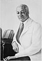
Alain Leroy Locke (1886-1954)
-
Captain Thomas Holme (1624-1695)
-
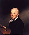
Charles Willson Peale
-
Francis Daniel Pastorius
-
Hannah Penn
-
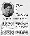
Jessie Redmon Fauset
-
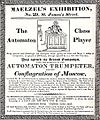
John Nepomuk Maelzel (1772-1838)
-

Pennsylvania Station
-
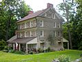
Printz's (Old Swedes) Mill
-
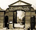
Schuylkill Arsenal
-
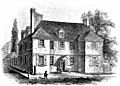
William Penn - Slate Roof House


See also
- List of Pennsylvania state historical markers
- National Register of Historic Places listings in Philadelphia, Pennsylvania
- List of National Historic Landmarks in Philadelphia
