
List of Sites of Special Scientific Interest in Leicestershire facts for kids

Leicestershire is a county in the East Midlands of England. It covers about 833 square miles (2,157 square kilometres). In 2011, around 980,000 people lived here. Leicester City Council manages Leicester city. The rest of the county is looked after by Leicestershire County Council. There are also seven smaller councils that help run things.
In England, special places called Sites of Special Scientific Interest (SSSIs) are protected by law. Natural England, a government group, chooses these sites. They make sure England's most important wildlife and geological spots are safe. As of January 2018, Leicestershire has 76 SSSIs. Most of these (57) are special for their plants and animals (biology). Twelve are special for their rocks and landforms (geology). Seven are special for both!
Contents
What Makes a Place an SSSI?
SSSIs are like nature's VIP areas. They are chosen because they have rare plants, animals, or amazing geological features. Protecting these places helps keep our natural world healthy and diverse.
Many of Leicestershire's SSSIs have other special titles too. For example, 19 are Geological Conservation Review (GCR) sites. This means they are super important for studying Earth's history. Six are Nature Conservation Review (NCR) sites, which are key for nature conservation. There's also one Special Area of Conservation (SAC), which is important across Europe.
Leicestershire also has three national nature reserves (NNRs). These are big areas managed for wildlife. Some SSSIs are on common land, meaning people can use them. Three even contain scheduled monuments, which are important historical sites.
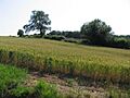
The biggest SSSI in Leicestershire is Bradgate Park and Cropston Reservoir. It covers a huge 399.3 hectares (987 acres). This park has rocks from the Ediacaran period, which are about 600 million years old! These rocks are very important for studying ancient life before the dinosaurs. The smallest SSSI is Gipsy Lane Pit, at just 0.5 hectares (1.2 acres). This tiny spot is important for scientists who study minerals because it has many rare sulphides.
Exploring Leicestershire's Special Sites
Let's look at a few examples of these amazing SSSIs and what makes them unique:
Ancient Woods and Rare Plants
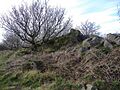
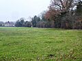
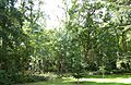
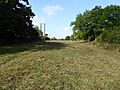
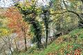
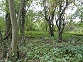
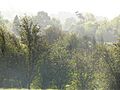
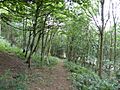
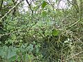
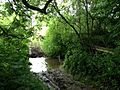
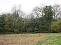
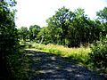
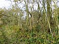
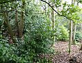
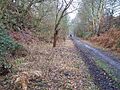
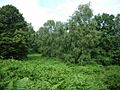
- Allexton Wood: This old wood grows on clay soils. It's mostly ash trees, with some elm and oak. You can find small streams here with a plant called opposite-leaved golden saxifrage.
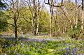
- Launde Big Wood: This wood is also on heavy clay. It's dominated by ash trees. You can find beautiful flowers like bluebells and yellow archangel here.
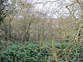
- Owston Woods: These woods are home to many different moths, beetles, and other insects, including some rare ones. You can also spot various birds and small mammals here.
Watery Worlds and Aquatic Life
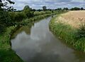
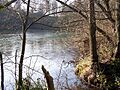
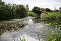
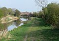
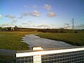
- Ashby Canal: This canal is full of different water plants and insects. You might see nine types of dragonfly! It's also home to water shrews and a rare water beetle.
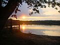
- Blackbrook Reservoir: This reservoir has a unique mix of plants along its edges. It's one of the few places in the Midlands where you'll find Juncus filiformis. It also has native white-clawed crayfish, which are protected.
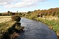
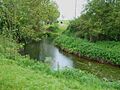
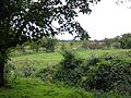
- River Mease: This river is super important for two types of freshwater fish: spined loach and bullhead. The plants in the river change as the water flows from fast to slow.
Hills, Quarries, and Ancient Rocks
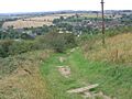
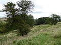
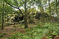
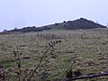
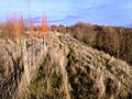
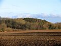
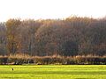
- Bardon Hill: This hill is a small piece of the old Charnwood Forest. It has woodlands, heath, and rocky areas. It's known for its many lichens and insects, especially spiders, with 133 different kinds!
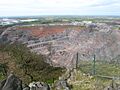
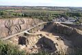
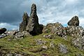
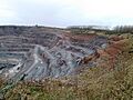
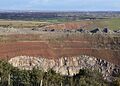
- Bardon Hill Quarry: This quarry has been dug for over 400 years! It shows rocks from an ancient volcano that erupted about 570 million years ago. Imagine, it was like the Montserrat volcano today!
- Bradgate Park and Cropston Reservoir: As mentioned, this park has some of the oldest rocks in the county, from 600 million years ago. Scientists study these rocks to learn about early life on Earth.
- Charnwood Lodge: This is the biggest moorland area in the East Midlands. It's famous for its 'bomb' rocks, which are volcanic blocks from 600 million years ago.
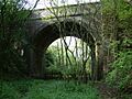
- Tilton Cutting: This is the best place in the East Midlands to see rocks from the Lower Jurassic period, about 180 million years ago. You can find many fossils here, including a special type of ammonite called Tiltoniceras acutum.
Grasslands and Meadows
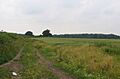
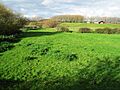
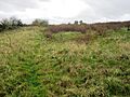
- Muston Meadows: These meadows are on clay soils and have old ridge and furrow patterns from farming long ago. You can find beautiful flowers like green-winged orchid, lady's bedstraw, and cowslip here.
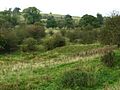
- Holly Rock Fields: This site is nationally important because it has a rare type of grassland with crested dog’s-tail and common knapweed. These fields haven't been changed by modern farming, so they have many different kinds of plants.
Public Access
Many SSSIs allow visitors, but some are private to protect sensitive wildlife.
- YES: You can visit most or all of the site.
- PP: You can visit part of the site.
- FP: You can only use footpaths that go through the site.
- NO: There is no public access to the site.
- WTPR: You need a permit from the Leicestershire and Rutland Wildlife Trust to visit.
Always check signs and local information before visiting any SSSI to understand access rules and help protect these special places.
Images for kids
-
Allexton Wood
-
Ashby Canal
-
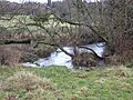
Bardon Hill
-
Bardon Hill Quarry
-
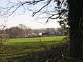
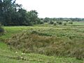
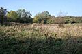
Barrow Gravel Pits
-
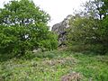
Beacon Hill
-
Benscliffe Wood
-
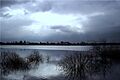
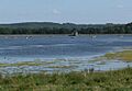
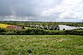
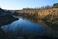
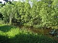
Blackbrook Reservoir
-
Botcheston Bog
-
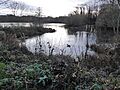
Cropston Reservoir
-
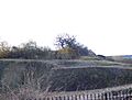
Breedon Quarry
-
Breedon Hill
-
Briery Wood Heronry
-

Swithland Reservoir
-
Burbage Wood and Aston Firs
-
Cave's Inn Pits
-
Charnwood Lodge
-
Chater Valley
-
Cliffe Hill Quarry
-
Coalville Meadows
-
Cotes Grassland
-
Cribb's Meadow
-
Croft Quarry
-
Croft Hill
-
Croft Pasture
-
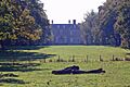
Croxton Park
-
Dimminsdale
-
Donington Park
-
Enderby Warren Quarry
-
Eye Brook Reservoir
-
Great Merrible Wood
-
Frisby Marsh
-
Gipsy Lane Pit
-
Grace Dieu and High Sharpley
-
Grantham Canal
-
Great Bowden Borrowpit
-
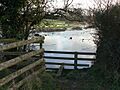
Groby Pool
-
Harby Hill Wood
-
Holly Rock Fields
-
Holwell Mouth
-
Ives Head
-
Kendall's Meadow
-
Kilby – Foxton Canal
-
The Drift
-
Launde Big Wood
-
Leighfield Forest
-
Lockington Marshes
-
Loughborough Meadows
-
Lount Meadows
-
Main Quarry, Mountsorrel
-
Misterton Marshes
-
Muston Meadows
-
Narborough Bog
-
Newhurst Quarry
-
Newton Burgoland Marshes
-
Oakley Wood
-
One Barrow Plantation
-
Owston Woods
-
Pasture Wood
-
River Eye
-
River Mease
-
Roecliffe Manor Lawns
-
Saddington Reservoir
-
Sheepy Fields
-
Sheet Hedges Wood
-
Shepshed Cutting
-
Sproxton Quarry
-
Stanford Park
-
Stonesby Quarry
-
Swithland Wood
-
Terrace Hills Pasture
-
Tilton Cutting
-
Twenty Acre Piece
-
Ulverscroft Valley
-
Wymondham Rough


.jpg)


See also
Sources
