
List of local nature reserves in Leicestershire facts for kids

Leicestershire is a lovely county in the middle of England, called the East Midlands. It's a big place, about 806 square miles (2,088 square kilometers). In 2011, nearly a million people lived here! The main city, Leicester, has its own council. The rest of the county is looked after by the Leicestershire County Council and seven smaller local councils.
Contents
What are Local Nature Reserves?
Local Nature Reserves, or LNRs, are special places for nature. Local councils create these areas to protect wildlife and important natural features. They are set up under a law from 1949. To become an LNR, the local council must own the land, lease it, or have a special agreement with the owner.
LNRs are important because they have unique plants, animals, or interesting rocks. Local councils have a duty to take care of these places. They can even make special rules to protect them. This helps keep these natural spots safe for everyone to enjoy and for wildlife to thrive.
Discovering Leicestershire's Nature Reserves
As of late 2017, Leicestershire had 23 Local Nature Reserves. These places are all open to the public, except for Knighton Spinney. You can only visit Knighton Spinney on special open days.
The biggest LNR is Burbage Common and Woods. It covers a huge 85 hectares (210 acres)! Here, you can find over 300 types of flowering plants. There are also 250 kinds of fungi, 100 bird species, and many butterflies and dragonflies. The smallest LNR is Lucas Marsh. It's only 1.5 hectares (3.7 acres). This marsh used to be a quarry.
Special Classifications for Nature Sites
Some nature sites have extra special classifications. These show they are important for different reasons.
- LRWT means the Leicestershire and Rutland Wildlife Trust helps look after the site.
- SSSI means Site of Special Scientific Interest. These are the very best places for wildlife or geology in the UK.
A Closer Look at Some Nature Reserves
Let's explore a few of the amazing Local Nature Reserves in Leicestershire. Each one offers something unique to discover.
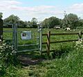
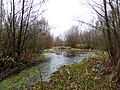
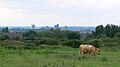
Aylestone Meadows
Aylestone Meadows is the largest open space in Leicester. It has beautiful meadows full of different plant species. You might even see longhorn cattle grazing here. Look out for wild animals like otters and bright kingfishers near the water.
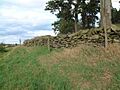
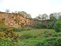
Billa Barra Hill
At Billa Barra Hill, the top of the hill used to be a quarry. This has left exposed rocks. These rocks are now home to many different mosses and lichens. Lower down, you'll find grassy areas. Local trees have been planted on the hill's lower slopes.
Birstall Meadows
Birstall Meadows are located along the River Soar. These meadows are damp and rich in flowers. Horses and cattle graze here. There are also large areas of open water. These spots are perfect for waterfowl to feed during winter.
Burbage Common and Woods
Burbage Common and Woods is the largest LNR in the county. It's a SSSI too! The woods have trees like ash and oak. You can also find hazel and hawthorn bushes. Look for flowers like sweet woodruff and water avens. The common area has natural grassland and some heathland.
Lucas Marsh
Lucas Marsh is the smallest LNR. It's part of Brock's Hill Country Park. This marsh is mostly covered by greater willowherb and common reed. You can also find rough grassland, hedges, trees, and scrub. Many butterflies fly here, including small tortoiseshells, speckled woods, peacocks, and orange tips.
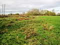
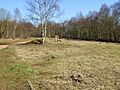
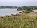
Moira Junction
Moira Junction used to be part of a railway yard. It closed in 1966 and became a nature area in 1991. This reserve has two lakes, birch woodland, and heath grassland. It's a great example of how old industrial sites can become new homes for nature.
Morley Quarry
The quarries at Morley Quarry are very old, with rocks from 600 million years ago! This makes it a Regionally Important Geological Site. The area has grassland and heath, with plants like heather and gorse. There's also a pond where toads breed.
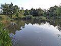
New Lount
New Lount is home to many different birds. You might spot green woodpeckers, chiffchaffs, blackcaps, willow warblers, and goldcrests. Common and soprano pipistrelle bats fly over the site's four ponds, catching insects.
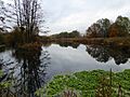
Reedbed Local Nature Reserve
The Reedbed Local Nature Reserve is part of Watermead Country Park. It's in the River Soar floodplain. This site has lakes, reedbeds, woods, marshes, and grassland. Many birds breed here, such as reed warblers, sand martins, and song thrushes.
Snibston Grange
Snibston Grange was once the beautiful garden of a local coal mine manager. Now, it's part of Snibston Country Park. It has two fishing lakes and a Victorian arboretum. An arboretum is like a tree museum, with many different types of old trees. There's also a wetland area and a wildflower meadow.
Images for kids
-
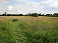
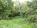
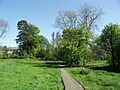
Aylestone Meadows
-
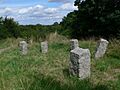
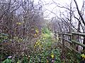
Billa Barra Hill
-
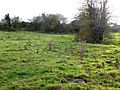
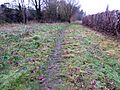
Birstall Meadows
-
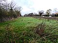
Bishop's Meadow
-
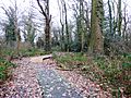
Burbage Common
-
Glen Parva
-
Goss Meadows
-
Halstead Road Centenary Pasture
-
Humberstone Park
-
Kirby Frith
-
Knighton Spinney
-
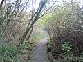
Lucas Marsh
-
Moira Junction
-
Morley Quarry
-
Nature Alive
-
New Lount
-
North Kilworth
-
The Orchards
-
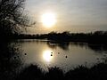
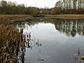
Reedbed
-
Saltersford Wood
-
Scraptoft
-
Snibston Grange
-
Watermead Country Park South


See also
