Aylestone Meadows facts for kids
Quick facts for kids Aylestone Meadows |
|
|---|---|
 |
|
| Type | Local Nature Reserve |
| Location | Leicester |
| OS grid | SK 571 015 |
| Area | 8.8 hectares |
| Managed by | Leicester City Council |
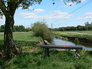
Aylestone Meadows is a large, beautiful Local Nature Reserve in Leicester, England. It covers about 8.8 hectares, which is like 12 football fields! It's a special place owned and looked after by Leicester City Council.
This amazing nature reserve is Leicester's biggest. It sits on the flat, low-lying areas next to the River Soar and River Biam, as well as several parts of the Grand Union Canal. It's a very important spot for protecting wildlife, and its trails are popular with hikers, families, dog walkers, and cyclists.
Contents
Discover Aylestone Meadows
Aylestone Meadows is a mix of different natural areas. You'll find flood meadows (fields that sometimes get covered by water), woodlands, and wetlands (areas where the ground is always wet). These different habitats are home to many kinds of plants and animals, some common and some quite rare. Even though it feels like you're far away, it's only about 1.6 miles from the city centre!
A Glimpse into History
You can find clues about the past at Aylestone Meadows. There's a packhorse bridge from the Middle Ages. This old bridge shows that people used to trade and live here a long time ago. The area often floods, which makes the land very rich and good for grazing animals. Because of this, a settlement grew here from prehistoric times, eventually becoming the village of Aylestone. The packhorse bridge was built from local granite. It helped people transport goods across the flood-prone area and even had wider spots for people to pass each other.
The Land and Its Rivers
Aylestone Meadows is shaped by its rivers. After the last Ice Age, a big river called the Bytham River changed its course. The old riverbed then became what we now know as the Soar Valley. While the River Soar is now controlled by canals through the city, Aylestone Meadows is a natural part of the flood plain that once stretched all the way to the River Trent.
Protecting the Floodplain
In July 2019, a special project started in the northern part of the park. The main goal was to bring back the natural marsh areas that help control floods. These marshy areas had slowly disappeared over time. This important work was expected to continue through 2020, helping to protect the park and nearby areas from flooding.
Where is Aylestone Meadows?
Aylestone Meadows is surrounded by several other areas. To the east, you'll find Aylestone and Aylestone Park. To the north are Westcotes and the city centre. To the west, you'll find Braunstone Park & Rowley Fields. The Grand Union Canal and the old Great Central Railway line both run through the park. There's also one public road, Middleton Lane, that crosses through it.

