List of dams and reservoirs in South Dakota facts for kids
Dams are big walls built across rivers. They hold back water, creating a large lake called a reservoir. These reservoirs store water for many uses. They can provide drinking water, help farmers water their crops, and even generate electricity. South Dakota has many important dams and reservoirs. They play a big role in managing water resources for the state.
A "major dam" is usually very tall, about 50 feet (15 meters) high. It can also hold a lot of water, like 5,000 acre-feet (6.2 million cubic meters). This is enough water to cover 5,000 football fields with one foot of water!
Important Dams and Reservoirs in South Dakota

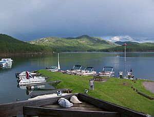
Marina at Sheridan Lake
Here is a list of some major dams and the reservoirs they create in South Dakota:
- Angostura Dam creates Angostura Reservoir. It is managed by the United States Bureau of Reclamation (USBR).
- Belle Fourche Dam creates Belle Fourche Reservoir. This dam is also managed by the USBR.
- Big Bend Dam forms Lake Sharpe. The United States Army Corps of Engineers (USACE) built and manages it.
- Big Stone Lake Dam helps create Big Stone Lake. This lake is on the border with Minnesota.
- Cold Brook Dam forms Cold Brook Lake. It is managed by the USACE.
- Cottonwood Springs Dam creates Cottonwood Springs Lake. This dam is also managed by the USACE.
- Deerfield Dam forms Deerfield Reservoir. It is managed by the USBR.
- Fort Randall Dam creates Lake Francis Case. This dam is managed by the USACE.
- Gavins Point Dam forms Lewis and Clark Lake. It is managed by the USACE and sits on the border with Nebraska.
- Oahe Dam creates Lake Oahe. This large dam is managed by the USACE and extends into North Dakota.
- Oglala Dam forms Oglala Lake. It is managed by the Oglala Sioux Tribe.
- Pactola Dam creates Pactola Lake. This dam is managed by the USBR.
- Shadehill Dam forms Shadehill Reservoir. It is managed by the USBR.
- Slater Dam is located east of CR 17 in Pennington County.
- Squaw Humper Dam is another dam in the state.
- Sheridan Dam creates Sheridan Lake. It is managed by the United States Forest Service.
- Reservation Dam and White Rock Dam help create Lake Traverse. These are managed by the USACE.
See also

All content from Kiddle encyclopedia articles (including the article images and facts) can be freely used under Attribution-ShareAlike license, unless stated otherwise. Cite this article:
List of dams and reservoirs in South Dakota Facts for Kids. Kiddle Encyclopedia.

