Little Ajo Mountains facts for kids
Quick facts for kids Little Ajo Mountains |
|
|---|---|
 |
|
| Highest point | |
| Peak | Black Mountain |
| Elevation | 3,008 ft (917 m) |
| Geography | |
| Country | United States |
| State | Arizona |
| Range coordinates | 32°21′06″N 112°52′32″W / 32.3517252°N 112.8754327°W |
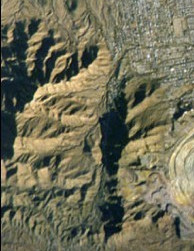
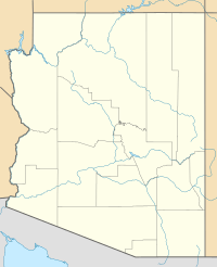
The Little Ajo Mountains are a small mountain range in southern Arizona, in Pima County, Arizona. The city of Ajo is right next to these mountains. Both the mountains and the city get their name from the Spanish word for garlic.
This mountain range is about 13 miles (21 km) long and 13 miles (21 km) wide. It is loosely connected to Childs Mountain in the northwest. The city of Ajo is located in the middle-east part of the range. Ajo is well-known for the New Cornelia open pit copper mine, which is found within the Little Ajo Mountains.
Contents
Peaks of the Little Ajo Mountains
The Little Ajo Mountains have several notable peaks.
- Black Mountain is an isolated peak south of Ajo. It is the highest point in the range, reaching 3,008 feet (917 meters) high.
- Cardigan Peak is 2,922 feet (891 meters) tall. It is part of the main mountain area west of Ajo.
- Ajo Peak is 2,619 feet (798 meters) high.
- North Ajo Peak is 2,776 feet (846 meters) high. Both Ajo Peak and North Ajo Peak are isolated peaks southwest of Ajo.
- Camelback Mountain is 2,573 feet (784 meters) tall. It is just south of Ajo and overlooks the New Cornelia copper mine pit to its east.
Nearby Mountain Ranges and Areas
The Little Ajo Mountains are surrounded by other interesting places.
- To the northeast are the Batamote Mountains.
- The Pozo Redondo Mountains are to the east.
- To the south, you'll find the Bates Mountains and the Ajo Range.
- The Growler Mountains are located to the west.
- The Barry M. Goldwater Air Force Range is to the north and west of the mountains.
- The Cabeza Prieta National Wildlife Refuge is also to the west.
Valleys Around the Mountains
Water flows from the Little Ajo Mountains into nearby valleys.
- Water from the north and northeast sides of the mountains flows into Tenmile Wash. This wash then goes northwest into Childs Valley.
- The southwest side of the range drains into Daniels Arroyo, which also flows northwest into Childs Valley.
- Water from the southeast side of the range flows south into the Cuerda de Leña. This area is part of the Valley of the Ajo. The water then turns west around the southern end of the Growler Mountains and joins the Growler Valley.
How to Get to the Mountains
The city of Ajo and the Little Ajo Mountains are easy to reach.
- They are about 70 miles (113 km) south of Interstate 8 if you take Arizona State Route 85.
- They are also about 80 miles (129 km) west of Quijotoa, Arizona and the Tohono O'odham Reservation.
 | Chris Smalls |
 | Fred Hampton |
 | Ralph Abernathy |


