Ajo Peak facts for kids
Quick facts for kids Ajo Peak |
|
|---|---|
| Highest point | |
| Elevation | 2,619 ft (798 m) NAVD 88 |
| Geography | |
| Location | Pima County, Arizona, U.S. |
| Parent range | Little Ajo Mountains |
| Topo map | USGS Chico Shunie |
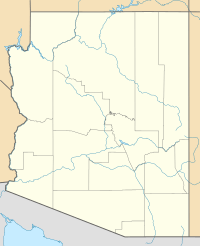
Ajo Peak (also known as O'odham: S-vepegĭ moʼokam or To:lo Vipidoḍ We:co in the O'odham language) is a mountain in southern Arizona. It is located in the northern and eastern parts of the Sonoran Desert.
This mountain peak stands about 2,619 feet (798 meters) tall. It is located about 12 miles (19 kilometers) north of the Organ Pipe Cactus National Monument.
There are two other peaks close by. Cardigan Peak is 2,922 feet (891 meters) high, and North Ajo Peak is 2,776 feet (846 meters) high.
The town of Ajo, Arizona, is a good starting point to explore the central areas of the Little Ajo Mountains, including Ajo Peak. The name "Ajo" comes from a Spanish word meaning "garlic."
Water Flow from Ajo Peak
Ajo Peak is part of the Little Ajo Mountains. These mountains act like a "water divide." This means they separate areas where water flows in different directions.
Imagine rain falling on the mountain. The water will flow down one side or another. From Ajo Peak, water flows in three main directions. This is why it's called a "Triple Divide."
- One direction goes southwest and then north. This water flows into the Growler Valley and the San Cristobal Wash Drainage. These paths go around the Little Ajo and Growler Mountain ranges.
- Another direction goes northwest.
- A third direction starts from the northeast side of the mountain. This water flows northwest through the eastern edge of the Childs Valley. It forms the beginning of the Tenmile Wash Drainage.
Both of these drainages eventually disappear into the ground. They do not reach the Gila River Valley.
See also
 In Spanish: Pico Ajo para niños
 | Tommie Smith |
 | Simone Manuel |
 | Shani Davis |
 | Simone Biles |
 | Alice Coachman |


