Gila River Valley facts for kids
Quick facts for kids Gila Valley |
|
|---|---|

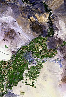
The Gila valley in Yuma County
|
|
| Length | 310 mi (500 km) E-W |
| Width | 14 mi (23 km) N-S |
| Geography | |
| Country | United States |
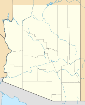
| State | Arizona |
| Counties | |
| Cities and towns | |
| River | Gila River |
The Gila River Valley is a long valley in Arizona. It is made up of many sections. This valley was carved out by the Gila River.
The Gila River starts in western New Mexico. It flows west across Arizona. The river changes direction as it moves. It creates different valleys along its path. Some parts of the river flow near Phoenix. Here, the Salt River Valley joins the Gila River Valley. In southwestern Arizona, the river forms smaller valleys. These include Dome Valley, Mohawk Valley, and Hyder Valley.
Two mountain ranges are named after the Gila River. The Gila Mountains (Graham County) are next to the valley. They are northeast of Safford. The Gila Mountains (Yuma County) are also near the valley. They are east of Yuma. These mountains are close to the Fortuna Foothills. The Gila River flows past them before joining the Colorado River.
Exploring the Gila Valley in Graham County
The Gila Valley starts in central Graham County, Arizona. This part of the valley is about 35 miles (56 km) long.
Two towns, Thatcher and Safford, are located here. They are upstream on the Gila River. The valley floor near Safford is about 2,906 feet (886 meters) high. This area along the river is where most people live in the Safford micropolitan area.
Discovering the Gila Valley in Yuma County
The Gila Valley in Yuma County, Arizona is a smaller section. It surrounds the Gila River where it meets the Colorado River. The Colorado River forms the border between California and Arizona. It also borders parts of Baja California and Sonora in Mexico. This valley is southwest of Yuma.
This part of the valley stretches for about 10 miles (16 km). It goes from the river's meeting point to the northern end of the Gila Mountains. The Gila River here twists and turns. It flows west, then southwest, and then west again.
The Gila Valley here has two main parts. The North Gila Valley is north of the Gila River. The South Gila Valley is to the south. The towns in this valley are mostly farming communities. This is especially true in the south and southwest, closer to Yuma, Arizona.
The South Gila Valley is next to the Yuma Mesa. The Fortuna Foothills are on the northwest edge of the Gila Mountains. The North Gila Valley has the Adair Range. This is a shooting range on the southern edge of the Laguna Mountains.
See also
 In Spanish: Valle del Gila para niños
 | Frances Mary Albrier |
 | Whitney Young |
 | Muhammad Ali |


