Florence, Arizona facts for kids
Quick facts for kids
Florence, Arizona
O'odham: S-auppag
|
|
|---|---|
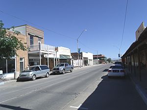
Main Street of the original town-site of Florence. The town-site was listed in the National Register of Historic Places on October 26, 1982, reference #82001623.
|
|
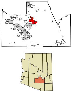
Location of Florence in Pinal County, Arizona
|
|
| Country | |
| State | |
| County | Pinal |
| Area | |
| • Total | 62.68 sq mi (162.33 km2) |
| • Land | 62.64 sq mi (162.23 km2) |
| • Water | 0.04 sq mi (0.10 km2) |
| Elevation | 1,539 ft (469 m) |
| Population
(2020)
|
|
| • Total | 26,785 |
| • Density | 427.62/sq mi (165.11/km2) |
| Time zone | UTC-7 (MST (no DST)) |
| ZIP codes |
85128, 85132, 85179
|
| Area code(s) | 520 |
| FIPS code | 04-23760 |
| GNIS feature ID | 2412633 |
| Website | http://www.florenceaz.gov/ |
Florence (in O'odham: S-auppag) is a town in Pinal County, Arizona, United States. It's the main town, or county seat, of Pinal County. Florence is one of the oldest towns in the area. It has a special historic district with more than 25 buildings. These buildings are listed on the National Register of Historic Places. In 2020, about 26,785 people lived in Florence.
Contents
Discover the History of Florence, Arizona
The land where Florence is now was once home to the Athabascans. These were ancestors of the San Carlos Apache tribe. Before Florence was founded, the Gila River was part of the border between the United States and Mexico. In 1853, the Gadsden Purchase made the U.S. territory much larger, moving the border south.
Who Founded Florence?
Levi Ruggles, a soldier from the American Civil War, started the town of Florence. He founded it on the south side of the Gila River. Ruggles came to Arizona in 1866 as a U.S. Indian Agent. He saw that the valley was good for farming. He found a spot where people could easily cross the Gila River and planned out the town there.
With help from Governor R.C. McCormick, Florence got a post office in August 1866. Ruggles held many public jobs, including being a Territorial Legislator. Florence later became the main town for the new Pinal County. In 1875, silver was found in the nearby mountains. This led to the famous Silver King Mine.
What Happened to Adamsville?
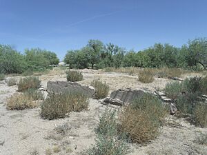
In 1870, Fred Adams started a farming town. It was about two miles west of Florence. This town, called Adamsville, had stores, homes, a post office, and a flour mill. In the early 1900s, the Gila River flooded badly after a storm. Most of Adamsville was washed away. Its residents then moved to Florence. Today, the area where Adamsville was is a ghost town. It is now part of Florence. You can find a historical marker about Adamsville at the junction of Highway 79 and 287.
How Did Farming Grow in Florence?
A canal was built in the 1880s. This canal helped bring water from the Gila River for farming. Because of this, farming and ranching became very important to Florence's economy. All land deals for Southern Arizona happened in Florence until 1881. That's when the Federal Land Office moved to Tucson.
Famous Gunfights and Trials
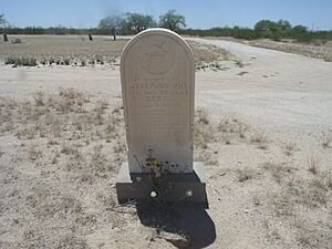
Florence was the site of a famous gunfight in the Old Southwest. In 1883, Sheriff Pete Gabriel hired Joseph (Joe) Phy as his deputy. Later, Gabriel decided not to run for sheriff in 1886. He first supported Phy for the job. But then, they had disagreements. The two friends became enemies.
On May 31, 1888, they had a fight in the Tunnel Saloon. The gunfight spilled out into the street. Both men were shot. Phy died a few hours later. Gabriel survived and passed away 10 years later.
The second Pinal County Courthouse was built in 1891. This courthouse was where important trials took place. One notable trial involved Pearl Heart, an outlaw known for a stagecoach robbery. She was tried in 1899.
Florence and Hollywood Connections
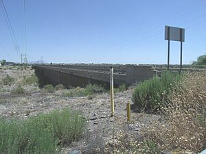
In 1940, the famous cowboy movie star Tom Mix died in Florence. He lost control of his car and crashed into a dry wash. This wash is now called the Tom Mix Wash. Mix often stayed in a house in Florence. He was returning from Tucson when the accident happened. There is a statue of a riderless horse with a plaque at the accident site.
Explore Florence's Location and Weather
Florence is located at 33°2′32″N 111°23′4″W / 33.04222°N 111.38444°W. The town covers about 8.3 square miles (21.5 square kilometers) of land. Florence has a typical hot desert climate, like much of lowland Arizona. This means it has very hot summers and warm winters.
| Climate data for Florence, Arizona (1971 to 2000) | |||||||||||||
|---|---|---|---|---|---|---|---|---|---|---|---|---|---|
| Month | Jan | Feb | Mar | Apr | May | Jun | Jul | Aug | Sep | Oct | Nov | Dec | Year |
| Record high °F (°C) | 89 (32) |
92 (33) |
99 (37) |
105 (41) |
115 (46) |
118 (48) |
119 (48) |
118 (48) |
117 (47) |
112 (44) |
97 (36) |
91 (33) |
119 (48) |
| Mean daily maximum °F (°C) | 66.3 (19.1) |
70.4 (21.3) |
74.5 (23.6) |
82.6 (28.1) |
91.2 (32.9) |
100.8 (38.2) |
102.4 (39.1) |
100.8 (38.2) |
96.8 (36.0) |
86.9 (30.5) |
74.3 (23.5) |
66.1 (18.9) |
84.4 (29.1) |
| Mean daily minimum °F (°C) | 38.3 (3.5) |
40.8 (4.9) |
44.3 (6.8) |
49.8 (9.9) |
58.3 (14.6) |
67.3 (19.6) |
75.5 (24.2) |
74.6 (23.7) |
68.5 (20.3) |
56.9 (13.8) |
44.3 (6.8) |
38.6 (3.7) |
54.8 (12.7) |
| Record low °F (°C) | 11 (−12) |
18 (−8) |
20 (−7) |
23 (−5) |
32 (0) |
35 (2) |
54 (12) |
50 (10) |
41 (5) |
30 (−1) |
14 (−10) |
16 (−9) |
11 (−12) |
| Average rainfall inches (mm) | 1.07 (27) |
1.06 (27) |
1.16 (29) |
0.41 (10) |
0.26 (6.6) |
0.17 (4.3) |
0.93 (24) |
1.22 (31) |
0.90 (23) |
0.90 (23) |
0.75 (19) |
1.22 (31) |
10.05 (254.9) |
| Average rainy days (≥ 0.01 inch) | 4.7 | 4.5 | 4.2 | 1.9 | 1.5 | 0.7 | 3.5 | 4.8 | 2.7 | 2.9 | 2.7 | 3.4 | 37.5 |
| Source: National Climatic Data Center | |||||||||||||
How Many People Live in Florence?
| Historical population | |||
|---|---|---|---|
| Census | Pop. | %± | |
| 1880 | 902 | — | |
| 1890 | 1,486 | 64.7% | |
| 1910 | 807 | — | |
| 1920 | 1,161 | 43.9% | |
| 1930 | 1,318 | 13.5% | |
| 1940 | 1,383 | 4.9% | |
| 1950 | 1,776 | 28.4% | |
| 1960 | 2,143 | 20.7% | |
| 1970 | 2,173 | 1.4% | |
| 1980 | 3,391 | 56.1% | |
| 1990 | 7,510 | 121.5% | |
| 2000 | 17,054 | 127.1% | |
| 2010 | 25,536 | 49.7% | |
| 2020 | 26,785 | 4.9% | |
| 2022 (est.) | 24,795 | −2.9% | |
| U.S. Decennial Census | |||
In 2015, Florence had about 30,770 people living in 6,832 homes. The population has grown a lot over the years. For example, in 1880, there were only 902 people. By 2020, the population was 26,785.
Florence's Role in the Justice System
Florence is home to several prisons. In 1909, the Yuma Territorial Prison closed. Its prisoners were moved to the new Florence Territorial Prison.
Prisons in Florence Today
As of 2016, Florence has many state, federal, county, and private prisons. These include:
- Arizona State Prison Complex – Florence, run by the Arizona Department of Corrections.
- Arizona State Prison Complex – Eyman, also run by the Arizona Department of Corrections.
- Arizona State Prison Florence-West, run by the GEO Group.
- Central Arizona Correctional Facility, also run by the GEO Group.
- Central Arizona Detention Center, run by Corrections Corporation of America.
- Florence Correctional Center, also run by CCA.
- The Pinal County Adult Detention Center, run by the county.
- The Pinal County Youth Justice Center, for younger prisoners, run by the county.
World War II History in Florence
During World War II, a large prisoner of war camp was located north of Florence. It held German and Italian prisoners, mostly captured during the North Africa campaign. This camp was called Camp Florence.
Japanese Americans were also held nearby at the Gila River War Relocation Center. Prisoners at Camp Florence were paid to pick cotton. You can learn more about this time at McFarland State Historic Park on Ruggles Avenue.
Getting Around Florence
The City of Coolidge runs a transportation service called Central Arizona Regional Transit (CART). This service helps people travel between Florence, Coolidge, Central Arizona College, and Casa Grande.
Fun Facts About Florence
- Florence is seen as the center of Pinal County. It's known for its historic buildings and rich past.
- A new community called Anthem is being built near Florence. It's about six miles northwest of the historic downtown.
- The town's old Main Street and desert views were used as the setting for the movie Murphy's Romance.
- Florence hosts the yearly "Country Thunder" music festival.
- The town is also home to the Florence Jr. Parada Rodeo. This is the oldest junior rodeo in the United States.
Must-See Places in Florence
- McFarland State Historic Park: This park is home to the first Pinal County Courthouse, built in 1876. You can find it at W. 24 Ruggle St.
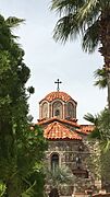
- St. Anthony's Greek Orthodox Monastery: This peaceful monastery was started in 1995.
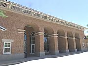
- Florence High School: The high school building was built in 1887. It's located at 1000 S. Main St. It's listed on the National Register of Historic Places.
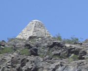
- Poston Butte: This is where you'll find the pyramid tomb of Charles Debrille Poston. He was known as "The Father of Arizona." The hill was renamed Poston Butte in his honor.
- Points of interest
-
Pyramid tomb of Charles Debrille Poston.
Historic Buildings in Florence
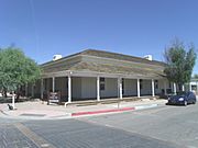
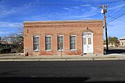
Florence has many historic buildings. Some are listed on the National Register of Historic Places. Others are considered historical by the Florence Historic District Advisory Commission.
See also
 In Spanish: Florence (Arizona) para niños
 | Roy Wilkins |
 | John Lewis |
 | Linda Carol Brown |


