Laguna Mountains (Arizona) facts for kids
Quick facts for kids Laguna Mountains (Arizona) |
|
|---|---|

Cargo Muchacho & Chocolate Mountains-(W & NW)
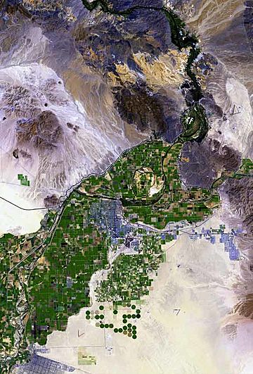
( ~ ) Circular Laguna Mountains (northeast of green agriculture) (black range north: SE-(section)-Chocolate Mtns |
|
| Highest point | |
| Peak | Boot Peak |
| Elevation | 1,080 ft (330 m) |
| Dimensions | |
| Length | 7 mi (11 km) (N-S) |
| Width | 7 mi (11 km) (E-W) |
| Geography | |
| Country | United States |
| State | Arizona |
| Region | Lower Colorado River Valley Gila River Valley ((northwest)-Sonoran Desert) |
| District | Yuma County, Arizona |
| Settlement | Yuma, AZ–Fortuna Foothills, AZ Winterhaven, CA |
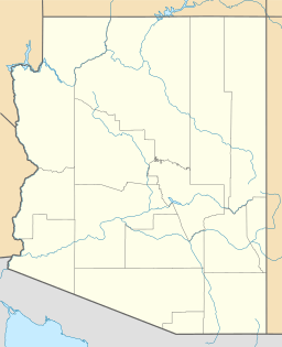
| Range coordinates | 32°49′23″N 114°29′39″W / 32.82306°N 114.49417°W |
| Borders on | Colorado River-W Mittry Lake-NW Chocolate Mountains (California)-NW Gila R. & Gila Mountains (Yuma County)-SE Gila Valley (Yuma County) & Yuma Mesa-S |
The Laguna Mountains are a small, round-shaped mountain range in the very southwest part of Arizona. They are located northeast of the city of Yuma and east of Winterhaven, California. The famous Colorado River runs along the western side of these mountains.
On the northwest side of the Laguna Mountains, you'll find Mittry Lake, which is also connected to the Colorado River. The Gila River flows along the southeast and south edges of the mountains. Eventually, the Gila River joins the Colorado River.
Most of the Laguna Mountains are surrounded by rivers or river valleys. Only the north and northeast parts are not bordered by a river. The northern part has a small area where water drains towards the Colorado River and Mittry Lake. This area is next to the Yuma Proving Grounds.
About the Laguna Mountains
The Laguna Mountains are a small, circular mountain range. They are about 7 miles (11 kilometers) wide in every direction. These mountains are located northeast of the Gila Valley, which is a flat area along the Gila River. This valley includes the northeastern part of Yuma and many farms.
West and southwest of Yuma, there is another area called the Yuma Valley. This valley is bordered by the Colorado River on its north, west, and southwest sides. A major road, U.S. Route 95, starts near the southeast of the Laguna Mountains. It then heads north towards Quartzsite, Arizona, which is about 90 miles away.
The highest point in the Laguna Mountains is a peak called Boot Peak. It stands at 1,080 feet (329 meters) tall. People have found minerals in these mountains, and there have been mines here for a long time. Some mining still happens today.
Fun Activities in the Mountains
The Laguna Mountains area is known for a place called Adair Park. This park is a shooting range located on the southern edge of the mountains. It's found in the North Gila Valley, just northwest of the northern end of the Gila Mountains in Yuma County. It's a popular spot for people who enjoy target practice.
See also
 In Spanish: Sierra de la Laguna (Arizona) para niños
 | Bessie Coleman |
 | Spann Watson |
 | Jill E. Brown |
 | Sherman W. White |


