Little Crooked Run facts for kids
Quick facts for kids Little Crooked Run |
|
|---|---|

Little Crooked Run
|
|
| Physical characteristics | |
| Main source | valley in southeastern North Union Township, Schuylkill County, Pennsylvania 1,480 ft (450 m) |
| River mouth | Tomhicken Creek in North Union Township, Schuylkill County, Pennsylvania 997 ft (304 m) 40°55′47″N 76°09′15″W / 40.92986°N 76.15412°W |
| Length | 1.7 mi (2.7 km) |
| Basin features | |
| Progression | Tomhicken Creek → Catawissa Creek → Susquehanna River → Chesapeake Bay |
| Basin size | 1.22 sq mi (3.2 km2) |
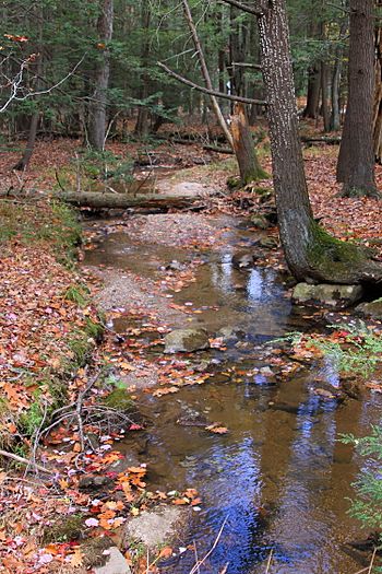
Little Crooked Run is a small stream located in Schuylkill County, Pennsylvania. It flows into Tomhicken Creek. This stream is about 1.7 miles (2.7 km) long and runs through North Union Township. The area of land that drains into Little Crooked Run, called its watershed, covers about 1.22 square miles (3.2 km2). The stream is known for its very clean and cold water, which makes it a great place for fish, especially wild trout. The main types of rock found in the stream's watershed are the Mauch Chunk Formation and the Pottsville Formation, and the soil is mostly Hazleton soil.
Contents
Where Little Crooked Run Flows
Little Crooked Run starts in a valley in the southeastern part of North Union Township, Schuylkill County, Pennsylvania. Its starting point is close to the border with East Union Township, Schuylkill County, Pennsylvania.
The stream first flows northeast for a short distance. Then, it turns north and slightly west, leaving the valley. After flowing for a while, it crosses Miller Road and another road called T872. A short distance downstream from there, Little Crooked Run meets and joins Tomhicken Creek. It joins Tomhicken Creek about 4.79 miles (7.71 km) before Tomhicken Creek reaches its own end.
Water Quality
Little Crooked Run is considered a healthy stream, meaning it's not badly polluted. However, its water is naturally low in nutrients and a bit acidic. This means it could be affected by acid rain, which is rain that has become more acidic due to pollution in the air.
The water in Little Crooked Run has a low amount of alkalinity, which helps to balance acids. Its pH level is 6.6, which is slightly acidic but still good for many aquatic animals. The water is also considered "soft," meaning it has a low amount of minerals like calcium and magnesium.
On a summer day in 1997, the air temperature near the stream was 30 °C (86 °F). At the same time, the water temperature of the stream was 15.3 °C (59.5 °F). The water's ability to conduct electricity, called specific conductivity, was 32 umhos.
Land and Rocks Around the Stream
The land near where Little Crooked Run joins Tomhicken Creek is about 997 feet (304 m) above sea level. At the very beginning of the stream, its source is higher, at just over 1,480 feet (450 m) above sea level.
Along its entire path, Little Crooked Run flows over rocks from the Mauch Chunk Formation. There is also an area with rocks from the Pottsville Formation nearby. The stream flows over a type of soil called Hazleton soil for its whole length.
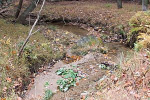
Little Crooked Run is a small stream, about 1.8 metres (5.9 ft) wide. It flows downhill quite steeply, dropping about 57.4 meters for every kilometer it travels. Some parts of the area near the lower end of Little Crooked Run can sometimes flood. However, most other areas in the stream's watershed are not likely to flood. A mountain called Green Mountain is located near where the stream begins.
Stream's Surroundings and History
The watershed of Little Crooked Run covers an area of 1.22 square miles (3.2 km2). Most of this area is located in North Union Township, but a small part is in East Union Township. There are some farms to the west of the stream in its middle sections. A neighborhood with homes is located near the stream's starting point.
Little Crooked Run is found on maps created by the United States Geological Survey for the Nuremberg area.
Important roads in the stream's watershed include Nuremberg Mountain Road, which runs along the northeastern edge of the watershed. About 40 percent of the stream's length is within 100 metres (330 ft) of a road. In 1990, about 22 people lived in each square kilometer of the watershed.
In the 1990s, more houses were built near the source of Little Crooked Run.
Aquatic Life
The Pennsylvania Department of Environmental Protection considers Little Crooked Run a "High-Quality Coldwater Fishery." This means its cold, clean water is excellent for fish that prefer cooler temperatures. It used to be just a "Coldwater Fishery," but its quality has improved. The Pennsylvania Fish and Boat Commission also calls it "Class A Wild Trout Waters," which means it's one of the best places for wild trout.
The only type of fish found in Little Crooked Run is the brook trout. These trout are wild, meaning they were born in the stream and not put there by people. There are many brook trout in the stream. For example, there are about 889 wild brook trout for every kilometer of the stream. Most of these trout are young, less than 175 millimeters long.
 | Delilah Pierce |
 | Gordon Parks |
 | Augusta Savage |
 | Charles Ethan Porter |


