Little River Canyon National Preserve facts for kids
Quick facts for kids Little River Canyon National Preserve |
|
|---|---|

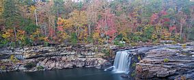
Little River Canyon
|
|
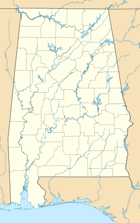
| Location | Cherokee and DeKalb County, Alabama, U.S. |
| Nearest city | Fort Payne, Alabama |
| Area | 15,288 acres (61.87 km2) |
| Established | October 21, 1992 |
| Visitors | 726,239 (in 2022) |
| Governing body | National Park Service |
| Website | Little River Canyon National Preserve |
The Little River Canyon National Preserve is a special protected area in the United States. It sits on top of Lookout Mountain near Fort Payne, Alabama and DeSoto State Park. This preserve was created by a law in 1992.
It covers about 15,288 acres (that's over 23 square miles!). The preserve protects the Little River, which some people say is the longest river that flows entirely on a mountaintop. Long ago, this canyon was known as "May's Gulf." Before it became a National Preserve, this area was part of Alabama's DeSoto State Park.
Contents
Discovering Little River Canyon
The Little River Canyon National Preserve is a fantastic place to explore nature. It's managed by the National Park Service, which helps keep it wild and beautiful for everyone.
The Amazing Little River
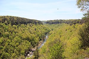
The Little River flows for almost its whole journey along the middle of Lookout Mountain in northeast Alabama. Over millions of years, this river has carved out one of the deepest canyons in the southeastern U.S. It starts in Georgia and then winds its way through the mountain. Finally, it leaves the mountain and flows into the Coosa River near Leesburg, Alabama.
The main part of the river is formed when two smaller rivers, the East Fork and the West Fork, join together. The East Fork is about 17 miles long, and the West Fork is about 25 miles long. After they meet, the Little River flows for another 23 miles through the canyon until it reaches Weiss Lake.
Exploring the Deep Canyon
Many people say the Little River is one of the cleanest and wildest rivers in the South. It doesn't have many dams, except for an old, unused one at DeSoto Falls. The canyon walls are made of Sandstone and can reach up to 600 feet high! You can often see these towering cliffs from the 23-mile-long scenic drive. This road is called the Little River Canyon Rim Parkway.
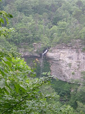
The river has three main waterfalls. DeSoto Falls is on the West Fork. Little River Falls marks the beginning of the canyon. There's also a seasonal waterfall called Grace's High Falls. This waterfall is Alabama's highest, dropping 133 feet into a side canyon. It's most impressive after a lot of rain.
Hiking and Adventure
Eberhart Point is a good spot if you want to hike down to the bottom of the canyon. There's a rough path that was once a road for a ski-lift project. That project was stopped many years ago, but you can still see some old parts of it.
Hiking upstream from Pine Tree Hole is much harder and only for experienced hikers. The river is also popular with people who enjoy whitewater sports. They carry their boats down to Pine Tree Hole to start their adventure.
Visitor Facilities
The National Park Service has some facilities within the preserve. Also, DeSoto State Park is located inside the preserve's boundaries. It offers a lodge, a restaurant, campgrounds, and other helpful services. There's also a day-use area at the mouth of the canyon. It's a great place for picnics and swimming.
Fun Activities at the Preserve
There are many ways to enjoy the Little River Canyon National Preserve.
- Camping: Backcountry camping is not allowed anymore.
- Hunting: If you want to hunt, you need a hunting license from Alabama or another state.
- ATVs: Riding ATVs (all-terrain vehicles) is not allowed.
- Fishing: You need an Alabama fishing license to fish. Using nets or seine fishing is not permitted.
The Jacksonville State University Little River Canyon Center is a large visitor center. It's a great place to learn more about the preserve.
 | Frances Mary Albrier |
 | Whitney Young |
 | Muhammad Ali |


