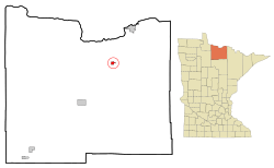
Littlefork, Minnesota facts for kids
Quick facts for kids
Littlefork
|
|
|---|---|

Location of the city of Littlefork
within Koochiching County, Minnesota |
|
| Country | United States |
| State | Minnesota |
| County | Koochiching |
| Area | |
| • Total | 1.19 sq mi (3.08 km2) |
| • Land | 1.19 sq mi (3.08 km2) |
| • Water | 0.00 sq mi (0.00 km2) |
| Elevation | 1,115 ft (340 m) |
| Population
(2020)
|
|
| • Total | 553 |
| • Density | 464.71/sq mi (179.37/km2) |
| Time zone | UTC-6 (Central (CST)) |
| • Summer (DST) | UTC-5 (CDT) |
| ZIP code |
56653
|
| Area code(s) | 218 |
| FIPS code | 27-37592 |
| GNIS feature ID | 0646969 |
Littlefork is a small city located in Koochiching County, Minnesota, in the United States. In 2020, about 553 people lived there.
Several important roads pass through Littlefork. These include U.S. Highway 71 and state highways 65 and 217. The city is also part of the Blue Ox Trail, which is a path for different activities.
Contents
Littlefork's Story
Littlefork got its name from the nearby Little Fork River. A post office opened in the area in 1902, helping the community grow.
Where is Littlefork?
Littlefork is a small city, covering an area of about 1.19 square miles (3.08 square kilometers). All of this area is land.
Littlefork's Weather
Littlefork experiences a wide range of weather throughout the year. Winters are very cold, with temperatures often below freezing. Summers are generally warm and pleasant. The city gets a good amount of rain, especially in the warmer months. Snowfall is common during winter.
| Climate data for Littlefork, Minnesota, 1991–2020 normals, extremes 1994–2013: 1200ft (366m) | |||||||||||||
|---|---|---|---|---|---|---|---|---|---|---|---|---|---|
| Month | Jan | Feb | Mar | Apr | May | Jun | Jul | Aug | Sep | Oct | Nov | Dec | Year |
| Record high °F (°C) | 49 (9) |
60 (16) |
67 (19) |
84 (29) |
92 (33) |
97 (36) |
94 (34) |
95 (35) |
91 (33) |
85 (29) |
72 (22) |
49 (9) |
97 (36) |
| Mean daily maximum °F (°C) | 15.4 (−9.2) |
22.2 (−5.4) |
35.8 (2.1) |
50.4 (10.2) |
64.1 (17.8) |
73.3 (22.9) |
77.5 (25.3) |
75.9 (24.4) |
66.7 (19.3) |
52.0 (11.1) |
35.0 (1.7) |
21.6 (−5.8) |
49.2 (9.5) |
| Daily mean °F (°C) | 3.9 (−15.6) |
8.9 (−12.8) |
23.5 (−4.7) |
38.5 (3.6) |
51.7 (10.9) |
61.6 (16.4) |
65.8 (18.8) |
64.0 (17.8) |
54.9 (12.7) |
41.7 (5.4) |
26.7 (−2.9) |
11.9 (−11.2) |
37.8 (3.2) |
| Mean daily minimum °F (°C) | −7.6 (−22.0) |
−4.3 (−20.2) |
11.3 (−11.5) |
26.6 (−3.0) |
39.3 (4.1) |
49.9 (9.9) |
54.1 (12.3) |
52.1 (11.2) |
43.1 (6.2) |
31.4 (−0.3) |
18.3 (−7.6) |
2.3 (−16.5) |
26.4 (−3.1) |
| Record low °F (°C) | −49 (−45) |
−50 (−46) |
−35 (−37) |
−4 (−20) |
17 (−8) |
29 (−2) |
35 (2) |
30 (−1) |
23 (−5) |
8 (−13) |
−19 (−28) |
−37 (−38) |
−50 (−46) |
| Average precipitation inches (mm) | 0.70 (18) |
0.64 (16) |
1.22 (31) |
1.91 (49) |
3.29 (84) |
4.46 (113) |
3.55 (90) |
3.33 (85) |
3.09 (78) |
2.31 (59) |
1.54 (39) |
1.09 (28) |
27.13 (690) |
| Average snowfall inches (cm) | 10.6 (27) |
6.5 (17) |
8.2 (21) |
5.1 (13) |
0.1 (0.25) |
0.0 (0.0) |
0.0 (0.0) |
0.0 (0.0) |
0.0 (0.0) |
2.1 (5.3) |
10.0 (25) |
11.9 (30) |
54.5 (138.55) |
| Average precipitation days (≥ 0.01 in) | 11.1 | 8.5 | 8.9 | 9.9 | 13.4 | 14.2 | 12.0 | 11.3 | 12.6 | 13.7 | 10.3 | 11.5 | 137.4 |
| Average snowy days (≥ 0.1 in) | 13.4 | 9.2 | 7.9 | 4.1 | 0.6 | 0.0 | 0.0 | 0.0 | 0.0 | 2.5 | 9.3 | 12.3 | 59.3 |
| Source 1: NOAA | |||||||||||||
| Source 2: National Weather Service | |||||||||||||
Who Lives in Littlefork?
The number of people living in Littlefork has changed over the years. Here's a quick look at the population from past censuses:
| Historical population | |||
|---|---|---|---|
| Census | Pop. | %± | |
| 1910 | 104 | — | |
| 1920 | 397 | 281.7% | |
| 1930 | 474 | 19.4% | |
| 1940 | 608 | 28.3% | |
| 1950 | 671 | 10.4% | |
| 1960 | 805 | 20.0% | |
| 1970 | 824 | 2.4% | |
| 1980 | 918 | 11.4% | |
| 1990 | 838 | −8.7% | |
| 2000 | 680 | −18.9% | |
| 2010 | 647 | −4.9% | |
| 2020 | 553 | −14.5% | |
| U.S. Decennial Census 2020 Census |
|||
Littlefork's Population in 2010
In 2010, there were 647 people living in Littlefork. These people lived in 258 households. Many of these households were families, including married couples.
About 23% of the people in Littlefork were under 18 years old. Around 24% were 65 years or older. The average age of people in the city was about 47 years old.
Famous Faces from Littlefork
- Tim Babcock, who later became the Governor of Montana, was born in Littlefork.
See also
 In Spanish: Littlefork (Minnesota) para niños
 | Isaac Myers |
 | D. Hamilton Jackson |
 | A. Philip Randolph |

