Lizard Head Pass facts for kids
Quick facts for kids Lizard Head Pass |
|
|---|---|

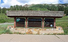
The sign at the top of the pass
|
|
| Elevation | 10,246 ft (3,123 m) |
| Traversed by | State Highway 145 |
| Location | Dolores / San Miguel counties, Colorado, United States |
| Range | San Juan Mountains |
| Coordinates | 37°48.7′N 107°54.5′W / 37.8117°N 107.9083°W |
| Topo map | Ophir |
Lizard Head Pass is a cool spot high up in the San Juan Mountains of Colorado. It's like a special doorway between two counties, Dolores and San Miguel. This pass sits at a super high point, about 10,246 feet (3,123 meters) above sea level!
It's also a natural dividing line for water. Rain and snow that fall on one side flow into the Dolores River, and on the other side, they flow into the San Miguel River.
What's in a Name? The Story of Lizard Head Pass
Have you ever wondered how Lizard Head Pass got its name? It's named after a tall, pointy mountain nearby called Lizard Head. This mountain looks a bit like a lizard's head sticking up into the sky! It's really tall, reaching about 12,995 feet (3,961 meters).
How People Travel Through the Pass
Today, you can drive right over Lizard Head Pass on State Highway 145. It's about 12 miles south of the turnoff for the town of Telluride. The roads here are pretty easy for cars to drive on.
Trains and the Galloping Goose
A long time ago, before cars were common, a special train line called the Rio Grande Southern Railroad used this pass. It operated until 1952. Even though the pass is easy for cars, it was a big challenge for the trains!
Because of the steepness, the railroad started using unique vehicles called Galloping Goose railcars. These were like buses on train wheels. They were lighter and could handle the mountain tracks better than big, heavy trains. It's a cool part of the pass's history!
 | Bessie Coleman |
 | Spann Watson |
 | Jill E. Brown |
 | Sherman W. White |

