
Llanadas facts for kids
Quick facts for kids
Llanadas
|
|
|---|---|
|
Barrio
|
|
.jpg)
Puerto Rico National Guard in Llanadas after Hurricane Maria
|
|

Location of Llanadas within the municipality of Isabela shown in red
|
|

Llanadas
Location in Caribbean
|
|
| Commonwealth | |
| Municipality | |
| Area | |
| • Total | 7.38 sq mi (19.1 km2) |
| • Land | 7.37 sq mi (19.1 km2) |
| • Water | 0.01 sq mi (0.03 km2) |
| Elevation | 545 ft (166 m) |
| Population
(2010)
|
|
| • Total | 2,315 |
| • Density | 314.5/sq mi (121.4/km2) |
| Source: 2010 Census | |
| Time zone | UTC−4 (AST) |
Llanadas is a small area, or "barrio," located in the town of Isabela, Puerto Rico. In 2010, about 2,315 people lived there. It's a part of the beautiful island of Puerto Rico, which is a commonwealth of the United States.
The Story of Llanadas
Puerto Rico used to be controlled by Spain. After the Spanish–American War, Spain gave Puerto Rico to the United States. This happened because of a peace agreement called the Treaty of Paris of 1898.
In 1899, the United States government counted everyone living in Puerto Rico. This count is called a census. The census found that 1,564 people lived in the Llanadas barrio at that time.
| Historical population | |||
|---|---|---|---|
| Census | Pop. | %± | |
| 1900 | 1,564 | — | |
| 1910 | 1,648 | 5.4% | |
| 1920 | 1,896 | 15.0% | |
| 1930 | 2,095 | 10.5% | |
| 1940 | 2,431 | 16.0% | |
| 1950 | 2,540 | 4.5% | |
| 1980 | 2,791 | — | |
| 1990 | 2,345 | −16.0% | |
| 2000 | 2,761 | 17.7% | |
| 2010 | 2,315 | −16.2% | |
| U.S. Decennial Census 1899 (shown as 1900) 1910-1930 1930-1950 1980-2000 2010 |
|||
Pictures of Llanadas
-
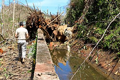
The Puerto Rico National Guard helping near Llanadas, Isabela after Hurricane Maria in 2017.
.jpg)
Want to Learn More?
 In Spanish: Llanadas para niños
- List of communities in Puerto Rico

All content from Kiddle encyclopedia articles (including the article images and facts) can be freely used under Attribution-ShareAlike license, unless stated otherwise. Cite this article:
Llanadas Facts for Kids. Kiddle Encyclopedia.