Lone Jack, Missouri facts for kids
Quick facts for kids
Lone Jack, Missouri
|
|
|---|---|

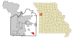
Location of Lone Jack, Missouri
|
|
| Country | United States |
| State | Missouri |
| County | Jackson |
| Area | |
| • Total | 5.92 sq mi (15.34 km2) |
| • Land | 5.92 sq mi (15.34 km2) |
| • Water | 0.00 sq mi (0.00 km2) |
| Elevation | 1,017 ft (310 m) |
| Population
(2020)
|
|
| • Total | 1,492 |
| • Density | 251.86/sq mi (97.25/km2) |
| Time zone | UTC-6 (Central (CST)) |
| • Summer (DST) | UTC-5 (CDT) |
| ZIP code |
64070
|
| Area code(s) | 816 |
| FIPS code | 29-43760 |
| GNIS feature ID | 0758307 |
Lone Jack is a city located in Jackson County, Missouri, United States. In 2020, about 1,492 people lived there. It is part of the larger Kansas City metropolitan area.
Contents
History of Lone Jack
Lone Jack was officially planned and marked out in 1841. Its name comes from a single black jack tree that stood alone and was a well-known landmark in the area. A post office has been open in Lone Jack since 1839.
The Battle of Lone Jack
On August 16, 1862, an important battle happened here during the American Civil War. Soldiers from the Union (Federal troops) fought against a larger group of Confederate soldiers. The battle took place right on the main street of the town. The fighting lasted for five hours before the Union forces had to retreat. Even though the Confederates won this battle, they could not stay in the town for long. Other Union forces were coming, so the Confederates had to leave.
Geography of Lone Jack
Lone Jack is located at 38°52′14″N 94°11′17″W / 38.87056°N 94.18806°W. This means it is in the western part of Missouri. According to the United States Census Bureau, the city covers a total area of about 3.75 square miles (9.71 square kilometers). All of this area is land.
Population and People
| Historical population | |||
|---|---|---|---|
| Census | Pop. | %± | |
| 1880 | 111 | — | |
| 1970 | 199 | — | |
| 1980 | 420 | 111.1% | |
| 1990 | 392 | −6.7% | |
| 2000 | 528 | 34.7% | |
| 2010 | 1,050 | 98.9% | |
| 2020 | 1,492 | 42.1% | |
| U.S. Decennial Census | |||
In 2010, there were 1,050 people living in Lone Jack. These people lived in 378 households, and 302 of these were families. The city had about 280 people per square mile.
Many households (44.7%) had children under 18 years old living with them. Most households (61.4%) were married couples. The average household had 2.76 people, and the average family had 3.05 people.
The average age of people in Lone Jack was 32.2 years old. About 28.3% of the residents were under 18. About 7% were 65 years old or older.
Education in Lone Jack
The Lone Jack C-VI School District is in charge of the schools here. They operate an elementary school, a middle school, and Lone Jack High School.
Lone Jack also has a public library. It is a part of the Mid-Continent Public Library system, which serves many communities.
See also
 In Spanish: Lone Jack (Misuri) para niños
 | Emma Amos |
 | Edward Mitchell Bannister |
 | Larry D. Alexander |
 | Ernie Barnes |

