Lone Pine Peak facts for kids
Quick facts for kids Lone Pine Peak |
|
|---|---|

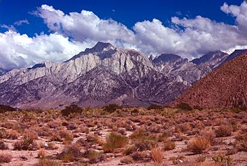
Lone Pine Peak from the Owens Valley
|
|
| Highest point | |
| Elevation | 12,949 ft (3,947 m) NAVD 88 |
| Prominence | 424 ft (129 m) |
| Parent peak | Rosco Peak |
| Listing | Sierra Peaks Section |
| Geography | |
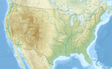
| Location | Inyo County, California, U.S. |
| Parent range | Sierra Nevada |
| Topo map | USGS Mount Langley |
| Climbing | |
| First ascent | 1925 by Norman Clyde |
| Easiest route | Scramble, class 2 |
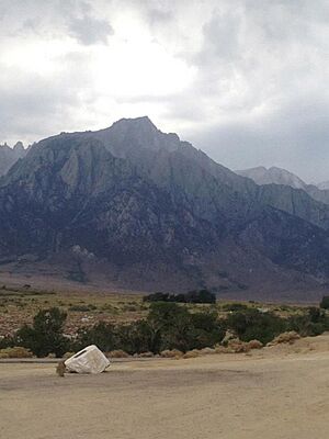
Lone Pine Peak is a tall and impressive mountain located in the Sierra Nevada mountain range. It stands proudly on the eastern side of the range, just west of a small town called Lone Pine, California. This peak is found in Inyo County, in the eastern part of California, U.S..
The very top of Lone Pine Peak marks the eastern edge of the John Muir Wilderness. This is a special protected area within the Inyo National Forest. You might even recognize Lone Pine Peak! It was the mountain featured in the background photo for the default desktop of macOS Sierra, an older version of Apple's computer operating system.
Contents
Exploring Lone Pine Peak
Lone Pine Peak is a significant landmark in the Sierra Nevada. It reaches an amazing height of 12,949 feet (about 3,947 meters) above sea level. This makes it one of the many high points in this famous mountain range.
Where is Lone Pine Peak?
This mountain is located in a beautiful part of California. It's in Inyo County, which is known for its stunning desert landscapes and towering mountains. The nearby town of Lone Pine is a popular spot for adventurers. Many people visit to explore the Sierra Nevada.
First Climbers and Routes
The first recorded climb to the summit of Lone Pine Peak happened in 1925. A famous mountaineer named Norman Clyde was the first to reach the top. He was known for his many first ascents in the Sierra Nevada.
The easiest way to climb Lone Pine Peak is often described as a "scramble." This means it's not quite a difficult rock climb, but it's more than just a hike. You might need to use your hands to steady yourself or climb over rocks. The difficulty is rated as class 2 on the Yosemite Decimal System. This system helps climbers understand how challenging a route is.
The Sierra Nevada Range
Lone Pine Peak is part of the larger Sierra Nevada mountain range. This range stretches for about 400 miles (640 kilometers) through California. It's home to many famous national parks like Yosemite and Sequoia. The Sierra Nevada is known for its granite peaks, deep valleys, and beautiful forests. It's a very important natural area in the United States.
The John Muir Wilderness
The summit of Lone Pine Peak is on the edge of the John Muir Wilderness. A wilderness area is a place that is kept as natural as possible. It means there are no roads or buildings, and people visit to enjoy nature without much human impact. This area is named after John Muir, a famous naturalist and conservationist. He worked hard to protect wild places like the Sierra Nevada.
 | Sharif Bey |
 | Hale Woodruff |
 | Richmond Barthé |
 | Purvis Young |


