Lone Pine, California facts for kids
Quick facts for kids
Lone Pine
|
|
|---|---|

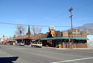
Main Street
|
|

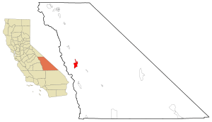
Location in Inyo County and California
|
|
| Country | United States |
| State | California |
| County | Inyo |
| Area | |
| • Total | 19.215 sq mi (49.766 km2) |
| • Land | 19.034 sq mi (49.298 km2) |
| • Water | 0.181 sq mi (0.468 km2) 0.94% |
| Elevation | 4,203 ft (1,281 m) |
| Population
(2020)
|
|
| • Total | 2,014 |
| • Density | 104.814/sq mi (40.469/km2) |
| Time zone | UTC-8 (Pacific) |
| • Summer (DST) | UTC-7 (PDT) |
| ZIP code |
93545
|
| Area codes | 442/760 |
| FIPS code | 06-42580 |
| GNIS feature ID | 2408123 |
Lone Pine is a small town in Inyo County, California, United States. It is located about 16 miles (26 km) south of Independence. In 2020, about 2,014 people lived here.
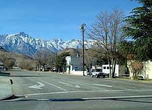
The town is in the Owens Valley, a beautiful area surrounded by mountains. To the west are the Sierra Nevada mountains, including Mount Whitney, the tallest peak in the lower 48 states. To the east are the Inyo Mountains. Lone Pine is famous for the nearby Alabama Hills, a unique landscape often seen in movies. The town got its name from a single pine tree that once stood at the entrance to Lone Pine Canyon.
Contents
History of Lone Pine
Long ago, the Paiute Native American people lived in the Owens Valley. They had trading routes that reached all the way to the Pacific Coast. They traded goods from the Owens Valley with other tribes like the Chumash.
The first cabin was built in Lone Pine during the winter of 1861–62. A small town grew there over the next two years. The Lone Pine post office opened in 1870.
The Great Earthquake of 1872
On March 26, 1872, a very strong earthquake hit Lone Pine. It happened at 2:30 in the morning. Most of the town's 80 buildings, made of mud and adobe, were destroyed. Only 20 buildings were left standing. Sadly, 26 people lost their lives. The earthquake also created Diaz Lake. A special mass grave north of town marks where the main fault line is. One of the few buildings that survived is a thick "Old Adobe Wall" behind the Lone Star Bistro.
Mining and Railroads
In the 1870s, Lone Pine was an important supply center for nearby mining towns. These included places like Cerro Gordo, which had one of California's richest silver mines. Silver was carried by cable to Keeler, then taken to smelters in Swansea. To help with mining, a sawmill was built near Horseshoe Meadows. This mill provided wood for the smelters and mines. The wood was floated down a flume, burned to make charcoal, and then shipped across Owens Lake to Swansea.
Railroads were also very important for Lone Pine. In 1883, the Carson and Colorado Railway line reached Keeler. This railway, with its engine called "The Slim Princess," brought a big economic boost. Passengers would arrive by train, stay overnight, and then take a stagecoach to Mojave.
Hollywood Comes to Town
In 1920, Lone Pine's history changed forever. A movie company came to the Alabama Hills to film The Round-Up. Soon, other filmmakers discovered the amazing scenery. Over the years, more than 400 movies, 100 TV shows, and many commercials have been filmed in Lone Pine and the Alabama Hills.
Many famous films were shot here. Some early ones include Riders of the Purple Sage (1925) with Tom Mix and Blue Steel (1934) with John Wayne. Later Westerns like The Gunfighter (1950) with Gregory Peck and How the West Was Won (1962) with James Stewart were also filmed here. Even non-Western movies used the area's unique look, such as Star Trek V: The Final Frontier (1989) and Gladiator (2000).
One very important movie filmed here was High Sierra (1941). It starred Humphrey Bogart and helped him become a leading actor. Director Raoul Walsh filmed scenes in Lone Pine and even on Mount Whitney.
Manzanar Relocation Center
After the attack on Pearl Harbor in 1941, President Roosevelt signed an order. This order required people of Japanese ancestry living on the Pacific coast to move to relocation camps. One of these camps, Manzanar, was built about 7 miles (11 km) north of Lone Pine.
Geography
Lone Pine is located in the Owens Valley. To its west are the beautiful Alabama Hills. These hills look very unique and have attracted many film companies. They were named in 1862 by people who supported the South during the American Civil War. They named them after the Confederate ship CSS Alabama.
Lone Pine is about 95 miles (153 km) east of Fresno. However, there are no roads across the Sierra Nevada mountains to get there directly. The closest large city you can drive to is Bakersfield, which is almost 170 miles (274 km) away.
The town covers about 19.2 square miles (49.7 square km). Most of this area is land, with a small amount of water.
Climate
Lone Pine has a cold desert climate. This means it has hot summers and cold winters. In January, temperatures are usually between 20s and 50s °F (-4 to 15 °C). In July, temperatures range from the 60s to upper 90s °F (15 to 37 °C). The air is usually very dry. On average, it rains less than 6 inches (15 cm) each year. Snowfall varies, but it averages about 5 inches (13 cm) annually.
People of Lone Pine
In 2010, Lone Pine had a population of 2,035 people. Most residents were White, with a significant number of Native American and Hispanic or Latino people. About 24% of the population was under 18 years old.
Lone Pine Indian Reservation
The Lone Pine Indian Reservation is located on the south side of town. It is home to members of the Paiute-Shoshone Indians of the Lone Pine Community of the Lone Pine Reservation. These are Paiute and Shoshone people. Their ancestors have lived in this valley for thousands of years. The climate and food supply here allowed them to live in settled villages.
Things to Do in Lone Pine

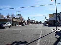
Lone Pine is a popular place for tourists. It is close to many famous natural attractions. These include Mount Whitney, Sequoia National Park, Kings Canyon National Park, Mammoth Mountain, Death Valley National Park, and Yosemite National Park. Many motels are along the main road for visitors. There is also an Interagency Visitor Center where you can get information.
Manzanar National Historic Site
The Manzanar National Historic Site is a very important place. It was a Japanese American internment camp during World War II. Manzanar is north of Lone Pine on Highway 395. It was one of 10 camps where Japanese Americans were held during the war. The United States National Park Service now protects and restores Manzanar as a U.S. National Historic Site. It is the best-preserved of these camps.
Film History at Lone Pine
The Lone Pine Film History Museum celebrates the area's movie past. The Alabama Hills west of town have been used as a filming location for many Western movies. Since the early days of filmmaking, directors have used this area to show the classic American West. Many famous directors and actors have worked here. These include John Wayne, Bing Crosby, Gene Autry, Clint Eastwood, and Barbara Stanwyck. The Whitney Portal road was used in the film High Sierra (1941). The movie Bad Day at Black Rock (1955) was also filmed in Lone Pine. More recently, scenes from Iron Man (2008) and Godzilla (2014) were shot here.
Actress Barbara Stanwyck loved Lone Pine. After she passed away, her ashes were scattered from a helicopter over the town. This was her wish because she filmed many Western movies there.
The Lone Pine Film Festival is held every year since 1989. It celebrates the rich history of filmmaking in the area. The Alabama Hills Recreation Area is managed by the Bureau of Land Management for public enjoyment.
Chess Tournament
From 1971 to 1981, Lone Pine hosted the annual Lone Pine International Chess tournament. Famous chess players, including world champion Tigran Petrosian, competed there.
Transportation
Lone Pine has a small airport called Lone Pine Airport. It has a 4,000-foot (1,219 m) runway. The town is located on U.S. Route 395. This is the main road through town. Owens Dry Lake is about 6 miles (10 km) south of town on US 395. Public transportation is provided by Eastern Sierra Transit Authority.
Education
Lone Pine has two schools. Lone Pine High School is at the south end of town. Lo-Inyo Elementary School is at the north end of town.
See also
 In Spanish: Lone Pine (California) para niños
 | William L. Dawson |
 | W. E. B. Du Bois |
 | Harry Belafonte |


