Long Strait facts for kids
Quick facts for kids Long Strait |
|
|---|---|

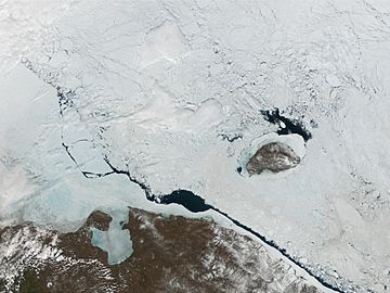
A view from space, with a long polynya in the strait and Wrangel Island to the north-east
|
|
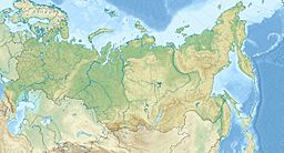
| Location | Russian Far East; between the East Siberian Sea and the Chukchi Sea |
| Coordinates | 69°49′N 176°10′E / 69.817°N 176.167°E |
| Native name | пролив Лонга Error {{native name checker}}: parameter value is malformed (help) |
| Part of | Arctic Ocean |
| Basin countries | Russia |
| Max. length | 128 km (80 mi) |
| Max. width | 141 km (88 mi) |
| Max. depth | 50 m (160 ft) |
| Frozen | Most of the year |
The Long Strait (which is Proliv Longa in Russian) is a body of water located in the Russian Federation. It is an important passage in the Arctic region. This strait connects two large seas and is often covered in ice for most of the year.
What is the Long Strait?
The Long Strait is a wide stretch of water. It separates Wrangel Island from the mainland of Siberia. The narrowest part of the strait is about 141 kilometers (88 miles) wide. This is the distance between Cape Blossom on Wrangel Island and Cape Yakan on the Siberian coast.
The strait also links the East Siberian Sea and the Chukchi Sea. Both of these seas are part of the larger Arctic Ocean.
History of the Long Strait
This strait was named after an American whaling captain. His name was Thomas W. Long. He was a sailor who explored these northern waters a long time ago.
In August 1983, a notable event happened here. About 50 ships got stuck in the thick ice. One ship was lost, and many others were damaged. This shows how challenging sailing in the Arctic can be.
See also
 In Spanish: Estrecho de De Long para niños
 | Sharif Bey |
 | Hale Woodruff |
 | Richmond Barthé |
 | Purvis Young |


