
Los Campitos (Los Llanos de Aridane) facts for kids
Quick facts for kids
Los Campitos
|
|
|---|---|
|
Neighbourhood
|
|
)_02_ies.jpg)
View of the Aridane Valley from Montaña Rajada in 2015; Los Campitos can be seen in the middle
|
|
_OSM_map.jpg)
Los Campitos
Location in La Palma

Los Campitos
Location in Canary Islands
|
|
| Country | |
| Autonomous Community | |
| Province | Santa Cruz de Tenerife |
| Island | La Palma |
| Municipality | Los Llanos de Aridane |
| Time zone | UTC±00:00 (WET) |
| • Summer (DST) | UTC+01:00 (WEST) |
| Postcode |
38769
|
Los Campitos is a small area, or neighbourhood, located on the island of La Palma in the Canary Islands, Spain. It's part of the larger town called Todoque. Until the year 2000, Los Campitos was its own separate place. Sadly, in 2021, a huge lava flow from the 2021 Cumbre Vieja volcanic eruption hit the area, destroying many homes.
About Los Campitos
Los Campitos is about 500 meters (1,640 feet) above sea level. It is located five kilometers south of Los Llanos de Aridane, a bigger town. This area is the eastern part of Todoque and is next to Las Manchas to the south.
People in Los Campitos used to farm the land without much irrigation. They also raised animals. The houses were spread out, mostly along a road called Camino El Pastelero. This road connects the main part of Todoque to the LP-2 main road, which is also known as Carretera del Sur de La Palma.
Los Campitos once had its own small school. Children from Los Campitos and a nearby area called El Paraíso went to this school.
A Look at History
At the end of the 1400s, Los Campitos was part of an area controlled by the native people of the island, called Tihuya. After Spain took over the island, this land became common land for everyone to use.
A writer named Gaspar Frutuoso said that Los Campitos was mainly used for raising livestock. He also noted that most of the people living there were descendants of the original islanders. However, some settlers from Europe also lived there.
In 1847, a writer named José María Wangüemert de Alcalá described Los Campitos. He wrote that it had 69 houses and 263 people living there. At that time, people had to go to Argual and Tazacorte to get water because there were no ponds to collect rainwater.
Later, in 1950, Los Campitos had 428 residents. By 1981, the population had decreased to 356 people.
Impact of the 2021 Volcano
The area of Los Campitos was greatly affected by the 2021 Cumbre Vieja volcanic eruption. The lava flows from the volcano destroyed many houses and buildings. This included the local school. The eruption changed Los Campitos so much that it was almost erased from the map.
-
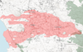
Extent of lava coverage with highlight of destroyed buildings i.a. in Los Campitos as of November 23, 2021

See also
 In Spanish: Los Campitos (Los Llanos de Aridane) para niños
